

produced by AVISO - Copyright CNES/CLS 2014
Animations of Maps of sea level anomalies (MSLA) Gulf Stream 2012-2013
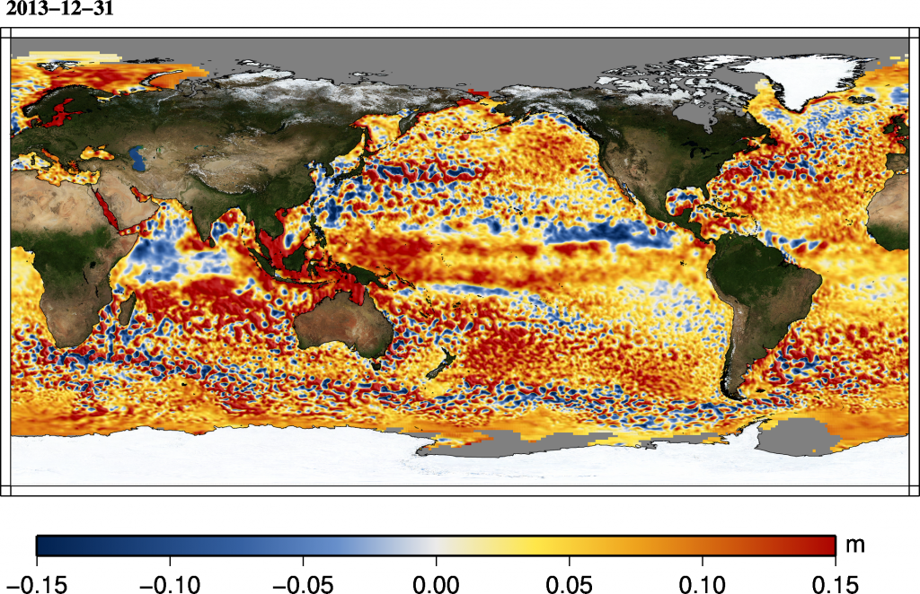
Downloads
| File | Type | Size | Lang | Resolution | Creation date | Represented date |
|---|---|---|---|---|---|---|
| msla_h_Global_monthly_1993_2014.mp4 | Video | 2.85Mb | ||||
| msla_h_Global_20131231.png | Image | 3.8Mb | 2177x1409 |
- Geographic area : Atlantic Ocean
- Instrument : Altimeter
- Parameter : Sea level anomalies
- Topic : Mesoscale Ocean circulation (eddies)
- Satellite : Multimission