

Altimetry Principle
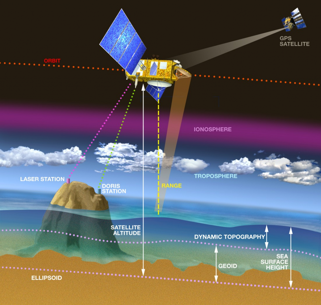
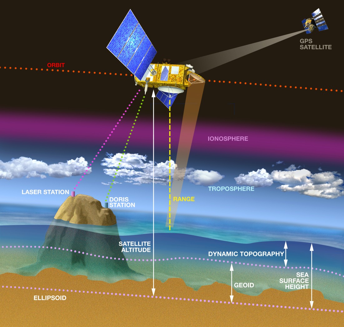
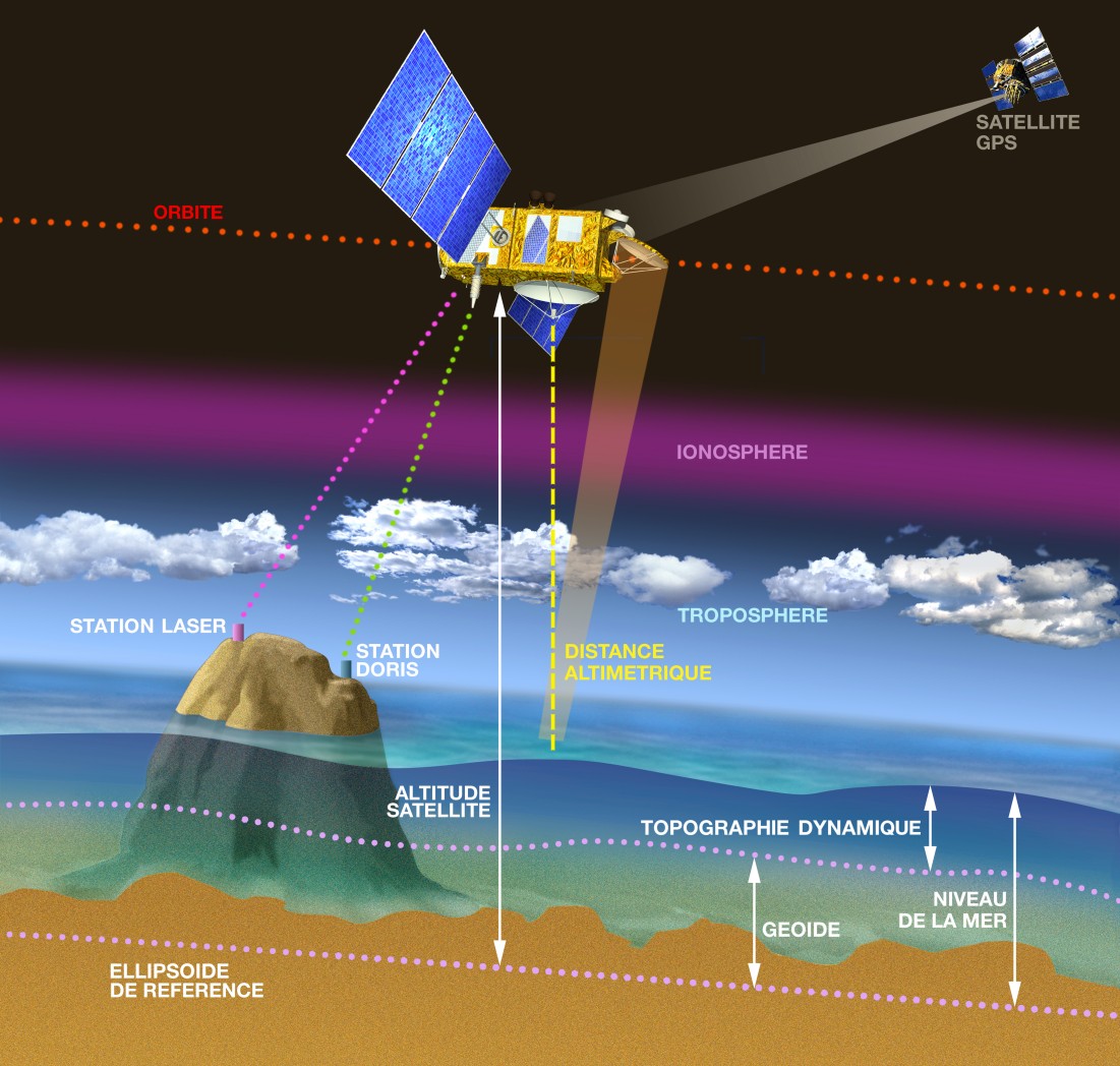
Satellite altimetry is a technique for observing the Earth and its oceans from Space. The principle is to precisely measure a satellite’s altitude and then the distance between the satellite and the target surface. By calculating the difference between the two, ‘sea-surface height’ is obtained. This sea-surface height, and in particular any variations, can be used to deduce a vast amount of information about the ocean and its movements. With systems such as Doris and GPS, which measure the satellite’s position extremely accurately, sea-surface height can be calculated to within just a few centimetres. Altimetry can also determine wave height and wind speed on the ocean, as well as surface height for lakes and rivers, information about the Earth’s gravity field, sea ice and polar ice cap topography.
Downloads
| File | Type | Size | Lang | Resolution | Creation date | Represented date |
|---|---|---|---|---|---|---|
| Alt_english.jpg | Image | 210.35kb | en | 1101x1048 | ||
| Alt_francais.jpg | Image | 213.41kb | fr | 1101x1048 |