


Cnes/Mira Production
Coastal erosion, example at Venice (video)
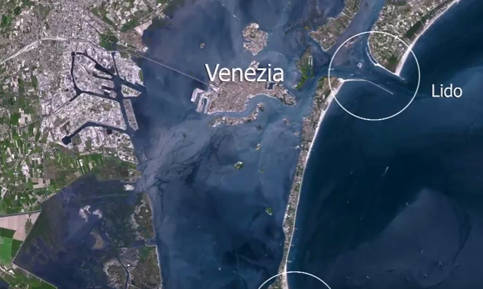
Venice, the city reclaimed from the sea…
The high tides or ‘acqua alta’ that occur between October and March are flooding the City of the Doges with increasing frequency. Such events are the result of several factors:
- a big lunar tide;
- southerly winds from the Adriatic;
- an unusual climate phenomenon producing heavy rain inland;
- human intervention that has weakened the lagoon’s natural protections;
- and subsidence due to engineering work and water extraction from mainland aquifers; between 1908 and 1990, Venice sank between 10 and 23 cm, depending on what data you look at.
The amplitude of the tides has been increasing for years now, sometimes to as much as 2 metres like in 1967, flooding the entire city. As a result, the government has undertaken extensive work to dredge canals and raise quays.
At the same time, a massive project is being developed to install 78 mobile tide barriers in 2018 that will close off the three openings in the sandbanks during high tides.
Will these efforts be enough to preserve the city? Global warming is expected to strengthen the southerly sirocco winds and further raise the mean level of the Adriatic to anything between 10 and 90 cm. If that happens, will the tide barriers be of any use? And will they withstand big storms?
Monitoring sea level and modelling ocean and climate phenomena in the Adriatic are vital to answer these questions. Studying and understanding these phenomena will help us to save Venice from drowning.
See also on https://youtu.be/G_UzBwkXLOQ
Downloads
| File | Type | Size | Lang | Resolution | Creation date | Represented date |
|---|---|---|---|---|---|---|
| venice_VA.mov | Video | 189.91Mb | en | 2016-10-20 | ||
| venise_erosion.png | Image | 489.69kb | 696x416 | 2016-10-20 | ||
| venise_VF.mov | Video | 189.57Mb | fr | 2016-10-20 |
- Geographic area : Mediterranean Sea
- Instrument : Altimeter
- Topic : Climate, Coastal applications, Mean Sea Level
- Satellite : Multimission, Swot