

CLS/CNES
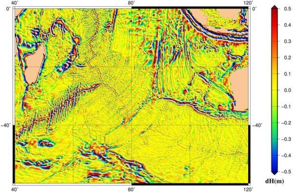
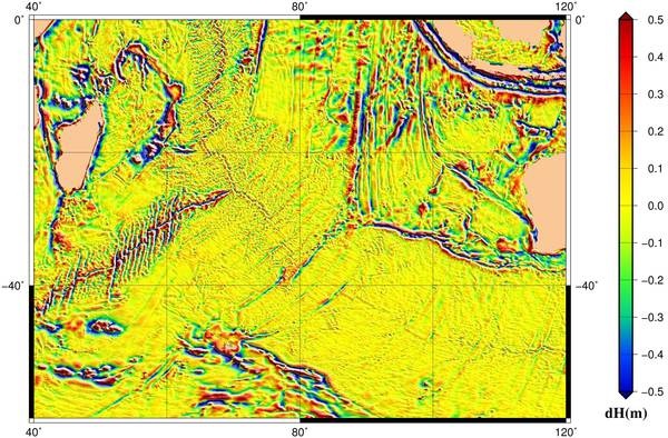
Mean Sea Surface: zoom on Indian Ocean triple junction
With now nearly 25 years of continuous, intercalibrated altimetry data available, computation of Mean Sea Surface becomes more and more precise. From the 1/16° grid of 1998, we are now at a 1/60°, with improved "short wavelengths" (i.e. small details on the plot), better accuracy near the coasts, etc.
The reliefs of the mean sea surface reveal for the highest/lowest features the attraction of the Earth’s mass on the motionless ocean surface, generating sea level variations of more than one hundred meters over distances of several thousands of kilometers, for example between the Eeastern and Western Atlantic Ocean. Also included into the Earth's attraction, but showing as "only" ~1 meter reliefs is the bottom topography, marked by mid-ocean ridges, fracture zones, deep-sea trenches and sea-mounts, and abyssal plains. Last but not least (but not the most evident features), currents and water masses of varying densities, producing sea level variations of several meters;
An accurate Mean Sea Surface is needed to reference height variations, and compute some data such as the Mean dynamic topography. Next challenge will be to make a Mean Sea Surface close to SWOT resolution, since this satellite will also need such a reference surface to compute anomalies.
Downloads
| File | Type | Size | Lang | Resolution | Creation date | Represented date |
|---|---|---|---|---|---|---|
| Zoom_SMO15V2_EclHmSFg.jpeg | Image | 24.09Mb | 18711x13222 | 2017-05-11 | ||
| Zoom_SMO15V2_EclHmSFg_sm.jpeg | Image | 129.11kb | 600x394 | 2017-05-11 |
- Geographic area : Indian Ocean
- Instrument : Altimeter
- Parameter : Surface height
- Topic : Bathymetry, Geodesy
- Satellite : Multimission