

Cnes/Mira Production, 2021
Space hydrology and calibration video
updated 2021
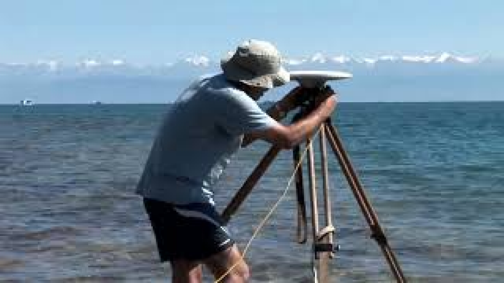
Lake Issyk Kul lies in Central Asia, in Kyrgyzstan. The world’s second largest mountain lake, it covers a surface area of 6,000 sq.km. It is here that a team of scientists from the LEGOS research laboratory has set up a base with their Kyrgyz colleagues to calibrate altimetry satellites. The main mission of the satellites is to track ocean circulation. But their radars are also useful for measuring water levels in lakes, inland seas and major rivers. The science of space hydrology has gained traction in recent years as the need for rigorous management of the world’s water resources becomes more apparent. This is especially the case for remote, hard-to-reach regions where ageing sensors make
regular monitoring difficult.
To pursue its development, space hydrology needs test sites to calibrate satellites in the
specific conditions of land surfaces. Lake Issyk Kul is particularly suited to this task. Its
extent, the quality of its hydrological infrastructures and the close cooperation with the Kyrgyz make it one of the best sites in the world. Scientists have installed a battery of instruments there, including GPS receivers. They have conducted periodic calibration of radar instruments for all satellite altimetry missions since Topex/POSEIDON. The site is thus helping to nurture space hydrology and lay the groundwork for the French-U.S. Swot mission.
Downloads
| File | Type | Size | Lang | Resolution | Creation date | Represented date |
|---|---|---|---|---|---|---|
| 04_hydrology_calibration.jpg | Image | 7.78kb | 320x180 | 2021-10-01 | ||
| 04_hydrology_calibration.mp4 | Video | 19.13Mb | en | 2021-10-01 | ||
| 04_space_hydrology_calibration.pdf | Electronic document | 2.93Mb | en | 2021-10-01 | ||
| 04_hydrologie_calibration.mp4 | Video | 19.09Mb | fr | 2021-10-01 | ||
| 04_hydrologie_spatiale_calibration.pdf | Electronic document | 2.94Mb | fr | 2021-10-01 |
- Geographic area : Africa, Asia, Europe, North America, Oceania, South America
- Instrument : Altimeter
- Parameter : Surface height
- Topic : Hydrology
- Satellite : Multimission, Swot