


Cnes/Mira Production, 2021
Pollutants video
updated 2021
The oceans have become our dustbin.While altimetry satellites can’t tackle this modernday plague on their own, by monitoring ocean currents and circulation they can help us to better track all kinds of pollutants and anticipate where they are likely to accumulate. For example, after the tragic tsunami that hit Fukushima in Japan, toxic waste was discharged into the ocean from the damaged nuclear power plant. Knowledge of ocean
currents, notably the Kuroshio Current, helped to predict where the waste would flow.
Dispersion des déchets nucléaires dans le Pacifique
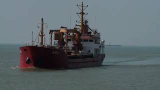
In the event of an oil spill from a stricken tanker or a ship deliberately flushing its tanks at
sea, we can predict the slick’s likely path and prepare to protect coastlines. Using ship positioning data and current charts, we can also work backwards to trace the source of pollution. Maps derived from altimetry data help to track other objects and determine if they are going to come ashore, like for example containers that fall overboard in a storm or ships running adrift. Not long ago, the existence of a 7th continent was brought to the public’s attention. Every year, more than 30 million tonnes of waste are tipped into the oceans. A sizeable part of this waste is made up of microplastics. Ocean current charts derived from altimetry data have shown that certain circular currents trap the waste, creating “danger zones” for marine life. The ocean garbage patch between Hawaii and the coast of California is six times the size of France.
Downloads
| File | Type | Size | Lang | Resolution | Creation date | Represented date |
|---|---|---|---|---|---|---|
| 07_pollutants.jpg | Image | 4.29kb | 320x180 | 2021-10-01 | ||
| 07_pollutants.mp4 | Video | 18.9Mb | en | 2021-10-01 | ||
| 07_pollutants.pdf | Electronic document | 3.93Mb | en | 2021-10-01 | ||
| 07_dechets.mp4 | Video | 18.45Mb | fr | 2021-10-01 | ||
| 07_suivi_polluants.pdf | Electronic document | 3.93Mb | fr | 2021-10-01 |
- Geographic area : All oceans
- Instrument : Altimeter, Model
- Parameter : Geostrophic ocean currents
- Topic : Large-scale Ocean circulation, Mesoscale Ocean circulation (eddies), Operational oceanography, Tides
- Satellite : Multimission