


CNES/CLS
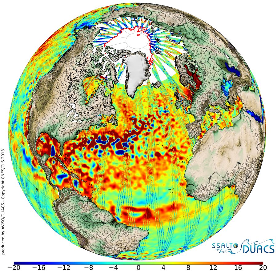
Sea Level Anomalies measured by Cryosat-2 around Arctic
Arctic Sea Level Anomalies measured by Cryosat-2 during the historical minimum of sea ice coverage on Septembre 2012. Below 66° North, the Ssalto/Duacs SLA map without Cryosat-2 (Jason-1 and Jason-2 only) data is plotted. Superimposed, the along-track track SLA from Cryosat-2 satellite (processed by the CNES processing segment and DUACS) complete the Jason-1/Jason-2 coverage to reveal the Arctic seal level uncovered from sea ice (red boundary represents the limit of the sea ice coverage). (unit in cm)
Downloads
| File | Type | Size | Lang | Resolution | Creation date | Represented date |
|---|---|---|---|---|---|---|
| globe_22905_TABLE_C_C2_V_MSS_DTU_etopo_logo.png | Image | 59.69Mb | en | 9000x9000 | -0001-11-30 | -0001-11-30 |
| globe_22905_TABLE_C_C2_V_MSS_DTU_sm.jpg | Image | 309.63kb | 900x900 |
- Geographic area : Arctic Ocean, Atlantic Ocean
- Instrument : Altimeter
- Parameter : Ice concentration, Sea level anomalies
- Topic : Mesoscale Ocean circulation (eddies), Sea Ice, Technique
- Satellite : Cryosat, Multimission