


CNES/CLS
High-precision altimetry with satellites working together
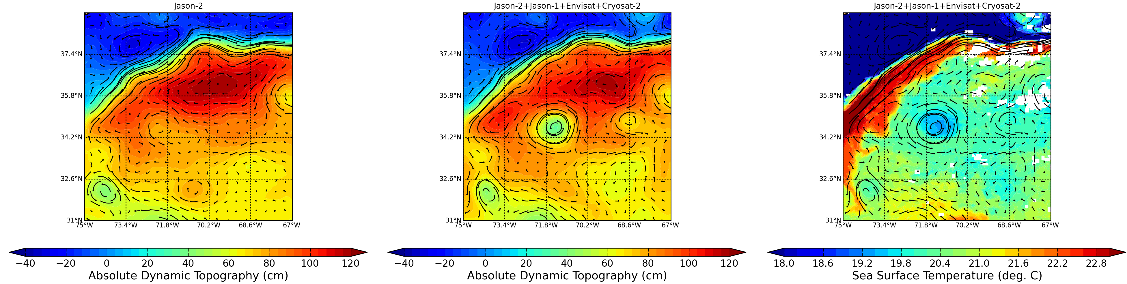
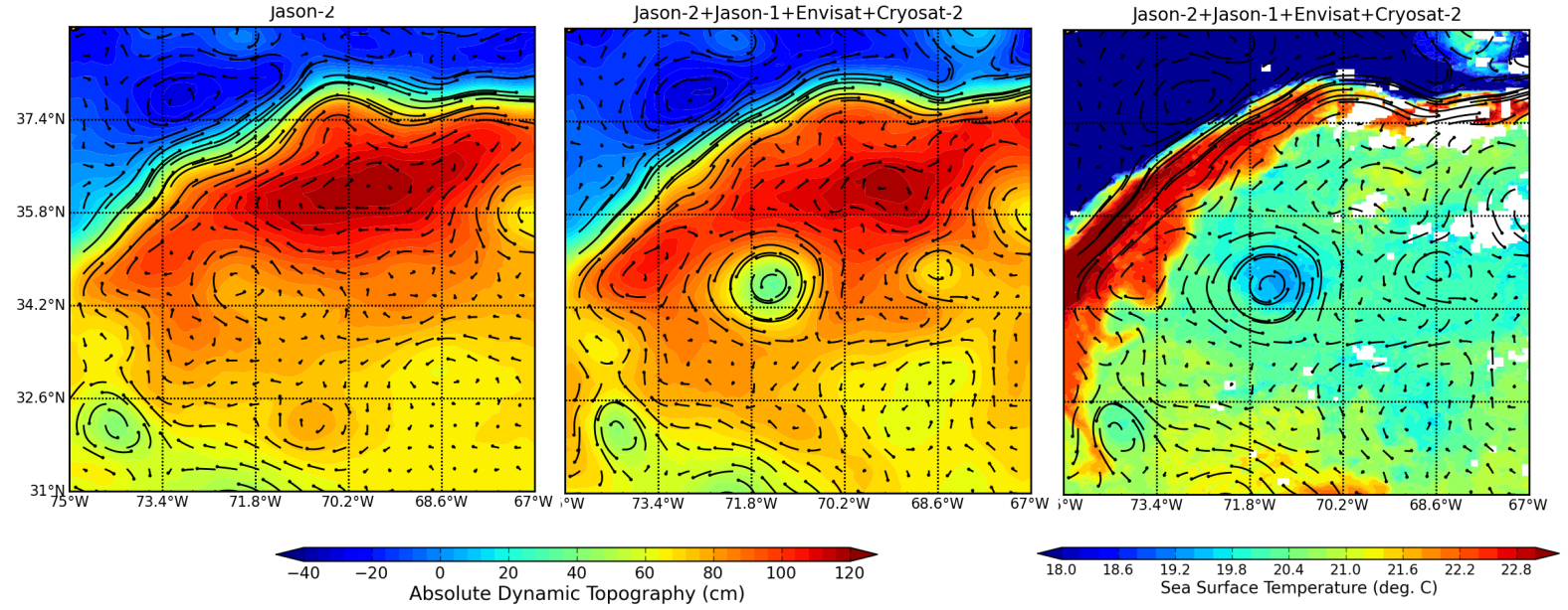
Maps of Absolute Dynamic Topography (in m) superimposed to absolute geostrophic currents (m/s) in the Atlantic Ocean on 2012/02/03 made from Jason-2 (left) and Jason-1+Envisat+Jason-2+Cryosat-2 (middle). Sea Surface Temperature- SST (in °C, right) superimposed to absolute geostrophic currents. Merging of the four satellite data shows eddy (near 71.8°W, 34.2°N) that are invisible, or just barely visible with only one satellite and much better sorted out with four of them. The SST map shows the same eddy which corroborates the findings of the altimetry.
At least two altimetry satellites are required to map the ocean and monitor its movements precisely, particularly at scales of 100 to 300 kilometres (mesoscale). With four altimetry satellites available, the resolution of sea surface height measurements is greatly enhanced. It allows more along-track data for model assimilation, higher resolution of multi-mission mesoscale maps and better resilience of the multi-mission observation system if an old altimeter becomes unavailable.
Downloads
| File | Type | Size | Lang | Resolution | Creation date | Represented date |
|---|---|---|---|---|---|---|
| duacs_MADT_SST_1_vs_4satellites.png | Image | 1.16Mb | 3904x984 | 2012-02-15 | 2012-02-03 | |
| duacs_MADT_SST_1_vs_4satellites_sm.png | Image | 848.4kb | 1576x614 | 2012-02-15 | 2012-02-03 |
- Geographic area : Atlantic Ocean
- Instrument : Altimeter
- Parameter : Sea surface temperature, Surface height
- Topic : Mesoscale Ocean circulation (eddies)
- Satellite : Cryosat, Envisat, Jason-1, Jason-2, Multimission