

CNES/CLS, 2012
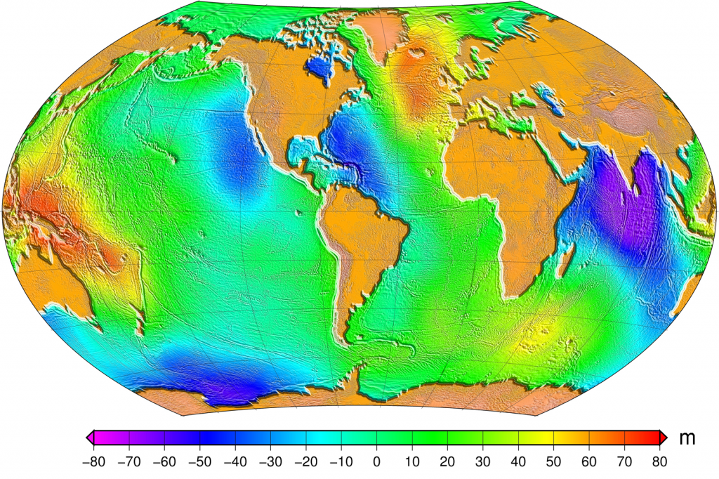
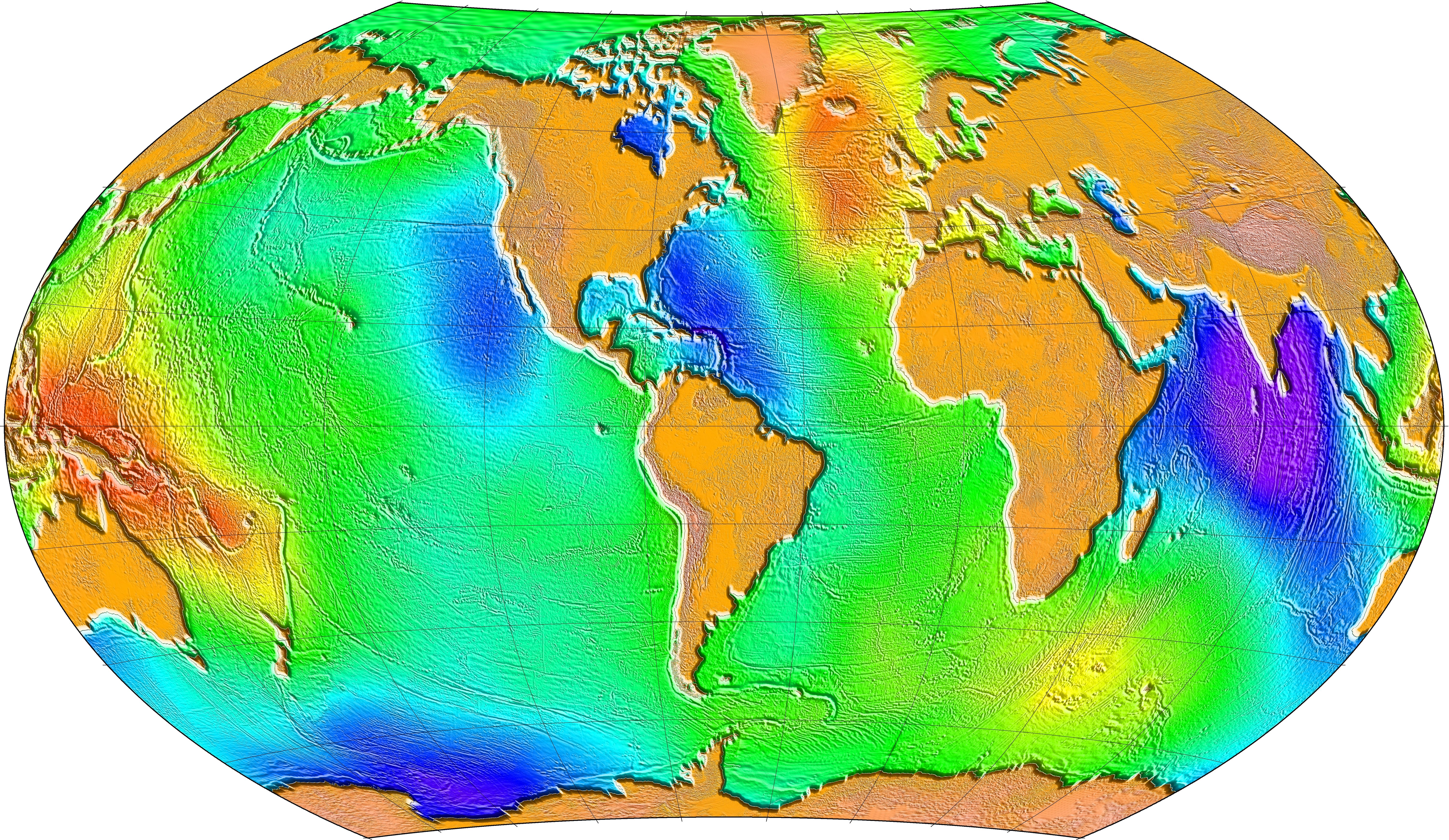
Mean Sea Surface: a glassy sea... of ridges and valleys
Satellite altimetry measures sea surface height, which depends on a number of phenomena such as the Earth's gravity field, ocean tides and currents, thermal expansion, winds and waves. The Mean Sea Surface represents the sea level due to constant phenomena. It can thus be likened to a flat, calm sea. But it would be wrong to think this surface is smooth. Ocean topography is shaped by permanent ocean currents and, mainly, by the gravity field. The geoid is the undulating surface related to this gravity field that reflects differences below the surface of the Earth (for example, variations in magma temperature). These differences can generate sea level variations of over 100 meters between two ocean regions thousands of kilometers apart. At smaller scales (a few kilometers), we can also observe ridges and valleys in the ocean floor (submarine mountains, ocean trenches, oceanic ridges, etc.) that cause variations of several meters at the ocean surface.
Downloads
| File | Type | Size | Lang | Resolution | Creation date | Represented date |
|---|---|---|---|---|---|---|
| Mss2011.jpg | Image | 2.15Mb | 1600x1067 | 2012-08-15 | ||
| Mss2011_b.jpg | Image | 6.03Mb | 6000x3480 | 2012-08-15 | ||
| MSS_scale.jpg | Image | 133.33kb | 320x4896 | 2012-08-15 |
- Geographic area : All oceans
- Instrument : Altimeter
- Parameter : Surface height
- Topic : Bathymetry, Geodesy, Large-scale Ocean circulation