


An unusually strong Indian monsoon
Lively Data, October 21, 2008
The wet monsoon season, which runs from June to September, brings rains that are vital to agriculture in South Asia. The current monsoon is particularly strong with heavy rains and is causing widespread destruction.
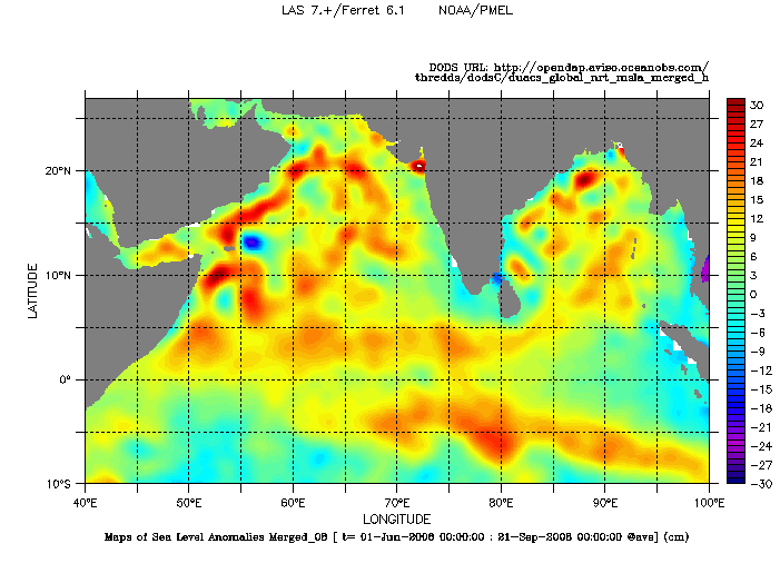
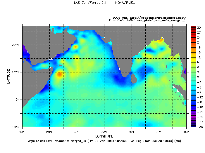
The monsoon of year 2005 was considered as a year of "normal" monsoon season while the year 2008 is regarded as a year of highly wet monsoon. The comparison between the summer monsoons in 2005 and 2008 in terms of sea level anomalies shows a significant difference between these 2 years. The sea level anomalies averaged over June to September show positive anomalies greater in 2008 in north-western Indian Ocean.
Maps of Sea Level Anomalies (SLA) averaged over summer monsoon months (June-September) for year 2008 (top) and year 2005 (bottom). The difference between these two years can also be mapped with the LAS (here). Choose Near-real time Data, Global, (Maps of) Sea Level Anomalies. Define the period in Define variable and select "T" in Apply to these axes and "Average" in Select analysis type. Then select the geographical area and a common color fill levels (-30,30,1)(32).
The comparison in terms of surface winds between two years with different monsoon intensity (2006 and 2008) shows no significant difference. If the wind is stronger in 2008 compared to 2006, the distribution areas seems equivalent (maps below).
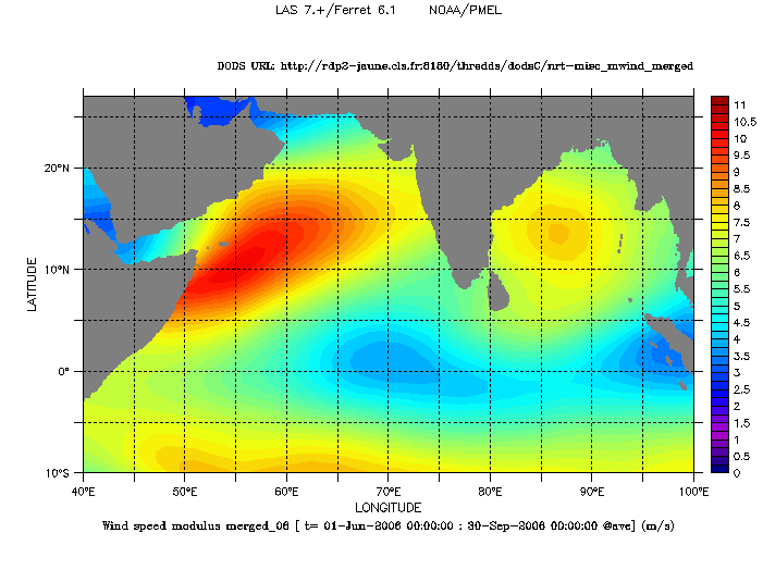

Mean winter merged wind speed modulus in m/s, averaged from June to September for year 2006 (left) and year 2008 (right). Choose Near-real time Data, Global, (Maps of) Wind Speed Modulus. Define the period in Define variable and select "T" in Apply to these axes and "Average" in Select analysis type. Select the geographic area, the palette and a common color fill levels (0,11,0.25)(12).
Another variable accessible with the LAS is interesting to describe the variability of the monsoon. The comparison in terms of the zonal component of geostrophic current between the years 2005 and 2008 shows a real difference. Between June to September 2008 (right below), the equatorial band is subject to westerlies currents (component U negative), while in the band 0-5 ° N, currents are reversed, from west to east (component U positive). Lower values and a different distribution are not observed in 2005 (left below).
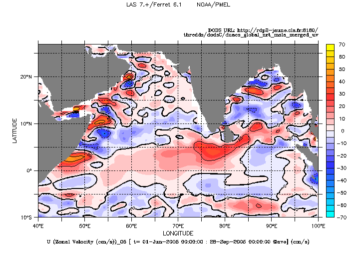
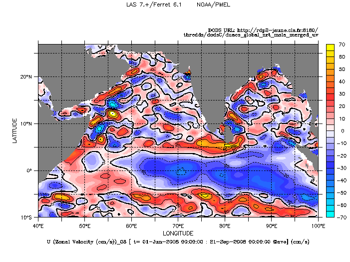
Zonal component of geostrophic current (in cm/s) averaged over June-September 2005 (left) and 2008 (right). To create these maps with the LAS, choose NRT, Global, (Maps of) Geostrophic Velocity Anomalies, and the variable U (Zonal Velocity (cm/s)). Define the period in Define variable and select "T" in Apply to these axes and "Average" in Select analysis type. Select the geographic area. To overlay colors and lines, select Color filled and lines in the Options Contour style. The "anomaly" palette is defined in Color filled levels (-70,70,10)(85) and lines in Contour levels : 10C.
Further information:
- Image of the month:
- August 2004 : <link en news idm aug-2004-summer-wet-monsoon-season index.html _self internal-link>Summer : wet monsoon season.
- Oct. 2002: Summer current, winter current
- Lively Data, May 23, 2005 : Looks on indian monsoon.
 Use the Live Access Server