

Aviso+
Animation with the 4 satellites grounds tracks (Jason2-Saral/AltiKa-Cryosat2-HY2A)
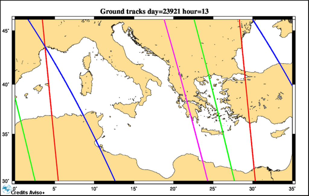
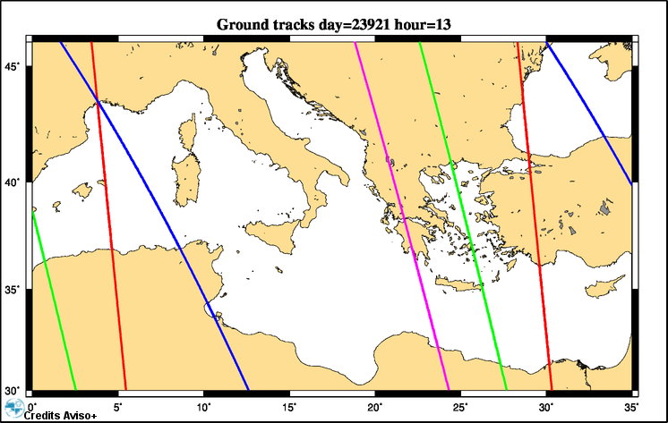
Grounds tracks for the 4 operational satellites on June 2015, over the Mediterranean Sea: Jason-2 ground tracks are blue, Saral/altiKa are green, Cryosat-2 are red and HY-2A are pink.
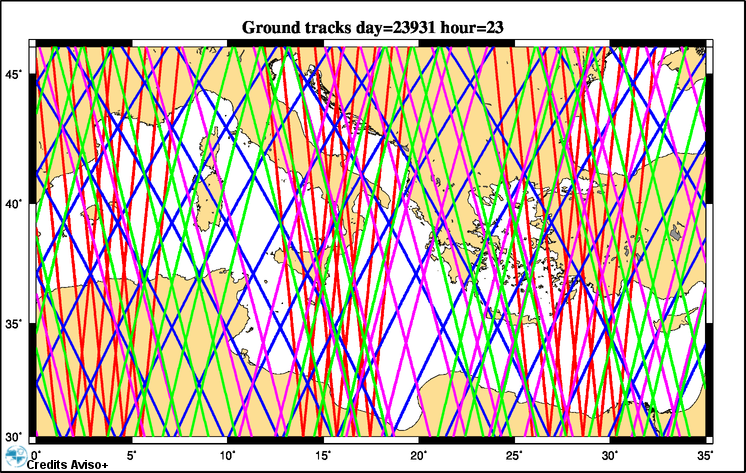
The ground tracks are displaying (and are cumulating) for each satellite and over a 10-day period (Jason-2 cycle) with a 1-hour delay between each frame. Days are written on the top of the maps with the units "Julian Days". The day for the first map (23 921) corresponds to 30 June 2015.
The orbit of an altimetry satellite is a compromise between spatial resolution (the distance between two ground tracks) and temporal resolution (delay between two revisits): Combine several satellites is a solution:
- Jason-2 has a repeat cycle of 10 days with a ground track separation of 315 km at the equator,
- Saral/AltiKa: 35 days, 75 km,
- Cryosat-2: 369 days (subcyle jours 30 days),
- HY-2A : 14 and 168 days.
A multisatellite system as this 4-satellite configuration allows more along-track data for model assimilation, higher resolution of multi-mission mesoscale maps and better resilience of the multi-mission observation system if an old altimeter becomes unavailable.
Downloads
| File | Type | Size | Lang | Resolution | Creation date | Represented date |
|---|---|---|---|---|---|---|
| traces_AllMissions_perhour_Med_23921_23931_logo.avi | Video | 25.42Mb | 2015-07-30 | 2015-06-30 | ||
| traces_AllMissions_perhour_Med_23921_23931_logo_sm.avi | Video | 12.04Mb | 2015-07-30 | 2015-06-30 | ||
| traces_AllMissions_logo_sm_264.png | Image | 479.19kb | 746x473 | 2015-07-30 | 2015-06-30 | |
| traces_AllMissions_logo_sm_14.png | Image | 175.57kb | 746x473 | |||
| traces_AllMissions_perhour_Med_23921_23931_logo_sm.mpg | Video | 7.4Mb | 2015-07-30 | 2015-06-30 |
- Geographic area : Mediterranean Sea
- Instrument : Altimeter
- Topic : Mesoscale Ocean circulation (eddies)
- Satellite : Cryosat, HY-2, Jason-2, Multimission, Saral