

Copyright CNES/CLS 2013
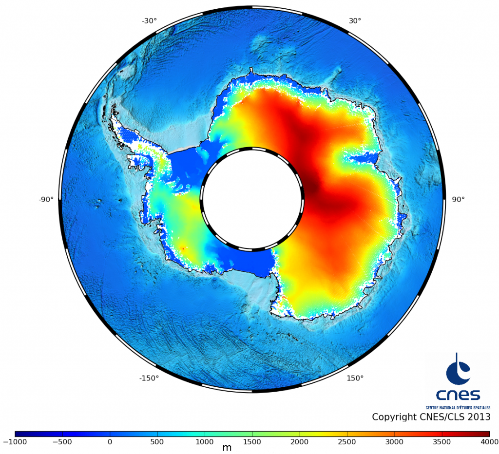
First Saral/AltiKa topography over Antarctica ice sheet
Antarctica and Greenland ice sheets are essential in the sea-level rise and climate understanding. Satellite altimetry is one of the powerful tools to study them. The Saral satellite, a joint-mission between Cnes and Isro, has been successfully launched the 25th of February 2013 and just ended its first cycle. AltiKa, the altimeter onboard has proven to be efficient and excellent results are already observed over the Antarctica ice sheet as we see on the topography figure for the first time since Saral is in flight.
Downloads
| File | Type | Size | Lang | Resolution | Creation date | Represented date |
|---|---|---|---|---|---|---|
| Saral_Height_Antarctica_Cycle1_Ka.png | Image | 1.26Mb | en | 1136x1034 |
- Geographic area : Antarctica
- Instrument : Altimeter
- Parameter : Surface height
- Topic : Ice sheets
- Satellite : Saral