


Cnes/Mira Production, 2021
Antarctic video
updated 2021
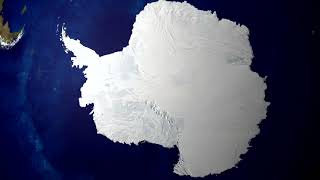
The Antarctic holds some 70% of the world’s freshwater stocks. It plays a key role in climate and can have a major impact on rising sea level through ice melt. So monitoring it from satellite to get the big picture is vital. Here is a map showing variations in ice height between September 2002 and October 2010, derived from Envisat satellite data. In it, we see that the western glaciers are losing several metres of ice per year, mainly as a result of warmer deep currents a few degrees above zero. In particular,
the glaciers flowing into the Amundsen Sea are melting faster. Were these glaciers to
disappear altogether, sea level would rise by no less than 1.2 metres.
Altimetry satellite observations have also shown that the Pine Island Glacier melted
significantly between 2009 and 2010.Altimetry is also very useful for understanding the
dynamics of glaciers and liquid water beneath the ice sheet. In 2007, water was found to be ‘cascading’ from the CookE2 subglacial lake into the sea, modifying the elevation of the ice sheet by several metres.
Envisat is no longer in service, but new altimetry satellites like the French-Indian SARAL, in the same orbit as Envisat, are taking its place to extend the continuous time-series of data. ESA’s CryoSat satellite, which recently marked its 10th year in orbit, has also been added to this constellation and is able to reach latitudes not covered until now.The
combination of a special type of polar orbit and the world’s first interferometric altimeter
has helped scientists to characterize variations in thickness of Antarctic continental ice
more finely than ever before and gain new insights into how they affect coastal dynamics
and global sea level rise. For the European Commission’s Copernicus programme, the
CRISTAL candidate mission, if selected, would fly a multifrequency radar altimeter to
measure not only ice thickness but also snow pack characteristics. Cross-calibrating
and combining these different but complementary missions will enable the current data record to be extended to better gauge the effects of climate change.
https://www.aviso.altimetry.fr/en/applications/ice-and-cryosphere/ice-sheets.html
https://youtu.be/9wOuy9260AA
Downloads
| File | Type | Size | Lang | Resolution | Creation date | Represented date |
|---|---|---|---|---|---|---|
| 05_antarctic.jpg | Image | 5.3kb | 320x180 | 2021-10-01 | ||
| 05_antarctic.mp4 | Video | 29.09Mb | en | 2021-10-01 | ||
| 05_antarctic.pdf | Electronic document | 2.75Mb | en | 2021-10-01 | ||
| 05_antarctique.mp4 | Video | 29.16Mb | fr | 2021-10-01 | ||
| 05_antarctique.pdf | Electronic document | 2.76Mb | fr | 2021-10-01 |
- Geographic area : Antarctica
- Instrument : Altimeter
- Parameter : Surface height
- Topic : Ice sheets
- Satellite : Cryosat, Envisat, ERS-1 & 2, Saral