


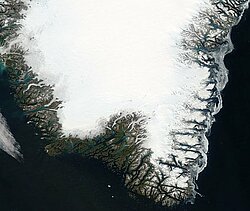
Ice sheets
Altimetry is a powerful tool for measuring both the dynamics and mass balance of ice sheets. Continental ice has an impact on sea level: if both of the major Greenland and Antarctica ice sheets were to melt, the sea level would rise by about 80 m.
Topography is one of the parameters relevant to the processes acting on ice sheets. It contains the signature of the main physical processes (climate and dynamic) that act on an ice sheet on both a small and large scale, and important information about local anomalies or general trend behaviour. Nowadays topography is also an initial condition for studying future evolution. Large-scale topography controls flow direction and its mapping enables the balance velocity to be derived. Moreover, the deformation and sliding velocities depend on the basal shear stress and thus on surface slopes. Accurate information about topography is, therefore, crucial to predicting future evolution and understanding ice dynamics, either by providing an empirical parameterisation of the flow laws or by pointing out unknown physical processes.
Moreover, altimeters also provide other parameters such as backscatter coefficient and waveform shape that give information on surface roughness and snow pack characteristics, from the global to the kilometre scale. Since ERS-1 was launched, with an orbit as high as 82°N and S, our vision of the ice sheets has been radically transformed. This long series, with ERS-2 and Envisat following ERS-1, has made it possible to discern changes in the shape and volume of both ice sheets, Greenland and Antarctica, which are related to climate change. Moreover, from April 1994 to March 1995, ERS-1 was placed on a geodetic orbit (two shifted cycles with a 168-day repeat) so that the topography of both ice sheets could be mapped with a resolution of 2 km. This precise topography has led to the detection of subglacial lakes, subglacial hydrological networks, outlet glacier anomalies, etc.
The 15 years of data from ERS-1, ERS-2 and Envisat have also made it possible to map the ice mass balance. Results show that the Greenland ice sheet is thinning at low altitudes while thickening at its centre. A simultaneous increase in accumulation rate at high altitude and snow melting at low altitude explains this pattern and strongly agrees with the theoretical behaviour of snow when confronted with climate change. On average therefore, the Greenland ice sheet seems to be thickening slightly at a rate corresponding to a decrease of 0.03 mm/yr in sea level. On the contrary, the Antarctica ice sheet is found to be stable, although local increases or decreases can be observed. For instance, in the western part a large sector is found to be thinning, whereas a few sectors in the eastern part are found to be thickening.
Further information:
- Newsletter #5, 1997 : Observing the polar ice caps. B.Legrésy and al.
- Rémy, F., The new vision of the cryosphere thanks to 15 years of altimetry (pdf), 15 years of progress in radar altimetry Symposium, Venice, Italy, 2006.
- Zwally, H.J. and A.C. Brenner, Ice sheet dynamics and mass balance, Satellite altimetry and Earth sciences, L.L. Fu and A. Cazenave Ed., Academic Press, 2001.