


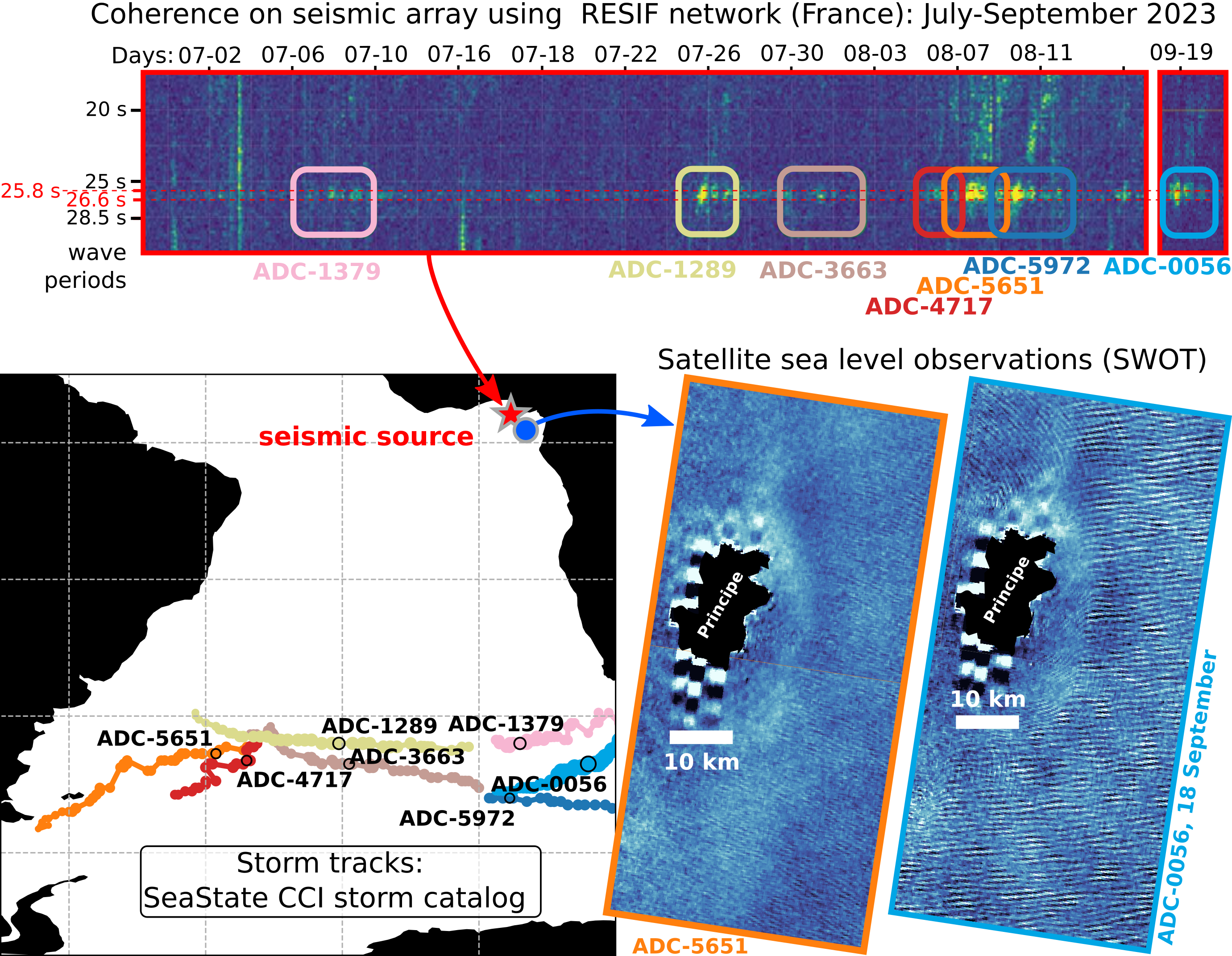
Swot reveals swells that connect ocean storms and mysterious seismic activity
2026-04-20A study published in the journal Nature Communications identifies a causal relationship between the occurrence of large storms in the Southern Ocean and, a few days later, bursts of microseisms with periods around 16 and 26 s, radiating from the Gulf of Guinea.
Read more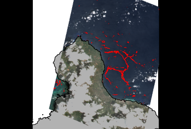
New: High Resolution Coastal Sargassum Floating Algae Detection
2026-04-13The product "High Resolution Coastal Sargassum Floating Algae Detection with VENUS mission in Carribean Arc" provides Alternative Floating Algae Index (AFAI) coastal maps derived from VENµS multispectral imagery across five Caribbean zones (northern–southern Yucatán, northern–southern Guadeloupe, Martinique) over 2022–2024.
Read more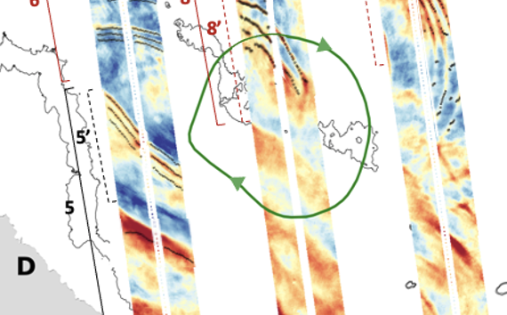
Interaction of internal solitary waves and eddies observed for the first time with Swot
2026-04-08For the first time, Swot enabled to observe Internal solitary waves signature in sea surface height. This allowed researchers to study the interactions of internal solitary waves with eddies on the Amazon Shelf, leading to a better understanding of their complex interactions.
Read more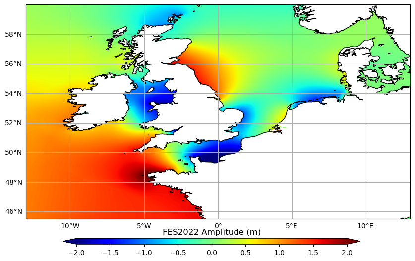
Release of Native Grid FES 2022 tide model
2026-03-30This new product contains the FES2022b ocean tide elevation atlas on the Native Finite-Element grid of the model. One global file is available for downloading, and it contains the thirty-four tide components for FES2022 ocean tide elevations.
Read more
New v3.0 of Experimental Multimission Gridded Sea Level Heights and Velocities with SWOT using MIOST
2026-03-25A new version 3.0 of the Experimental Multimission Gridded Level 4 Sea Level Heights and Velocities with SWOT using MIOST mapping method is now available on AVISO.
Read more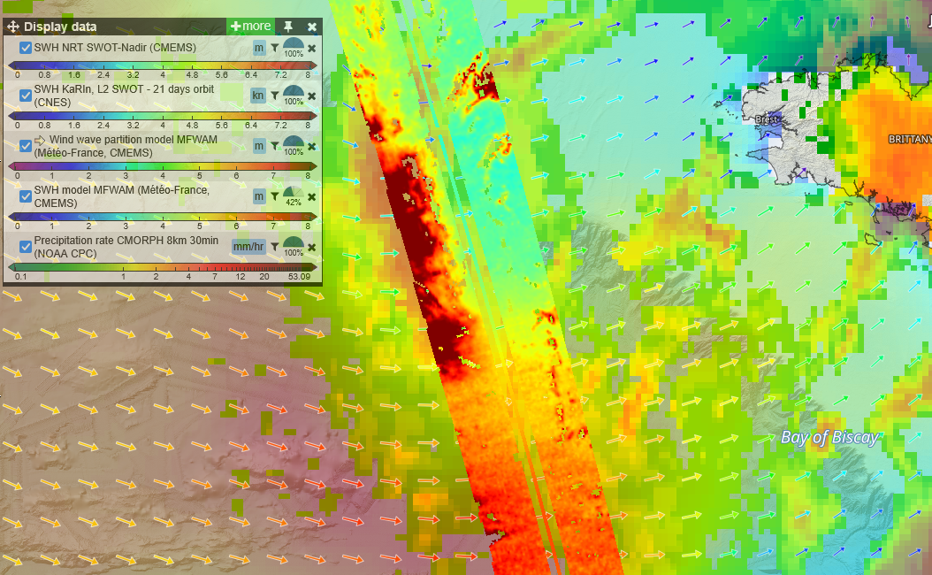
Winds, waves and rain off the western European coasts seen by Swot and nadir altimeters
2026-03-12Two storms, Nils and Pedro, crossed South-west of France mid-February, coming from the Atlantic Ocean. As most such winter storms, they lead to high waves and high winds, but they also were heavy with rain.
Read more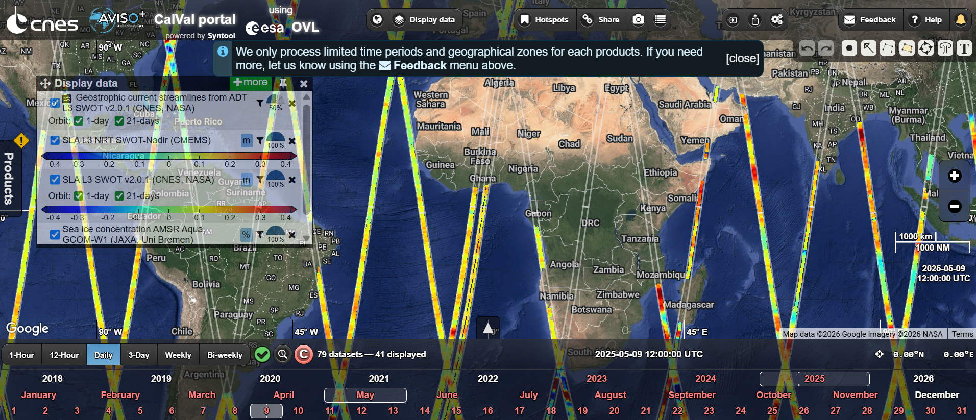
Explore the New AVISO CalVal Visualization Portal
2026-02-04Powered by OceanDataLab, AVISO introduces a new visualizer for exploring some of its key products.
Read more
AVISO+ Newsletter #24
2026-02-04Release of the 24th Aviso+ Users Newsletter: recent updates and insights to help you stay connected with the latest developments in altimetry data.
Read more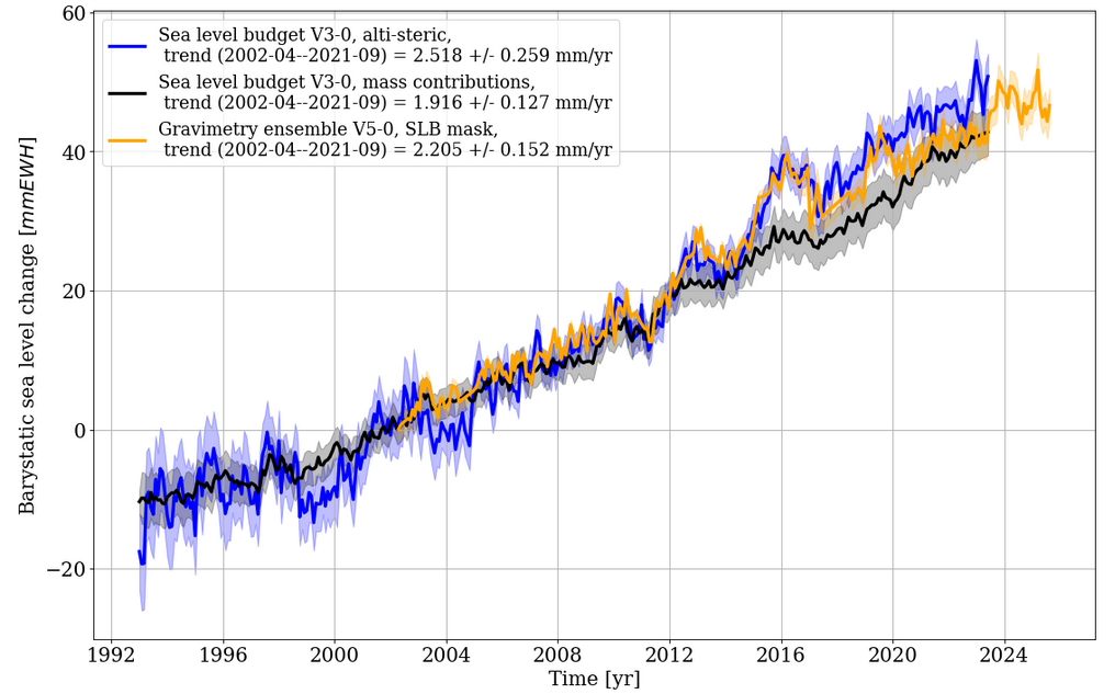
New versions for Barystatic and Manometric sea level changes from satellite geodesy
2026-02-03Version 5.0 for barystatic and manometric sea level changes estimated using satellite gravimetry approach and version 3.0 for barystatic and manometric sea level changes estimated using sea level budget approach.
Read more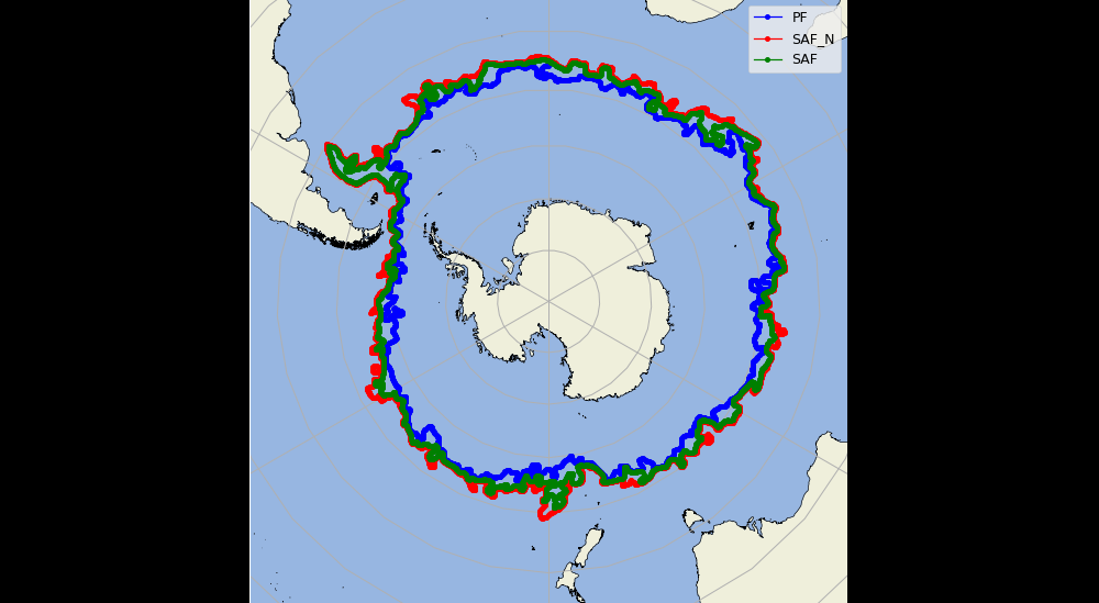
Version 2.0 of Antarctic Circumpolar Current - fronts product
2026-01-28Release of version 2.0 of the product Antarctic Circumpolar Current - fronts product with a temporal extention to April 2025. It contains 3 files of variables to monitor the position of the three main fronts of the Antarctic Circumpolar Current (ACC) - the Polar Front, and the northern and southern branches of the Subantarctic Front.
Read more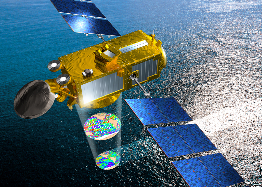
Jason-3, 10 years in orbit!
2026-01-17The Jason-3 satellite was launched 10 years ago, on January 16th, 2016.
Read more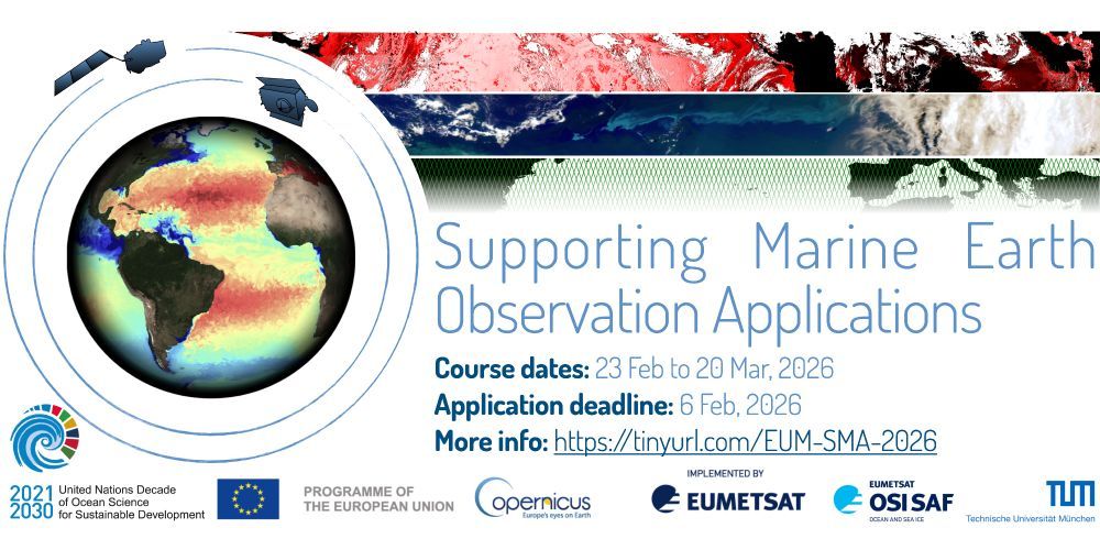
Applications for 2026 Eumetsat Supporting Marine Applications course are now open!
2026-01-13Online training course (23 February - 20 March 2026) focusing on focus will be on data streams from Eumetsat Copernicus marine missions (Sentinel-3, Sentinel-6) and derived downstream products
Read more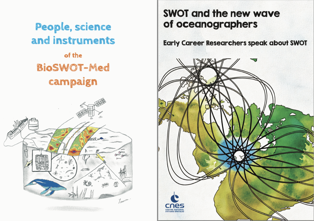
Two e-books on Swot
2026-01-06The Swot-Adac consortium has published two e-books on Swot: "Swot and the New Wave of Oceanographers", "People, science and instruments of the BioSwot-Med campaign"
Read more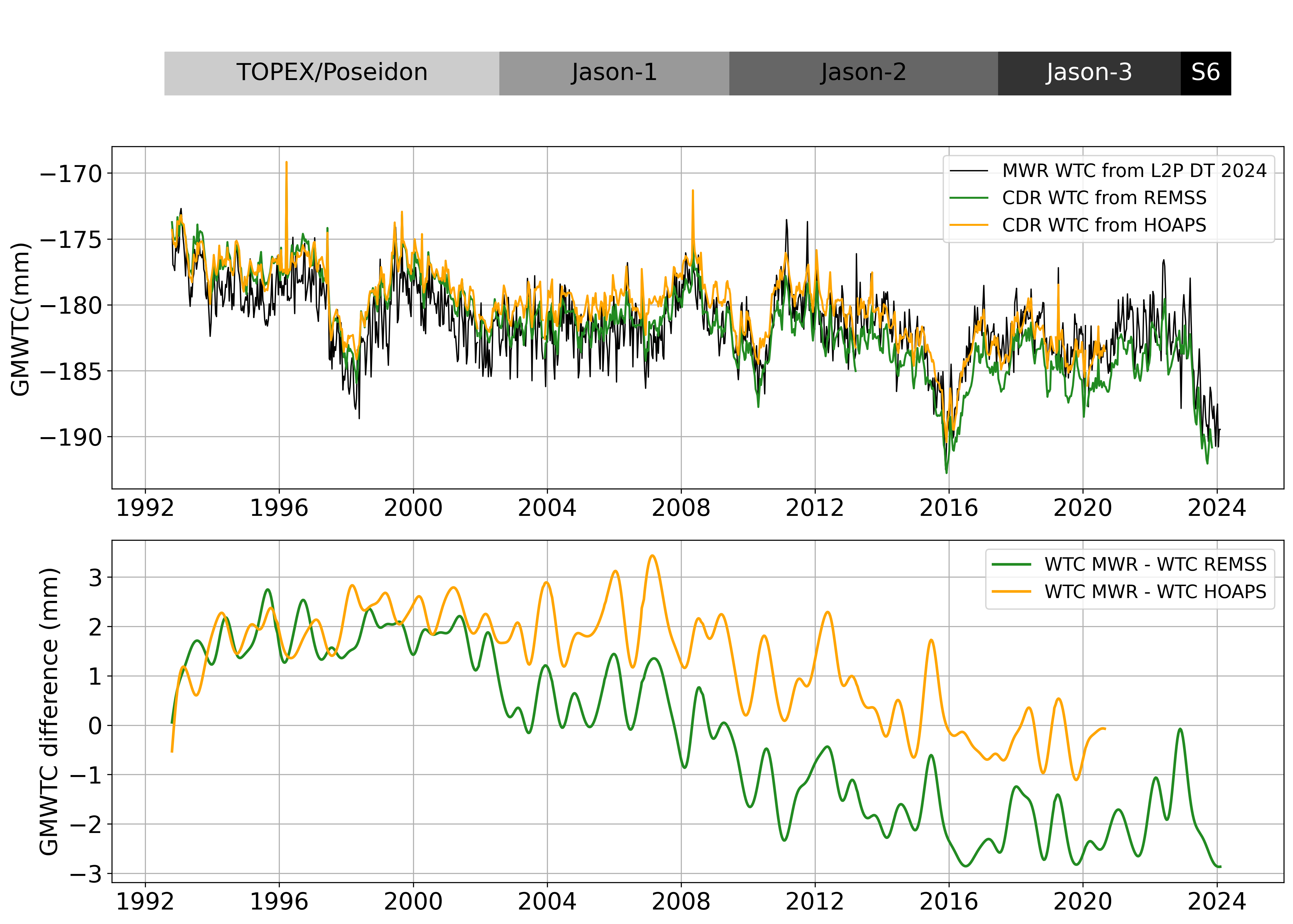
Version 2 of Wet troposphere correction from water vapour climate data records
2025-12-22Release of Version 2.0 of the Wet troposphere correction from water vapour climate data records.
Read more
Swot, already 3 years old!
2025-12-18Swot was launched three years ago, on December 16, 2022, as part of a collaboration between Nasa/JPL and Cnes, including contributions from UKSA and CSA.
Read more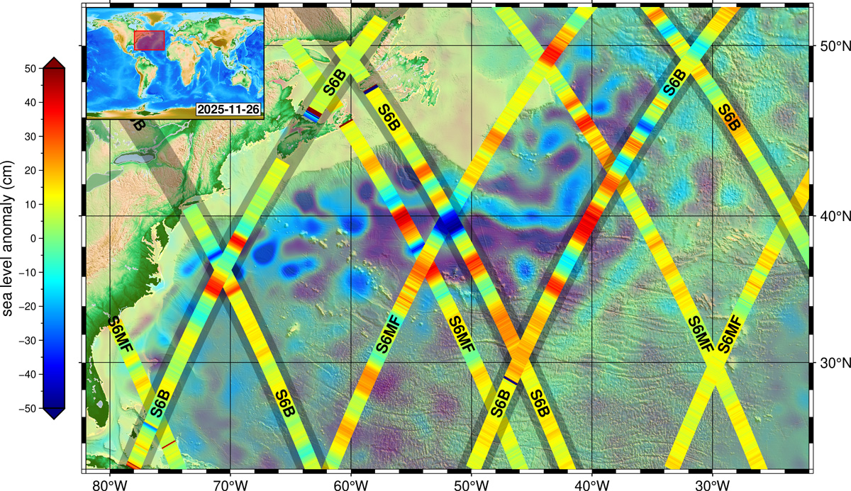
Copernicus Sentinel-6B delivers first altimeter images and reaches final orbit
2025-12-17The first altimeter images from the European-US ocean-monitoring satellite Copernicus Sentinel-6B have been released on 16 December, just weeks after its successful launch on 17 November 2025, offering an early demonstration of how the mission will enhance the global monitoring of oceans, coasts and inland water bodies.
Read moreSwot reveals swells that connect ocean storms and mysterious seismic activity
A study published in the journal Nature Communications identifies a causal relationship between the occurrence of large storms in the Southern Ocean and, a few days later...
New: High Resolution Coastal Sargassum Floating Algae Detection
The product "High Resolution Coastal Sargassum Floating Algae Detection with VENUS mission in Carribean Arc" provides Alternative Floating Algae Index (AFAI) coastal maps...
Interaction of internal solitary waves and eddies observed for the first time with Swot
For the first time, Swot enabled to observe Internal solitary waves signature in sea surface height. This allowed researchers to study the interactions of internal solita...
Release of Native Grid FES 2022 tide model
This new product contains the FES2022b ocean tide elevation atlas on the Native Finite-Element grid of the model. One global file is available for downloading, and it con...
New v3.0 of Experimental Multimission Gridded Sea Level Heights and Velocities with SWOT using MIOST
A new version 3.0 of the Experimental Multimission Gridded Level 4 Sea Level Heights and Velocities with SWOT using MIOST mapping method is now available on AVISO.
Winds, waves and rain off the western European coasts seen by Swot and nadir altimeters
Two storms, Nils and Pedro, crossed South-west of France mid-February, coming from the Atlantic Ocean. As most such winter storms, they lead to high waves and high winds,...
Explore the New AVISO CalVal Visualization Portal
Powered by OceanDataLab, AVISO introduces a new visualizer for exploring some of its key products.
AVISO+ Newsletter #24
Release of the 24th Aviso+ Users Newsletter: recent updates and insights to help you stay connected with the latest developments in altimetry data.
New versions for Barystatic and Manometric sea level changes from satellite geodesy
Version 5.0 for barystatic and manometric sea level changes estimated using satellite gravimetry approach and version 3.0 for barystatic and manometric sea level changes ...
Version 2.0 of Antarctic Circumpolar Current - fronts product
Release of version 2.0 of the product Antarctic Circumpolar Current - fronts product with a temporal extention to April 2025. It contains 3 files of variables to monitor ...
Jason-3, 10 years in orbit!
The Jason-3 satellite was launched 10 years ago, on January 16th, 2016.
Applications for 2026 Eumetsat Supporting Marine Applications course are now open!
Online training course (23 February - 20 March 2026) focusing on focus will be on data streams from Eumetsat Copernicus marine missions (Sentinel-3, Sentinel-6) and deri...
Two e-books on Swot
The Swot-Adac consortium has published two e-books on Swot: "Swot and the New Wave of Oceanographers", "People, science and instruments of the BioSwot-Med campaign"
Version 2 of Wet troposphere correction from water vapour climate data records
Release of Version 2.0 of the Wet troposphere correction from water vapour climate data records.
Swot, already 3 years old!
Swot was launched three years ago, on December 16, 2022, as part of a collaboration between Nasa/JPL and Cnes, including contributions from UKSA and CSA.
Copernicus Sentinel-6B delivers first altimeter images and reaches final orbit
The first altimeter images from the European-US ocean-monitoring satellite Copernicus Sentinel-6B have been released on 16 December, just weeks after its successful launc...