Mean Sea SurfaceMSS_CNES_CLS2022
Mean sea surface height wrt T/ P or WGS84 reference ellisoid computed on a 20 years period (1993-2013) with 29 years of altimetry data.
This Mean Sea Surface (also called MSS) corresponds to marine geoid undulations (±120 meters ) and to the "permanent" sea level rise (1-2 meters). | 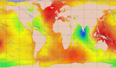 |
Mean Dynamic TopographyMDT_CNES-CLS22
Mean sea surface height above geoid computed on a 20 years period (1993-2012).
The Mean Dynamic Topography results from the ocean mean geostrophic currents | 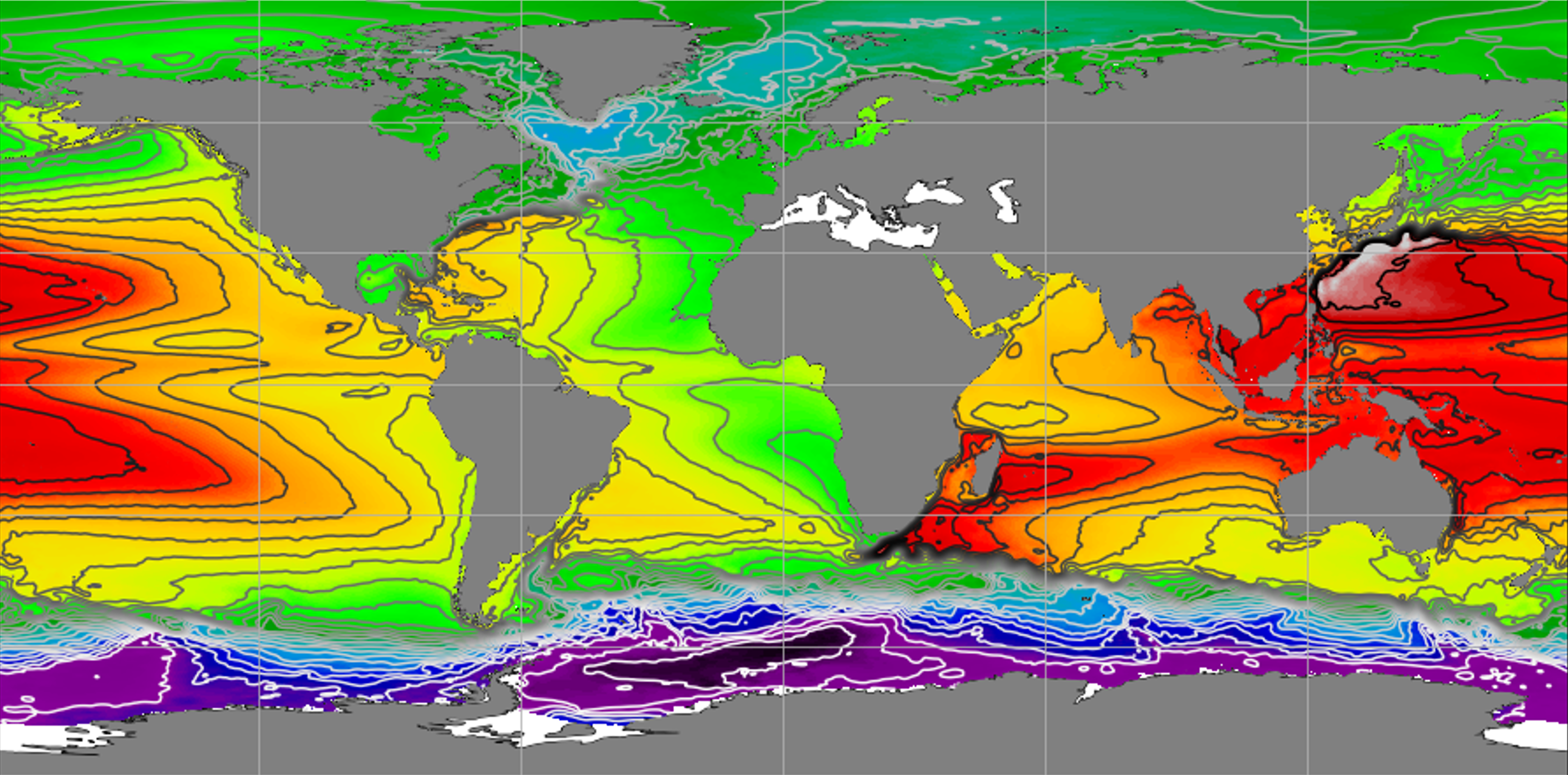 |
Mean Dynamic TopographyMDT_HYBRID-CNES-CLS22-CMEMS2020
Contains the MDT-CNES-CLS22 for global ocean and the CMEMS 2020 MDTs for Black Sea and Mediterranean Sea | 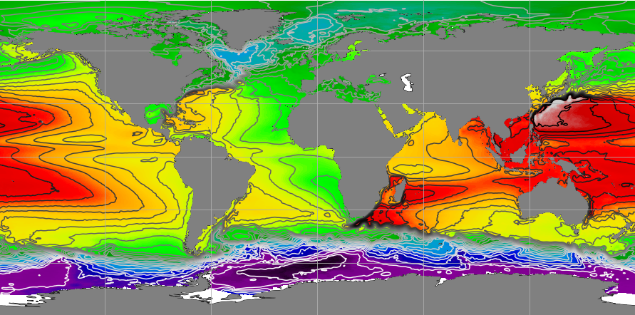 |
Mean Dynamic TopographySMDT2014-20Y_MED
Mean sea surface height above geoid computed on a 20 years period (1993-2012).
This sea surface height is specifically computed over Mediterranean Sea. | 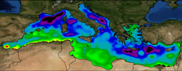 |
Global tideFES2022
Ocean tide elevations (amplitude, phase), tide loading and tide currents computed by up-to-date finite elements modelling and data (both tide gauges and altimeter) assimilation. |  |
Internal Tide MIOSTMIOST-IT
MIOST-IT solution is based on an original gridding process using ocean signals modes variability and all altimeter measurements available on the nearly entire altimeter era. | 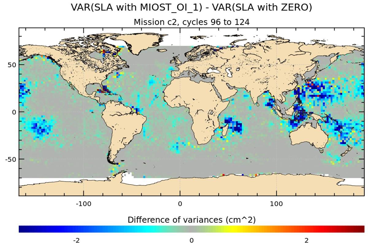 |
Coastal tideX-TRACK Tidal Constants
Coastal tidal constants computed for 73 constituents by using harmonic analysis for long-time series missions. |  |
Atmospheric CorrectionDynamic Atmospheric Correction using ERA5
Correction of the ocean response to atmospheric wind and pressure forcing, DAC-ERA5 product is a combination between TUGO HR barotropic model output (high frequencies) and the Inverted Barometer correction (IB, low frequencies). | 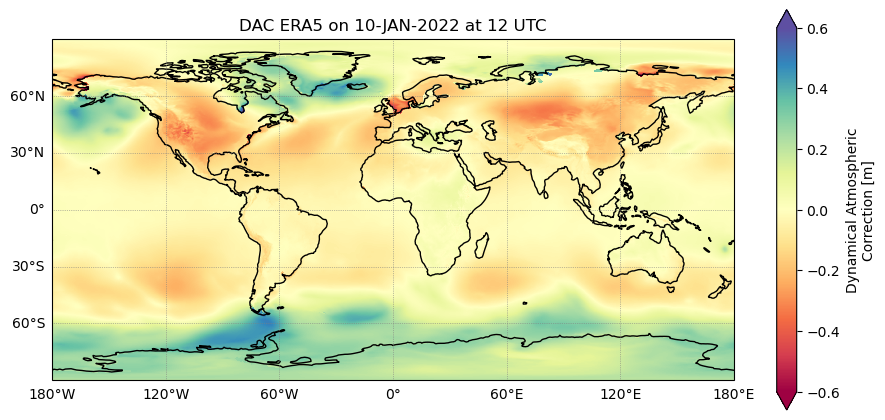 |
Atmospheric CorrectionDynamic Atmospheric Correction
Correction of the ocean response to atmospheric wind and pressure forcing, computed using Mog2D barotropic model for high frequencies (i.e. less than 20 days), and an Inverted Barometer correction for lower frequencies. |  |
Atmospheric CorrectionDynamic Atmospheric Correction dedicated to SWOT Calval phase
Correction of the ocean response to atmospheric wind and pressure forcing, computed using Mog2D baroropic dedicated to SWOT Calval Phase (cut-off 2 days) | 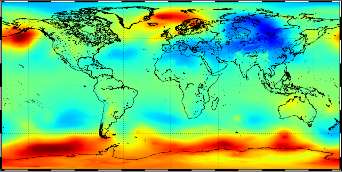 |
Atmospheric CorrectionGPD+ Wet tropospheric correction
GPD+ dataset where the correction is computed by combining all available observations in the vicinity of the point: valid measurements from the on-board microwave radiometer, from Global Navigation Satellite System (GNSS) coastal and island stations, and from scanning imaging MWR on board various remote sensing missions. | 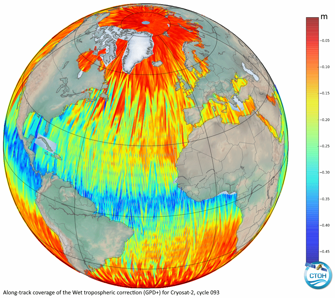 |
Atmospheric CorrectionWet tropospheric correction from water vapour climate data records
In order to reduce the long term stability uncertainty of the GMSL, the WTC derived from highly stable water vapour climate data records (CDRs) from independent measurements on board meteorological satellites is proposed. | 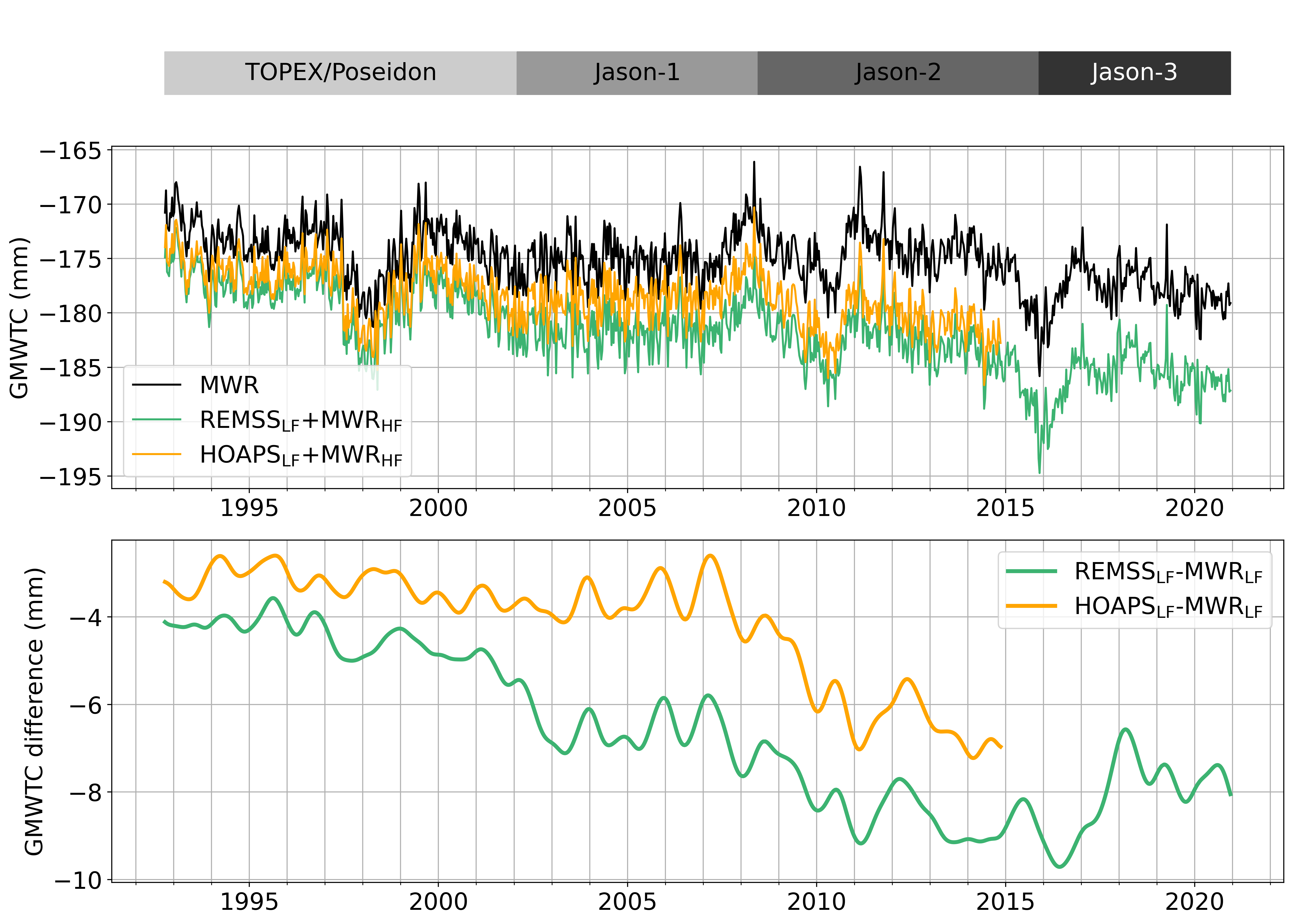 |
Slope correction for Sentinel-6A SAR altimetrySlope correction for Sentinel-6A SAR altimetry
This product provides slope correction maps for Sentinel-6A SAR mode. These maps are derived from the approach originally developed for LRM mode by Sandwell and Smith (2014), adapted to reflect the geometry and orientation of SAR altimeter ground footprints. | 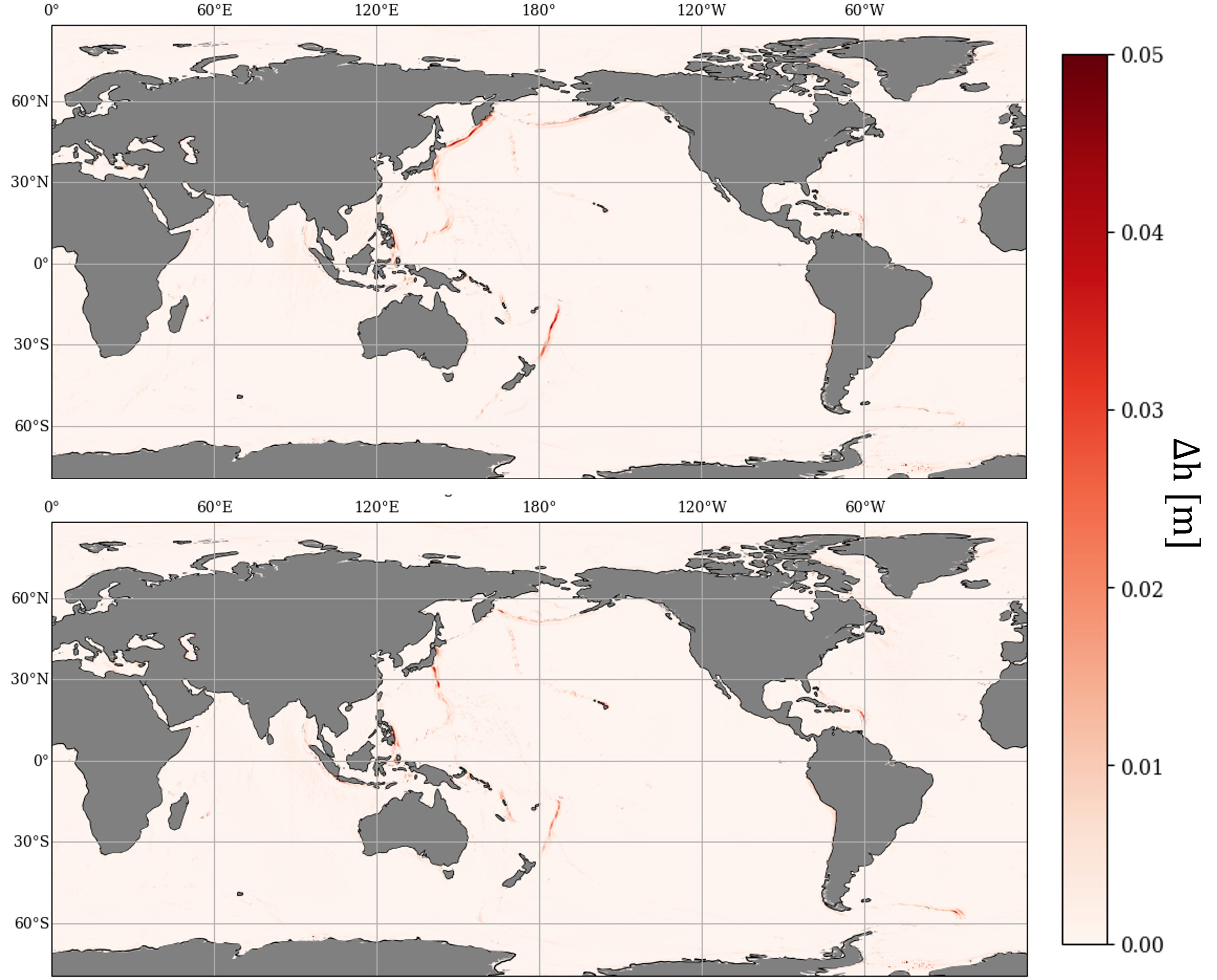 |
Range latitudinal empirical correction for Jason-1/2/3 GDRRange latitudinal empirical correction for Jason-1/2/3 GDR
This dataset provides an abacus to correct from the effect of a rounding error in the ground processing of the Jason-1, Jason-2 and Jason-3 missions on the altimeter range estimations. |  |


 Products .