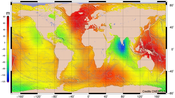
Mean Sea Surface MSS_CNES_CLS2022
Types of dataset: auxiliary product
DOI: 10.24400/527896/a01-2022.017 - more metadata
Contents: mean sea profile above a reference ellipsoid (T/P or WSG84). This surface is available on a regular grid (1/60°x1/60°, 1 minute). Another grid provides the estimation of error fields which represent the MSS accuracy estimated through the inverse technique.
Use: geodesy, geophysics, oceanography (operational oceanography, modeling, ocean variability studies)
Description : product for 20-year reference period (1993-2012), based 29 years of altimetry data (mean profiles, geodetic mission and SLA) Topex/poseidon, ERS-2, GFO, Jason-1,Jason-2, Jason-3, Envisat, SARAL/AltiKa, Cryosat-2, Sentinel-3A&B. The use of several missions requires to readjust all missions between them. Thus, a reference mission is chosen and other missions are adjusted with this latest (description of MSS CNES_CLS2022).
Geographic coverage: Global (79.4°S to 88°N)
Format : netCDF-4 format
Distribution media: FTP/SFTP, Gridded Data Extraction Tool, TDS; please refer to MY AVISO+
Condition of access: products delivered as stated in the licence agreement. To get an acces to the last version of MSS product, please fill in, select the given product "MSS_CNES_CLS (Mean Sea Surface)" and valid the registration form.
Copyright : 1993-ongoing CNES-CLS
MSS_CNES_CLS2022
| Name | Distribution media | Frequency | Data period | File weight |
|---|---|---|---|---|
| MSS CNES-CLS 2022 | please refer to MY AVISO+ | N/A | based on 1993 - 2012 | 1.6 GB |
Releases of MSS
MSS_CNES_CLS2015
This mean sea surface follows on MSS_CNES_CLS_2011. The key points of this CNES_CLS 2015 MSS:
- a drastic improvement of the shortest wavelengths,
- a better correction of the oceanic variability,
- a reduced degradation of SLA near the coast.
- globaly, strong reduction of errors when computing SLA
- more homogeneity of accuracy compared to the former versions
| Name | Distribution media | Frequency | Data period | File weight |
|---|---|---|---|---|
| MSS CNES-CLS 2015 | please refer to MY AVISO+ | N/A | based on 1993 - 2012 | 1.6 GB |
July 2011: New MSS_CNES_CLS2011
This mean sea surface follows on MSS_CNES_CLS_2010. The shorter wavelengths of this new MSS were significantly improved while maintaining the capability of the optimal analysis for removing the residual effect of the ocean variability.
It has been produced in the frame of the SLOOP project, funded by CNES/SALP, aiming at improving the quality of altimetric products in open ocean.
MSS_CNES_CLS10
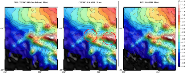
This model is affected by artifact (that affect the shortest wavelengths lower than 30 km) concerning seamounts that appear too smoothed. This was due to the behavior of the objective analysis, which tended to overestimate the residual ocean variability at the expense of the topography (static geophysical structure).
Further information: Schaeffer P. et al.: The new CNES CLS 2010 Mean Sea Surface, oral presentation at OSTST 2010 meeting (pdf, 10 MB).


