




Multivariate Inversion of Ocean Surface Topography, Internal Tide Model (MIOST-IT)
Types of dataset: auxiliary products
DOI: 10.24400/527896/a01-2022.003 - more metadata
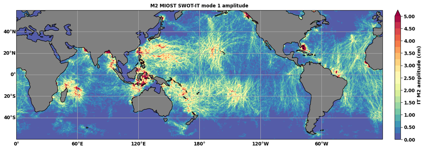
Contents: MIOST-IT database includes 4 tidal components for the ocean internal tide surface elevations. Each tidal component is described by 2 grids (amplitude and phase) provided on a cartesian grid 1/10°x1/10°.
- The internal tide elevations for the four tidal frequencies M2, S2, K1, O1, are available for download.
- The regional atlases are also provided.
- The tidal prediction code is also available to download including a README file in a "prediction" folder.
Use: open ocean oceanography, operational oceanography, ocean circulation, tide studies
Description: MIOST-IT solution is based on an original gridding process using ocean signals modes variability and all altimeter measurements available on the nearly entire altimeter era. MIOST-IT24 (Tchilibou et al., 2025) is a global atlas of coherent internal tide developed during the period 2024-2025. This atlas represents an updated version of MIOST-IT (refere here as MIOST-IT22), which was released in 2022 by Ubelmann et al. (2022).
Geographic coverage: global between latitudes +/-68.5°,notice that diurnal tides are filled with zeros for |Lat| > 30° for O1 and for |LAt| > 32° for K1.
Format: NetCDF-4
Condition of access: Internal tide elevations are delivered for any purposes, as stated in licence agreement
Tools: source of the prediction algorithm in Python
Citation: please cite “Those products were designed, implemented and validated by CLS, DATLAS and LEGOS and distributed by AVISO with support from CNES. MIOST-IT Internal tide Model products (Version 2024) [Dataset]. CNES. https://doi.org/10.24400/527896/A01-2022.003”
Documentation: More details about the MIOST-IT model construction, its performances and the prediction code, are available in the User Handbook
References:
Tchilibou, M., Barbot, S., Carrere, L., Koch-Larrouy, A., Dibarboure, G., and Ubelmann, C.: M2 monthly and annual mode-1 and mode-2 internal tide atlases from altimetry data and MIOST: focus on the Indo-Philippine archipelago and the region off the Amazon shelf, Ocean Sci., 21, 1469–1486, https://doi.org/10.5194/os-21-1469-2025 , 2025.
Ubelmann C., Carrere L., Durand C., Dibarboure G., Faugère Y. and Lyard F.: Simultaneous estimation of Ocean mesoscale and coherent internal tide Sea Surface Height signatures from the global Altimetry record, https://doi.org/10.5194/os-2021-80 pdf

The following links propose animations of the M2 baroclinic tides on the global ocean:
Copyright: 2021 – CLS/DATLAS/LEGOS/CNRS/CNES
Internal Tide - MIOST
| Product files | version | AVISO Distribution services | File weight | Handbook |
|---|---|---|---|---|
| MIOST IT | v2024 | CNES AVISO FTP/SFTP access (with AVISO+ credentials):
CNES AVISO THREDDS Data Server access (with AVISO+ credentials): tds-odatis.aviso.altimetry.fr/thredds/catalog/dataset-auxiliary-miost-it/catalog.html | 4 files of 3,3 GB each + regional atlases : files of 3,9MB and 1 MB | |
| v2022 | 4 files of 104 MB each |
Data
- Products guide.
 Products .
- Sea surface height products .
- Value-added products .
- Wind/wave products .
- Auxiliary products .
- Sentinel-6 Delay-Doppler Altimetry Retracking 5 parameters.
- Sentinel-6 Level-2P skewness products.
- MSS .
- MDT .
- Global tide - FES.
- Coastal Tide - XTRACK .
- Internal tide - MIOST.
- Dynamic Atmospheric Correction using ERA5.
- Dynamic Atmospheric Correction dedicated to SWOT CalVal Phase .
- Dynamic Atmospheric Correction .
- Wet troposphere correction from water vapour climate data records.
- GPD+ Wet Tropospheric Correction.
- Slope correction for Sentinel-6A SAR altimetry.
- Range latitudinal empirical correction for Jason-1/2/3 GDR.
- References.
- Ice products .
- Ocean indicators products .
- Ocean data challenges .
- Tide Gauges products.
- Data access .
- Product information .
- CALVAL .