Mobile version

Altimetry applications in videos

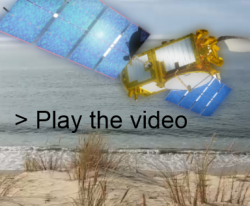
"Altimetry applications in videos" produced by Cnes on the occasion of the Jason-3 launch, traces the many fields where this technique is involved: the rising mean sea level, operational oceanography, the water cycle, marine wildlife, monitoring coasts.

  • Mean Sea Level

    Altimetry satellites are a crucial tool for observing variations in mean sea level. Satellite measurements show a mean sea level rise of around 3.1 mm a year between 1993 and 2012. This global rise is linked to warming caused chiefly by greenhouse gas emissions. Predictions for the 21st century are more alarming, with global warming expected to drive a significant rise in sea level.

  • Arctic

    Satellite monitoring of Arctic sea ice provides key indicators to assess the extent of climate change and give us a true picture of our planet.

  • Meteo and rogue waves

    Altimeters can measure sea surface height first and foremost the waves height, which is of prime importance to marine weather forecasters in terms of maritime safety. Wave heights from altimetric measurements are assimilated into sea state forecast models, and improve significantly their predictions.

  • Monitoring coasts

    Our coasts are subjected to changing ocean conditions, with rising sea level, more frequent storms, extreme weather events and erosion to name a few. Satellites have a key role to play in this task.

  • Operational oceanography

    Altimetry data are key measurements to describe and forecast how ocean conditions are likely to evolve out to several weeks. Many applications are taking advantage of the quality of satellite altimetry data.

  • Pollutants

    Microplastics, oil spill, nuclear waste, source of pollutions are numerous offshore.

    Altimetry satellites, by monitoring ocean currents and circulation, can help us to better track all kinds of pollutants and anticipate where they are likely to accumulate.

  • Ocean odyssey

    Jason-3 has been successfully launched last 17 January, 2016. Although its final orbit will be reached in a few days, its data are expected by users to serve a multitude of applications. It extends the high-precision ocean altimetry data record to support climate monitoring, operational oceanography and seasonal forecasting. Jason-3 is the result of a joint effort by national agencies Cnes, Nasa and operaitonal agencies, Eumetsat and Noaa,

EnglishFrançais
Rss feedsContactPartnersFAQLexiconLegal noticePersonal Data Protection PolicyMobile
You must enable cookies in your browser preferences to save the modifications
You are using an older version of Internet Explorer, please update to take full advantage of Aviso+ features

Customize the home page

View all widgets
Reduce display
Public profile
User profile

Select/Deselect widgets

Discover AVISO+

Customizable home, reading tools, products search guide, etc.. Discover step by step the features of the new site AVISO+.

Customizable homepage

This home page is composed of blocks called "widgets".

Rearrange the blocks with a "Click & Drop".

Hide a widget with the cross at the top right. Reset or add a widget with the "wrench" icon. The "User" and "Public" profiles offer a predefined organization.

All the modifications are automatically saved as cookies on your machine so as to enable you to have your own specific AVISO+.

Reading tools

Ease your reading by choosing the page background colour (black/white) and/or by modifying the font size.

Browsing menu and breadcrum trail

To ease your browsing through AVISO+, you can use at any time the main banner items with the interactive submenus or use the browsing menu on the left side of the screen (it is open by default). For more readiness of the page contents, you can fold and unfold the browsing menu by clicking on the tab. At any time you can know where you are thanks to the browsing menu or the breadcrum at the top of the page.

Products search guide

The first submenu of the "Data" banner item leads you to a new search form enabling you to find quickier the product that suits your needs. The list of results is updated according to your selection criteria.

AVISO+ Multimedia

The first submenu of the "Multimedia" banner item leads you to AVISO+ collections of images and videos linked to altimetry and its applications. Have a nice visit!