


El Niño on Novembers
Lively Data : August 16, 2004
Monitoring and forecasting of the El Niño phenomena is one of the most striking applications of altimetry. November is the month when El Niño and La Niña are the most visible on the sea level anomaly maps. The Live Access Server can average the data over a month. The phenomena is thus visible each November for 12 years -- since first Topex/Poseidon data -- with "El Niño" years (1992, 1994, 1997 and 2002), "La Niña" (1995,1996,1998,1999) and "normal" years.
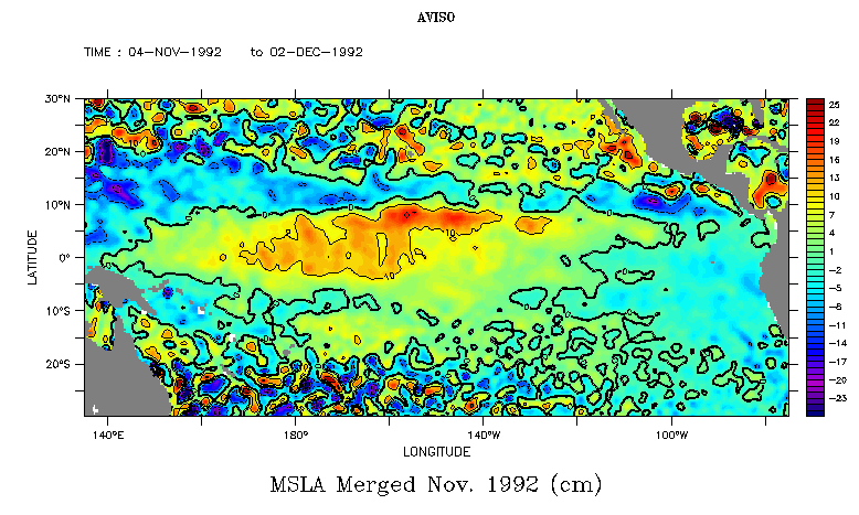
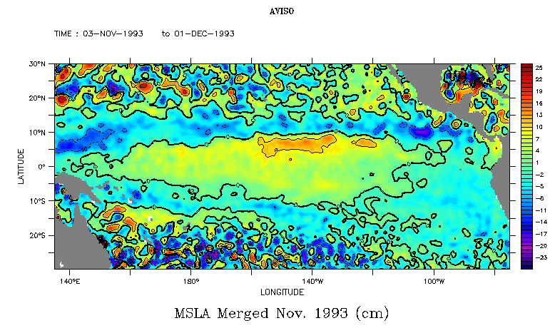
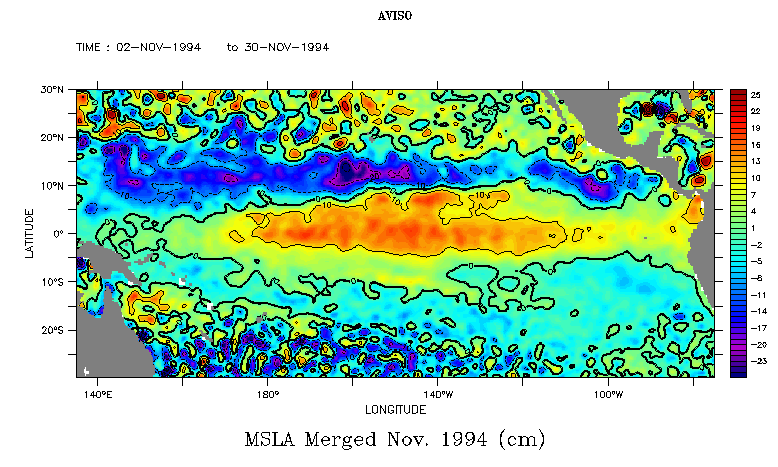
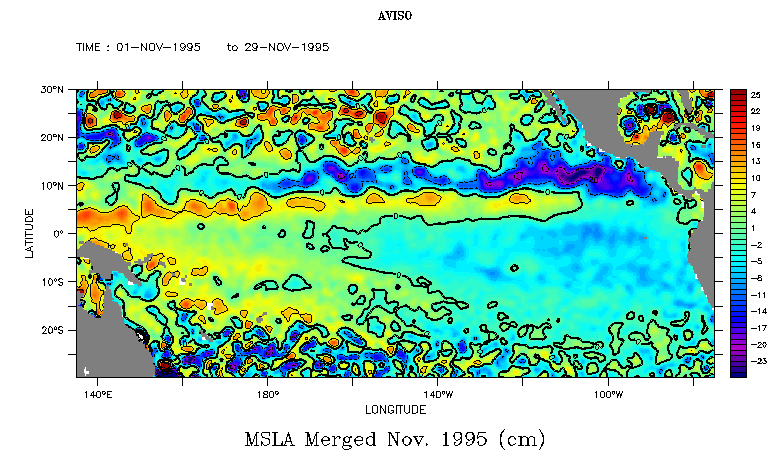
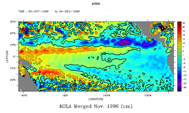
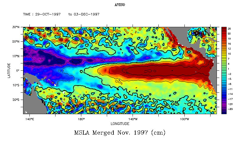
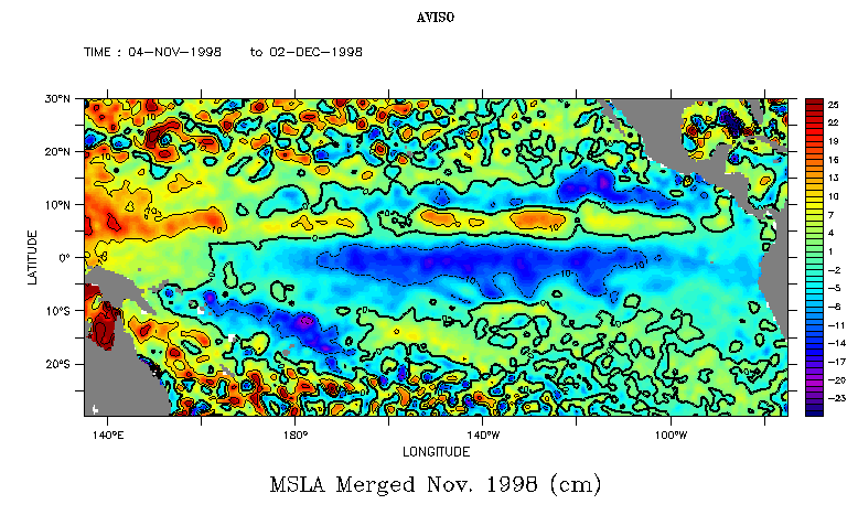

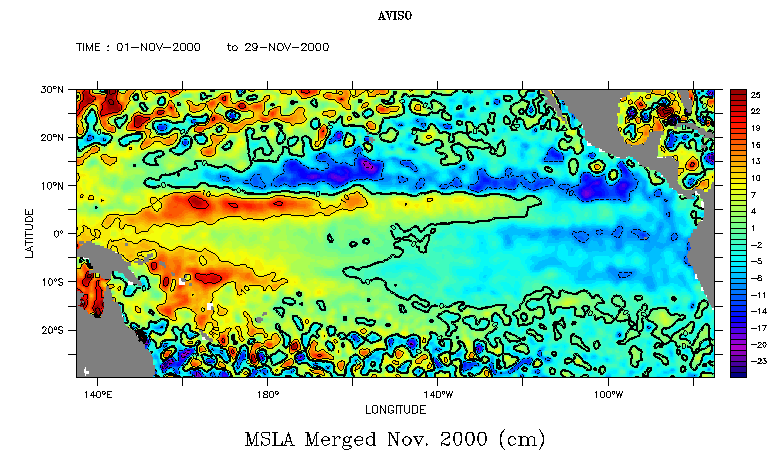
Monthly averages maps over Novembers each years since 1992, over the Equatorial Pacific. To plot such maps, you have to select a dataset (here, Ssalto/Duacs delayed time Maps of Sea Level Anomalies), the variable (Maps of Sea Level Anomalies Merged), click on "next, and then on "Define variable". On this last page, choose "Average", and T for the axis. Then pick your period of interest (here a particular month, but other choices are possible), click on "next", and choose your area. You will then have a map representing an average of your variable over the period.
(Click on each map to enlarge it)
 Use the Live Access Server