


Latest News
12.04.2018 2 - 8 April 2018 week

Scientists Surprised by Relentless Cosmic Cold Front (NASA, 03/04/18)
Plastic partout ! Histoires de déchets (Arte, 04/04/18)
Antarctica loses grip(ESA, 03/04/18)
Même un réchauffement de 2°C aura une incidence importante...[more]
05.04.2018 19 March - 1 April 2018 weeks

Réchauffement climatique : la menace dâune montée des eaux se confirme dans lâAntarctique (Sud Ouest, 20/03/2018)Geoengineering polar glaciers to slow sea-level rise (Science Daily, 19/03/2018)Cyclone Tropical MARCUS dans...[more]
28.03.2018 25 years of altimetry in video

Last August, we celebrated the 25years of Topex/Poseidon launch. To review the achievements of this period, a video has been made and is now available in the Gallery
23.03.2018 12 - 18 March 2018 week

Coral reef experiment shows: Acidification from carbon dioxide slows growth (Science Daily, 14/03/2018)
Le réchauffement climatique pourrait menacer jusqu'à 50% des espèces dâici à 2080 (20 Minutes, 14/03/2018)
Itâs 50...[more]
15.03.2018 5 March - 11 March 2018 week

Les scientifiques prévoient une hausse de plus de 2°C dans 13 villes (Challenges, 07/03/2018)
Un océan de plastique filmé en Indonésie (Le Point, 07/03/2018)
Desertification and monsoon climate change linked to shifts in...[more]
09.03.2018 26 February - 4 March 2018 week
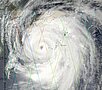
Probabilité de cyclogenèse en augmentation dans l'océan indien (Cyclone Ocean Indien, 26/02/18)
70 % des manchots royaux sont menacés de disparaître dâici à la fin du siècle (Le Monde, 26/02/18)
LâAntarctique,...[more]
07.03.2018 March 2018: flash flood at the Têt river mouth
SWOT will provide with high resolution coastal and inland measurements over rivers. They will help in modelling dramatic events such as flash flood and their impacts.
News
 Archives .
- Aviso Newsletter .
- Search.
- Front-page news.
- Image of the month .
- Operational news and status .