




Latest News
19.12.2023 Special Issue SARAL Newsletter #22

We are pleased to announce you the publication of the Aviso+ Newsletter #22 : a special issue celebrating SARAL/AltiKa 10-yr anniversary highlighting several domains in which SARAL/AltiKa has highly contributed, being a...[more]
15.12.2023 New version of SSALTO/DUACS Experimental products including CFOSat for wave-current interactions studies

It includes a new CFOSat processing, a new mapping process (MIOST) merging 8 missions. The filtering has changed and the temporal coverage has been extended.
12.12.2023 hydroweb.next platform is now open, distributing data for hydrologists

The hydroweb.next platform just opened Its ambition is to centralize a maximum amount of data for hydrologists.[more]
06.12.2023 SWOT "Beta Pre-Validated" KaRIn Science Data products public release
The joint NASA/CNES SWOT project is pleased to announce the public release of SWOT "Beta Pre-Validated" KaRIn Science Data products (PIB0 version).[more]
04.12.2023 December 2023: Mega-icebergs seen by Swot

Icebergs are visible in Swot data, including such mega-icebergs as the one just going off the Weddell Sea these days.

15.11.2023 Release of Reprocessed TOPEX/Poseidon Data
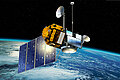
It is with enormous pleasure and no small amount of relief that we announce the release of the newly reprocessed TOPEX/Poseidon Data, just 11,411 days after launch. [more]
News
 Archives .
- Aviso Newsletter .
- Search.
- Front-page news.
- Image of the month .
- Operational news and status .