


Flooding in the Yangtse basin (China)
Altimetry enable to monitor river levels. Current flooding over the Yangtse basin can be seen in the hydrology-dedicated data.
Catastrophic flooding are occuring in the Yangtse basin (China) this year. The Yangtse, with its very steep banks and (relatively) narrow bed upriver is not the best test case. However, still the current flooding can be seen especially in the hydrology-dedicated data processed from Jason-2. The river level at the choosen point (over Banbian Hu lake, Hunan, China, at about 29°N, 112.2°E) is about 4 m higher than in April.
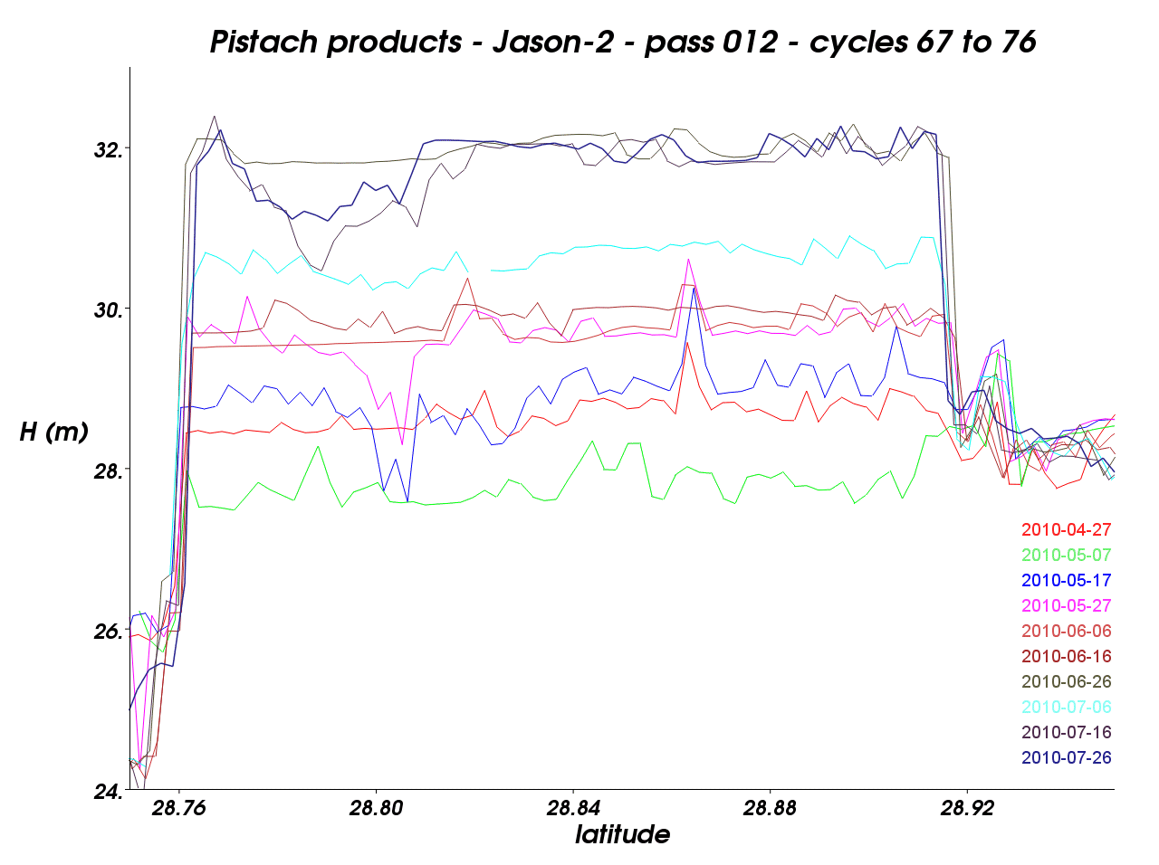
Altimetry-derived heights over the Banbian Hu lake (Hunan, China), every ten days since April (Jason-2 data processed for hydrology applications)