


Looks on indian monsoon
Lively Data : May 23, 2005
Not only an easy mapping tool, the LAS is also able to process statistics with data. Considering one year mean of sea level anomalies (MSLA merged, used in low resolution to focus on major features), it is possible to verify a few differences between Atlantic and Pacific Oceans on one hand, and Indian Ocean on the other hand.
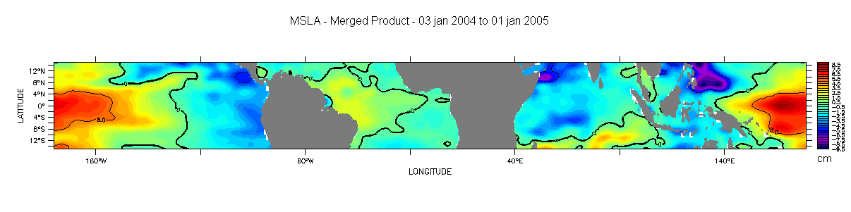
Mean Sea Level Anomalies, computed from January 2004 to January 2005. These statistics are available when choosing « Define variable » in the menu, then "average" and "t" as the main parameter.
In both equatorial Pacific and Atlantic Oceans, warm waters, seen as higher sea level, are mainly located on bassin's west side because of Trade Winds.
Indian Ocean circulation is influenced by monsoon and its changing winds. Image of the month from october 2002 titled "Summer current, winter current" shows this indian ocean circulation.
Here LAS allows us to visualize wind's variability via annual mean and variance of wind modulus.
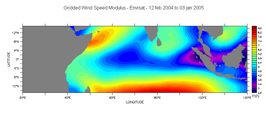
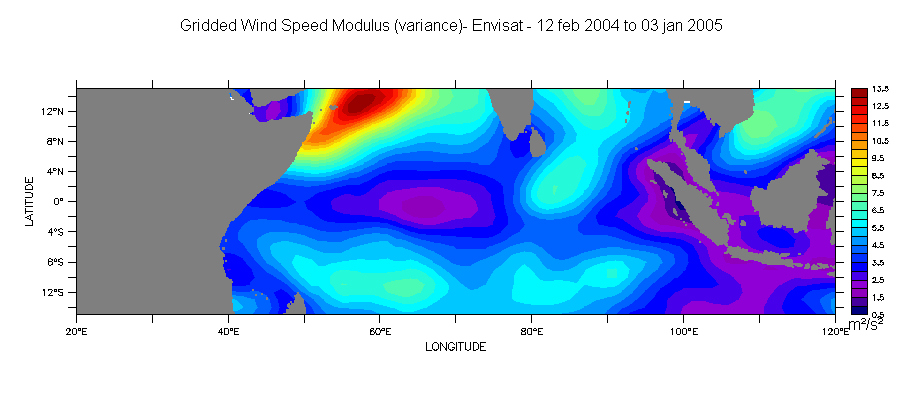
Mean and variance for gridded wind speed modulus, Envisat data, February 2004 to January 2005. Access to variance via "Select analysis type" menu.
There are no really strong wind fields around the equator, except in an area located between 5° et 15° of latitude; this area, which corresponds to Somalia current, presents the most important variability. Consequences are, in terms of oceanic currents:
- in winter a low anomaly, i.e a cyclonic circulation and Somalia current turns towards north,
- in summer a high anomaly, i.e an anticyclonic circulation and Somalia current turns towards south.
See also :
- Image of the month, October 2002, "Summer current, winter current", to see maps of sea level anomalies and of geostrophic currents in this area,
- Image of the month, August 2004, "Summer: wet monsoon season" , to get complementary informations about monsoon.
 Use the Live Access Server