


Wind and waves
Lively Data : October 14, 2005
Recent events showed terrible damage of extreme marine meteorological phenomena, like hurricane series in the Gulf of Mexico.
Wind datasets are available on Live Access Server ("gridded wind speed modulus"); these are the results of processes using altimetry data. Mapping these data, in the Gulf of Mexico area and in late august 2005, gives a vizualisation of Katrina hurricane which devastated american coastal areas.
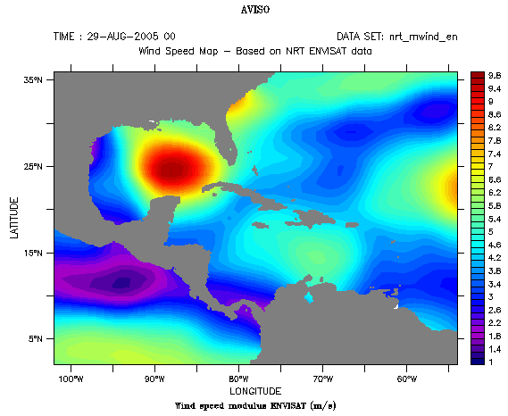
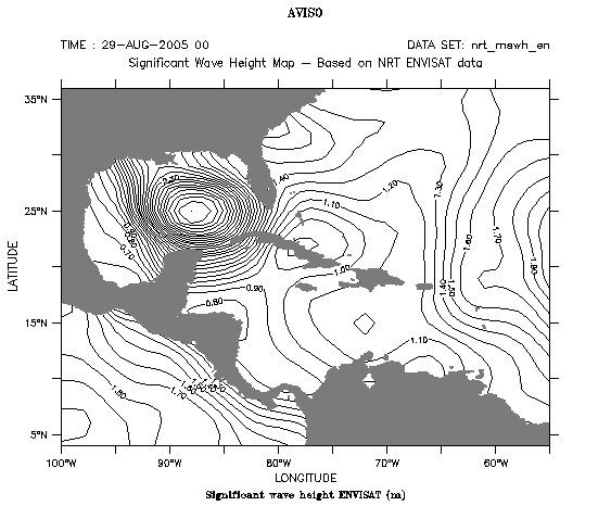
Left: wind speed modulus computed using Envisat data on august 29, 2005;choose "gridded wind speed modulus" dataset, then select Envisat.Right: Significant wave heights (still from Envisat data) at the same time and place. Choose now "Gridded significant wave height" dataset, and then Envisat. There are two ways to obtain this kind of maps: you can either use "solid white" palette, or put to zero colors palette (i.e write "(0,0,0)" in "Fill levels" field) and draw twenty lines by writing "20" in "Contour levels" field (example in our case). Link between estimated wind speed and wave heights seems to be evident here.
This is not exactly the kind of information that is directly usefull to hurricane modelling. On the other hand, among satellite altimetry data, sea surface heights are assimilated and associated to sea surface temperature (SST) in intensification models of hurricanes.
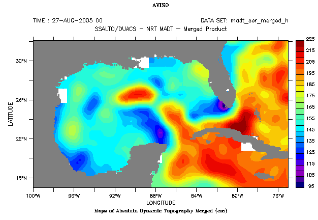
Absolute dynamic topography, august 27, 2005, combining all satalite data sources available. Select "Ssalto/Duacs Near-Real Time Absolute Dynamic Topography then "merged"; geographic area is here defined by ( 17°N-32°N, 100°W-75°W).
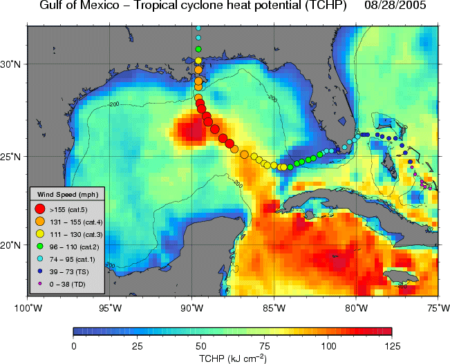
Hurricane heat potential computed from altimetry and SST (right) on August 28, 2005, crédits Noaa/AOML), which suggests an intensification of Katrina hurricane along loop current (see Lively data, April 20, 2005: Geostrophic velocities on the loop).
.
See also:
- Lively data, April 20, 2005: Geostrophic velocities on the loop.
- Applications: Hurricane Katrina intensification
 Use the Live Access Server