


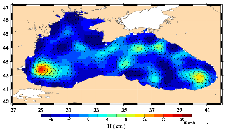
Better outlined eddies in Black Sea
In the new Ssalto/Duacs v3.0.0, the reference surface (or mean profiles) used for SLA computation was improved with respect to the previous version. Improved quality of the mean profiles, combined with higher quality of the altimeter measurement and processing, allowed us to improve the spatial coverage of the data specially in coastal
areas or enclosed seas.
As the global ocean product, the regional product over the Black Sea takes advantage of the DT Duacs reprocessing.
Permanent and semi-permanent well known eddies are better outlined in the new Ssalto/Duacs DT version. They also seem to have strong gradients. The formal mapping error is less, even in the Eastern basin where the sampling is anyway weaker.
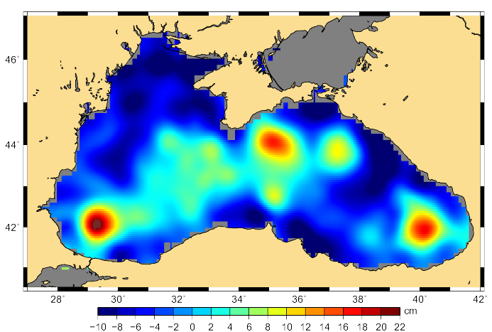
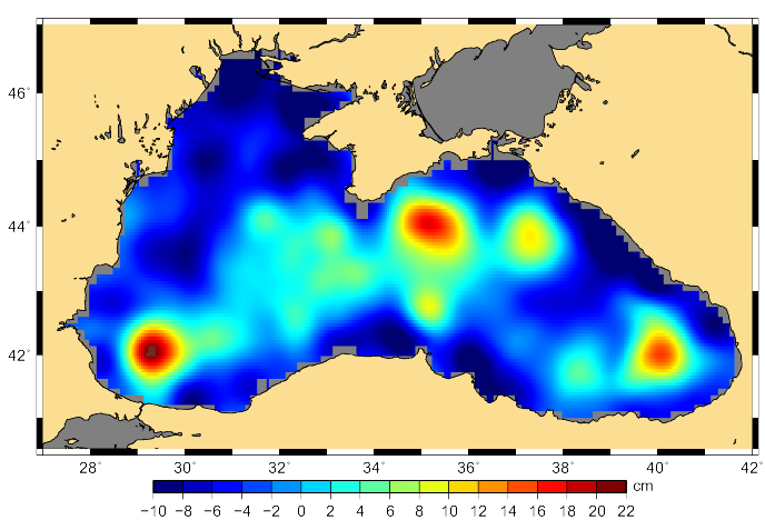
Old (left) and new (right) Ssalto/Duacs DT of MSLA on 2003/09/10 over the Black Sea. Credits Ssalto/Duacs.
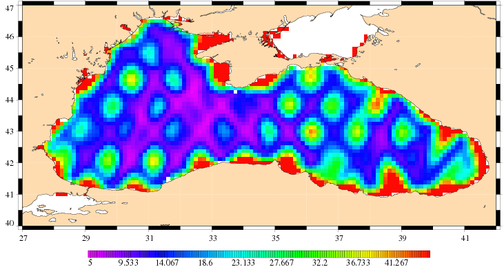
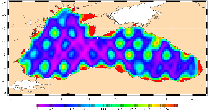
Old (left) and new (right) Ssalto/Duacs Maps of merged SLA Formal Mapping Errors expressed in % on 2003/09/10. Credits Ssalto/Duacs.
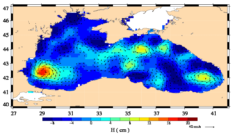
Old (left) and new (right) Ssalto/Duacs Maps of merged SLA superimposed with the geostrophic currents between August 06 and September 24, 2003 (a map per week). Click on each maps to see an animation. Credits Ssalto/Duacs.
Further information:
- Illustrations and more details on the parameters used for the Ssalto/Duacs reprocessed DT data set (pdf).
- Information, access to Ssalto/Duacs data: Data
- Ssalto/Duacs user handbook in <link file:2217 pdf download>pdf.
- Image of the month, March 2008: Black Sea's eddies
- Lively Data, <link en data data-access-services live-access-server-las lively-data apr-17-2009-black-sea-a-new-regional-product-for-the-las index.html>April 17, 2009: Black Sea : a new regional product for the LAS