




Latest News
12.09.2023 XTRACK L2P 2022: New AZORES area
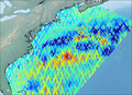
A new area AZORES has been added to the XTRACK L2P version 2022 product. There are now 27 coastal areas that are distributed.
07.08.2023 Version 1.1 of Wet Troposphere Correction from water vapour CDRs
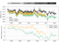
The new version 1.1 of the Wet Troposphere Correction from water vapour climate data records is now online on Aviso+, taking into account new versions of input data.
03.08.2023 August 2023: Assessing coastal vulnerability in Ghana
![Flood extent mapping for each scenario of Extreme Coastal Water Levels where: (A) 30th percentile of ECWLs with 19% of the area being potentially flooded, (B) 60th percentile of ECWLs with 29% of the area being potentially flooded, (C) 98th percentile of the area being potentially flooded. (from [Brempong et al., 2023])](/fileadmin/_processed_/e/a/csm_202308_jmse-11-01144-g006_837da7874b.png "Flood extent mapping for each scenario of Extreme Coastal Water Levels")
Sea level rise is already adding to extreme events for low-lying coasts. Altimetry helps in assessing the risks.
02.08.2023 Swot orbit changed for the "science" orbit

Between 10 and 20 July, Cnes teams performed a series of manoeuvres to raise Swot satellite's altitude by 33 km. The satellite has been in a calibration and validation 1 day orbit for 6 months. The aim of the orbit change is to...
12.07.2023 New on AVISO+: Barystatic and manometric sea level changes from satellite geodesy
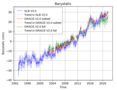
The barystatic and manometric sea level changes represent the mass component of sea level changes at global and regional scales respectively. They are estimated here using two different approaches: from satellite gravimetry and...
03.07.2023 Polar Oceans Products: release of v2.0
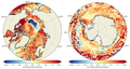
A new version v2.0 is available for Arctic and Southern Oceans SSALTO/DUACS experimental gridded and along-track products.[more]
03.07.2023 July 2023: Detecting eddies around Antarctica
![Sea level anomaly datasets and eddy detection on 2017/09/01, Eddy Kinetic Energy in the Southern Ocean (The black dashed line is the −1,000 m isobath. The bold black line is the limit of the subpolar Southern Ocean, defined here as the −180 cm MDT contour) (modified from [Auger et al., 2023])](/fileadmin/_processed_/0/5/csm_202307_jgrc25466-fig-0001-2_e68a86336c.png)
Sea level anomalies gridded datasets encompassing seasonnally-ice covered regions have been computed and released for Arctic and Antarctic. From those, Eddy Kinetic Energy (EKE) and mesoscale eddies detection can be processed.
News
 Archives .
- Aviso Newsletter .
- Search.
- Front-page news.
- Image of the month .
- Operational news and status .