Ex-Hurricane Erin swell on the French coasts


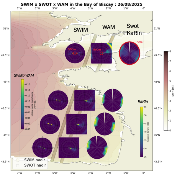
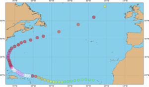
The ability of observing ocean swell is one of the unexpected capabilities of Swot, published by [Ardhuin et al., 2024; https://doi.org/10.1029/2024GL109658 ]. Hurricane Erin began on August 11st, 2025, over Tropical mid-Atlantic, went north of Hispaniola & Cuba and then continued north then north-east, being reclassified as "extratropical storm" south of Iceland on August 22th. However, it was still a strong storm, which touched Ireland and Scotland by August 26th. Its swell reached the Bay of Biscay and the English Channel on the same day, with an alert emitted by Meteo France. Portuguese authorities also emitted an alert, and high swell was detected along the French coasts.
Swot and CFOSat observed this high swell. And their measurements enable to build 2D ocean wave spectra, with their direction, period and amplitudes. The long swell (wavelength longer than 500 m) propagating toward the French coast was in particular observed by Swot KaRIn (using the 250 m Sea Surface Height Anomaly data) and CFOSat Swim with its rotating radar. Both KaRIn and SWIM data and the WAM model output are in good agreement, showing a long swell coming from the West/Northwest.
References
- Ardhuin, F., Molero, B., Bohé, A., Nouguier, F., Collard, F., Houghton, I., et al. (2024). Phase-resolved swells across ocean basins in SWOT altimetry data: Revealing centimeter-scale wave heights including coastal reflection. Geophysical Research Letters, 51, e2024GL109658. https://doi.org/10.1029/2024GL109658
- Ardhuin F., M. De Carlo, A. Ollivier, A. Nigou, Altimetry and the many scales of the ocean surface elevation: wave heights, wave groups, skewness, and sea level "noise”, "30 years of progress in radar altimetry Symposium, Montpellier, France, 2-7 September 2024
Data:
- First version of the KaRIn L3_LR_WW product, developed by CLS/LOPS based on Ardhuin's publication
- CFOSat products
See also:
- Image of the Month, October 2024: Swot & swell


