


Saturated color scale
Lively Data : April 16, 2004
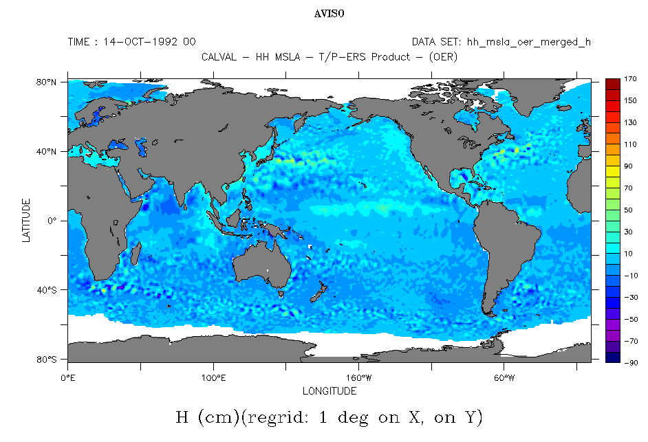
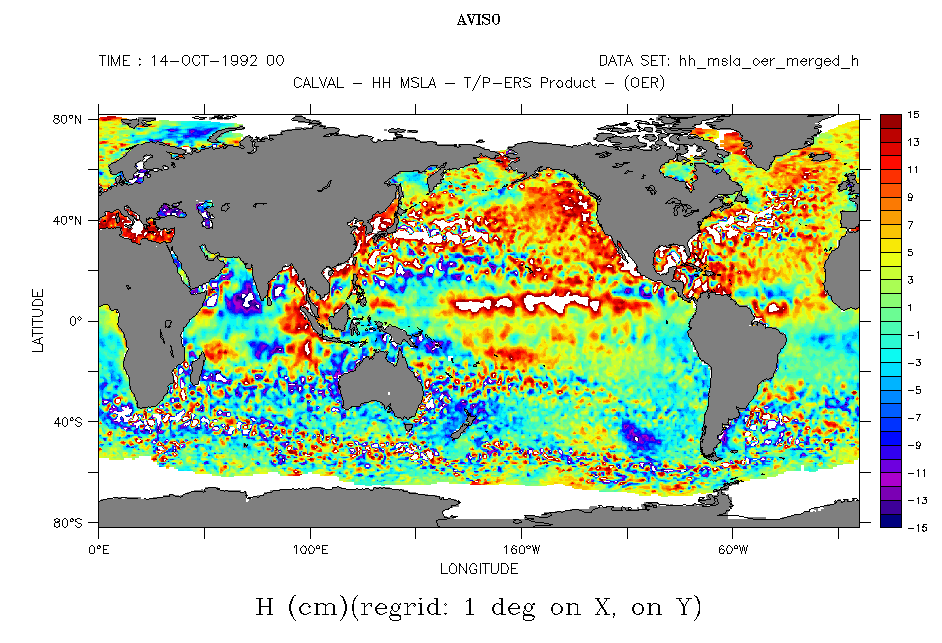
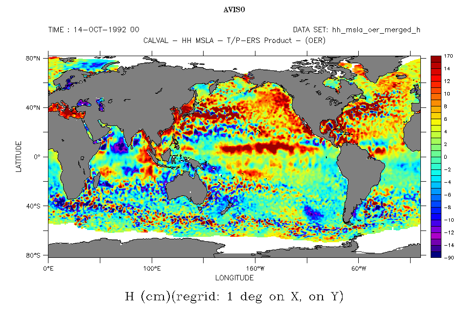
Altimetric measurements have often very high extreme values, mostly in strong turbulence areas -- typically in the majors currents like Gulf Stream or Kuroshio. A plot of a global map without specification can lead to a nearly uniformly colored map, since typical sea level variations are hidden by the amplitude of the color scale needed to have the extreme values.
The Live Access Server allow to impose color scale minima and maxima, depending on what we wish to see. For major current variations +/-30 cm (or even +/-50 cm) are needed; for El Niño, +/-20 to 25 cm are OK. For the rest of the ocean +/-15 cm are more than enough most of the time. To fix those extrema, we saw (Scaling the ocean - July 7, 2003) that you have to click on "output options", then typing in "fill option": (min, max, interval). But this lead to blank areas, where values exceed the defined extrema. To avoid this, you can type (absolute min)(min, max, interval)(absolute max), where absolute min and max are the map extreme values (or very high ones). Color scale is then saturated.
 Use the Live Access Server