




Experimental Products: Polar Ocean Gridded Level-4 Sea Surface Heights and Velocities
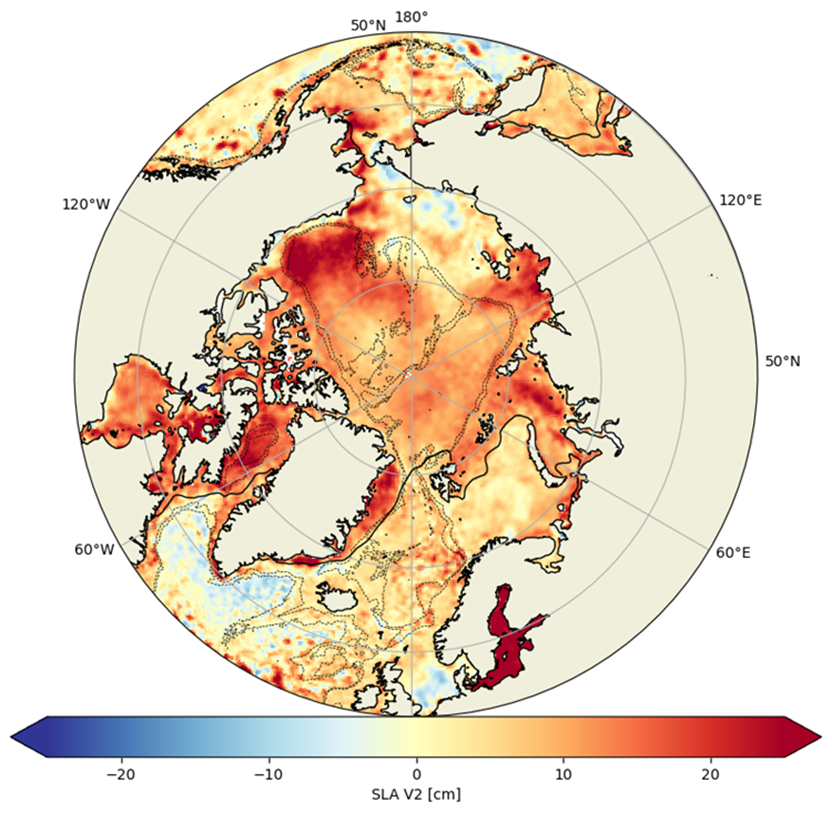
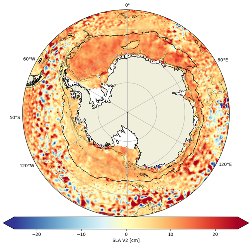
Types of dataset: Experimental Ssalto/Duacs gridded monomission and multimission altimeter products dedicated to Polar Oceans. This dataset is one of the experimental products which are available on the SSALTO/DUACS experimental products
DOI: 10.24400/527896/AVISO-2026.005 - more metadata
Contents: sea level heights computed with respect to a twenty-year mean.
Condition of access : Users should keep in mind that these products are experimental products. Notably, they are not produced on an operational basis.
Description: Experimental gridded level-4 product of Sea Surface height Anomalies and geostrophic velocities from 50°N up to 88°N for the Arctic Ocean and 50°S to 88°S for the Southern Ocean.
The products include ice-covered regions using sea level observations within the leads (open water area within a fracture of sea ice). Waveform classification of satellite echoes is performed to differentiate leads and open ocean from floes measurements using neural-network-based classification method. Then the missions are cross calibrated on SARAL/AltiKa and the Sea Level Anomalies along-track data from 3 altimetry missions are generated (10.24400/527896/AVISO-2026.004). The gridded products are computed using several types of mapping method (Optimal Interpolation (OI) or Multiscale Interpolation Ocean Science Topography (MIOST)).
Therefore, the files available are:
- 3 monomission gridded files using Optimal Interpolation (OI) mapping method: SARAL/AltiKa, Cryosat-2 and Copernicus Sentinel-3A
- multimission gridded files combining the 3 satellites using Optimal Interpolation (OI) mapping method
- multimission gridded files combining the 3 satellites using Multiscale Interpolation Ocean Science Topography (MIOST) mapping method
Citation: When using the SSALTO/DUACS experimental products, please cite: "The Polar Ocean Gridded Level-4 Sea Surface Heights and Velocities Experimental Product is processed by SSALTO/DUACS and freely distributed by AVISO. CNES, & CLS. (2026). Experimental Polar Ocean Gridded Level-4 Sea Surface Heights and Velocities (Version 2.0) [Data set]. CNES. doi.org/10.24400/527896/AVISO-2026.005”.
Geographic coverage: Polar Oceans: 50°N to 88°N for Arctic Ocean and 50°S to 88°S for Southern Ocean.
Tools and references:
- User handbook: SSALTO/DUACS experimental products handbook: SLA for polar Oceans
- Veillard P, Prandi P, Pujol M-I, Daguzé J-A, Piras F, Dibarboure G and Faugère Y (2024) Arctic and Southern Ocean polar sea level maps and along-tracks from multi-mission satellite altimetry from 2011 to 2021. Front. Mar. Sci. 11:1419132. https://doi.org/10.3389/fmars.2024.1419132
- Veillard, P., Prandi, P., Auger, M., Faugere, Y., and Dibarboure, G.: Sea level maps of the Arctic (and southern) ocean from satellite altimetry from 2011 to 2021, EGU General Assembly 2023, Vienna, Austria, 23–28 Apr 2023, EGU23-7859, https://doi.org/10.5194/egusphere-egu23-7859 , 2023.
- Prandi et al., OSTST 2022: Benefits of multi-altimeter combination for Arctic sea surface height retrievals, https://doi.org/10.24400/527896/a03-2022.3306
- Auger, M., Sallée, J.-B., Prandi, P., & Naveira Garabato, A. C. (2022). Subpolar Southern Ocean seasonal variability of the geostrophic circulation from multi-mission satellite altimetry. Journal of Geophysical Research: Oceans, 127, e2021JC018096. https://doi.org/10.1029/2021JC018096
- Prandi, P., Poisson, J.-C., Faugère, Y., Guillot, A., and Dibarboure, G., 2021: Arctic sea surface height maps from multi-altimeter combination, Earth Syst. Sci. Data, 13, 5469–5482, https://doi.org/10.5194/essd-13-5469-2021
- Study with those products: Bonaduce et al., OSTST 2022, Exploitation of high-resolution datasets for sea level studies in the Nordic Seas and Arctic Ocean
Copyright: 2010-2022 - CNES/CLS
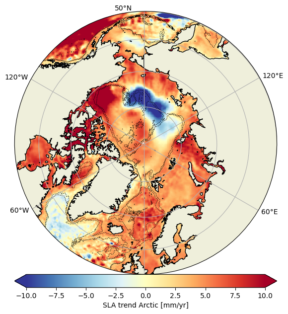
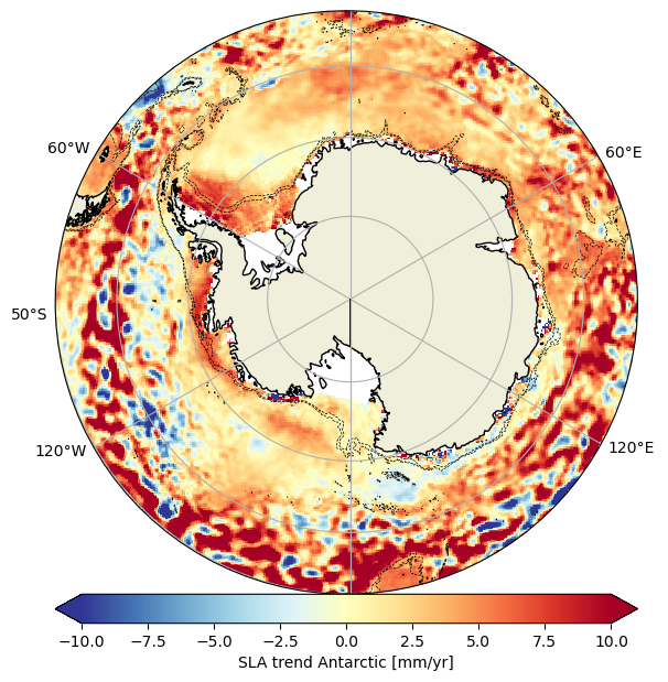
Videos: Absolute dynamic topography maps from multimission satellite altimetry (left: Arctic Ocean, right: Southern Ocean). Particules are advected into the ocean currents and the black line denotes the 30% threshold in sea ice concentration.

Delayed-time gridded SLA and velocities dedicated to Polar Oceans products
| Satellite | Area | Version | Type | Authenticated access service | Resolution | Data period | File weight |
|---|---|---|---|---|---|---|---|
| SARAL/AltiKa | Southern Ocean | 2.0 | gridded (monomission) | CNES/AVISO FTP/SFTP access (with AVISO credentials):
CNES AVISO THREDDS Data Server access (with AVISO credentials): | 75 km/10 days (but 2 consecutive dates are not independent as a result of 30 days averages) | 2013/03/18-2022/07/09 | 188 Mb |
| Cryosat-2 | 2012/12/18-2021/12/21 | 179 Mb | |||||
| Sentinel-3A | 2016/06/30-2021/06/24 | 101 Mb | |||||
| SARAL/AltiKa | Arctic Ocean | 2013/03/18-2022/07/09 | 188 Mb | ||||
| Cryosat-2 | 2010/07/12-2021/12/31 | 229 Mb | |||||
| Sentinel-3A | 2013/03/18-2022/07/09 | 101 Mb | |||||
| Merged | Southern Ocean | gridded (multimission with OI) | 25 km/3 days, but 2 consecutive dates are not independent | 2013/01/02-2021/12/31 | 3.8 Mb (1 file per 3 days) | ||
| Arctic Ocean | 2011/01/03-2021/12/30 | ||||||
| Southern Ocean | gridded (multimission with MIOST) | 2012/12/21-2021/12/31 | 265 Mb | ||||
| Arctic Ocean | 2011/01/03-2021/12/30 |
Data
- Products guide.
 Products .
- Sea surface height products .
- Global .
- Regional .
- SSALTO/DUACS Experimental products.
- Experimental Products: Polar Ocean Along-track Level-3 Sea Surface Heights.
- Experimental Products: Polar Ocean Gridded Level-4 Sea Surface Heights and Velocities.
- Europe area - Along-track Sea Level Heights.
- Europe area - Gridded Sea level Anomalies Mean and Climatology.
- Along-track Sea Level Anomalies 5Hz.
- Gridded sea level heights and derived variables - Dynamic Interpolation.
- Gridded sea level heights and derived variables combining altimetry and drifters.
- X-TRACK SLA .
- CoastalDT-SLA products.
- Value-added products .
- Wind/wave products .
- Auxiliary products .
- Ice products .
- Ocean indicators products .
- Ocean data challenges .
- Tide Gauges products.
- Data access .
- Product information .
- CALVAL .