


Mission's objectives
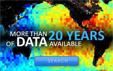
Is the Earth getting warmer? What do the ocean currents hold in store for tomorrow? What are the underlying processes driving ocean movements? The Jason series of satellites will sustain radar altimetry observations in the coming decades, providing continuous data on sea surface height (SSH) accurate to within a few centimetres all over the globe, to tell us more about variations in surface and deep-water ocean circulation. Designed to follow on from Topex/Poseidon, Jason-1's instruments and data processing systems have drawn extensively on the lessons learned from its predecessor. Jason-1 is a true ocean observatory that will supply SSH and sea-state measurements in near-real time to an international user community.
Oceanography and ocean forecasting
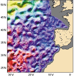
Forecasts of ocean circulation and its eddies. Credits Shom/CLS. | Ocean variability is the central focus of the Jason-1 mission. The satellite's orbit - identical to Topex/Poseidon - has been defined to cover 90% of the world's ice-free oceans every ten days. Real-time data delivery will make it possible to issue ocean bulletins in much the same way as we do weather forecasts today. |
Climatology and climate prediction
Altimetry data yield vital information for studying and predicting climate, in particular climatic phenomena such as El Niño. Jason-1's ability to measure mean sea level with millimetre accuracy will be a key asset for monitoring climate change.
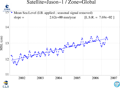
Global variations in mean sea level measured by Jason-1 (Credits CLS/Legos).
Marine meteorology
Jason-1 delivers sea-state data (wave heights and wind speed) within three hours. This information will help us to better understand and predict weather conditions over the oceans.
Significant wave heights measured by Jason-1 in July2007. (Credits Aviso)
Geophysics
The Earth's gravity field affects sea level. By measuring the ocean's dynamic topography, we can learn more about plate tectonics, bottom topography, movements of the Earth's mantle and many other geophysical phenomena. Altimetry data are also used to study ice, lakes and rivers, and relief in desert regions.
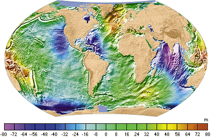
The mean sea surface shows how the Earth's gravity field affects the oceans.(Credits Shom/CLS)
See the Applications section, for more details
See the scientific objectives in Y. Ménard, L.L. Fu, 2000: Jason-1, on the tracks of Topex/Poseidon, Aviso Newsletter, 7, January 2000.