


Slope correction for Sentinel-6A SAR altimetry
Types of dataset: auxiliary products
Contents: Available on the period 01/02/1992 – 31/12/2022
DOI: 10.24400/527896/a01-2025.007 - more metadata
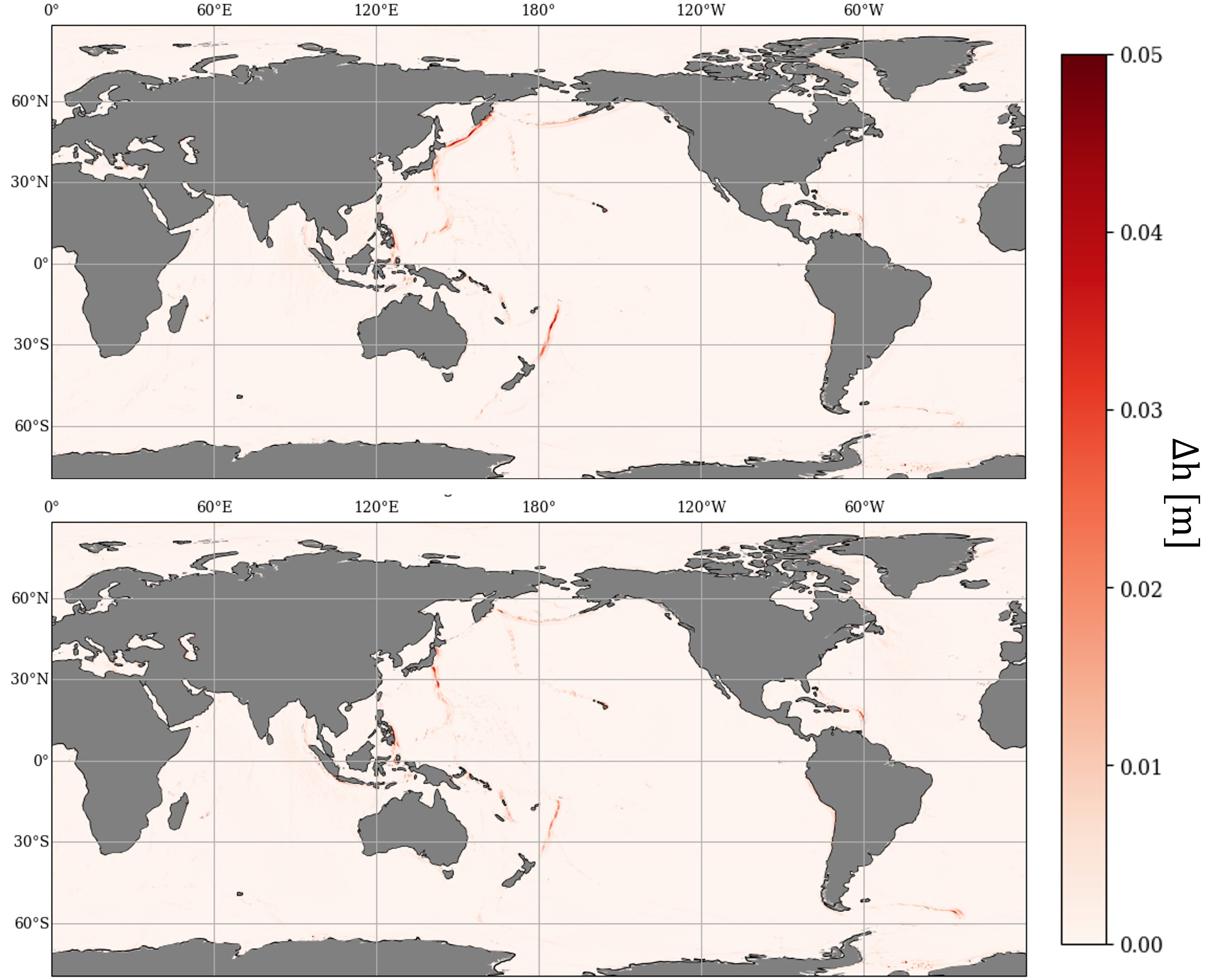
Description: This product provides slope correction maps for Sentinel-6A SAR mode. These maps are derived from the approach originally developed for LRM mode by Sandwell and Smith (2014), adapted to reflect the geometry and orientation of SAR altimeter ground footprints. As the SAR altimeter has a rectangular ground footprint, the correction depends on the approach angle between the ground track direction and the orientation of the MSS gradients. Two correction maps are therefore included in this product: one for ascending tracks and one for descending tracks.
Citation: Please cite: "This product was produced by CLS as part of the DUACS project and distributed by AVISO+ with the support of CNES, (2025). Slope correction for Sentinel-6A SAR altimetry (Version 1.0) [Data set]. CNES. https://doi.org/10.24400/527896/A01-2025.007 "
Geographic coverage: global
Format: NetCDF
Condition of access: products delivered for any purposes as stated in the licence agreement.
References:
- User Manual
- Gamot, J., Pujol, M. I., Schaeffer, P., & Bignalet-Cazalet, F. (2025). Slope correction for ocean SAR altimetry. ESS Open Archive . February 18, 2025. https://doi.org/10.22541/essoar.173991386.64041762/v1
- Sandwell, David & Smith, Walter. (2014). Slope correction for ocean radar altimetry. Journal of Geodesy. 88. https://doi.org/10.1007/s00190-014-0720-1
Slope correction for Sentinel-6A SAR altimetry
| Product | Authenticated access service | Version | Data period | File weight |
|---|---|---|---|---|
| Slope correction for Sentinel-6A SAR altimetry | CNES AVISO FTP/SFTP access (with AVISO+ credentials):
CNES AVISO THREDDS Data Server access: | 1.0 | 01/02/1992 – 31/12/2022 | 200MB (one file) |
Data
- Products guide.
 Products .
- Sea surface height products .
- Value-added products .
- Wind/wave products .
- Auxiliary products .
- Sentinel-6 Level-2P skewness products.
- MSS .
- MDT .
- Global tide - FES.
- Coastal Tide - XTRACK .
- Internal tide - MIOST.
- Dynamic Atmospheric Correction using ERA5.
- Dynamic Atmospheric Correction dedicated to SWOT CalVal Phase .
- Dynamic Atmospheric Correction .
- Wet troposphere correction from water vapour climate data records.
- GPD+ Wet Tropospheric Correction.
- Slope correction for Sentinel-6A SAR altimetry.
- Range latitudinal empirical correction for Jason-1/2/3 GDR.
- References.
- Ice products .
- Ocean indicators products .
- Ocean data challenges .
- Tide Gauges products.
- Data access .
- Product information .
- CALVAL .


