Mobile version

Record flood in the Amazon basin

After months of intense rains, the Amazon basin sustains record floods. Satellite altimetry can make a major contribution for monitoring fluctuations in continental waters.

Persistent and intense rains over the upstream Amazon basin since September 2011 exceeded water levels in continental waters. These high water levels fed many tributaries and strongly impacted a huge number of people. These people will still affected by diseases or homeless once the waters will begin to recede. .

Satellite remote-sensing techniques and in particularly, satellite altimetry have enabled new hydrological applications to be developed for monitoring fluctuations in continental waters. 

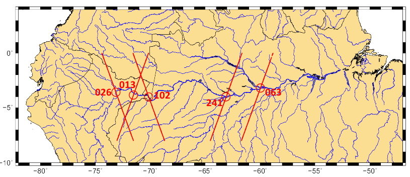
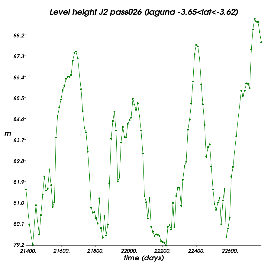
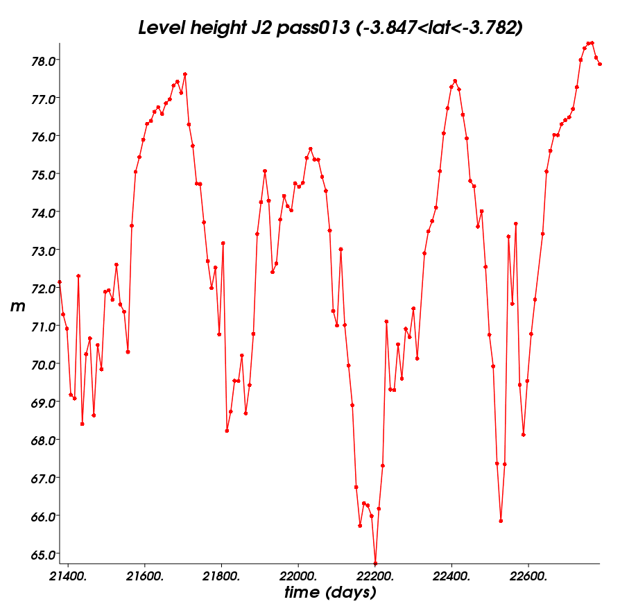
Here, we use the Jason-2 data provided by Pistach project (IGDR products with a specific treatment adapted to continental waters) from July 2008 to today to plot water level time series in several points where the Jason-2 ground tracks overfly the waters. From these time series below, we can see that the current peak flood overpasses the previous ones occurred in 2009 and 2011. The 2012 peak flood occurred in April in upstream basin whereas the water levels is not yet begin to decrease in downstream areas.


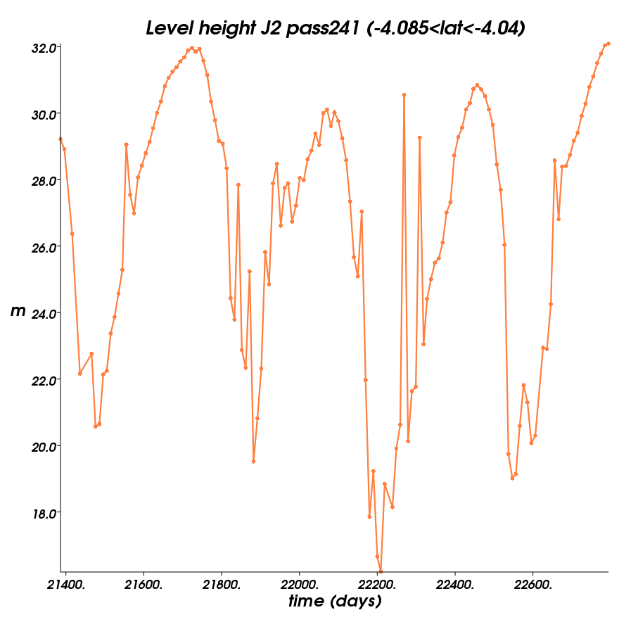
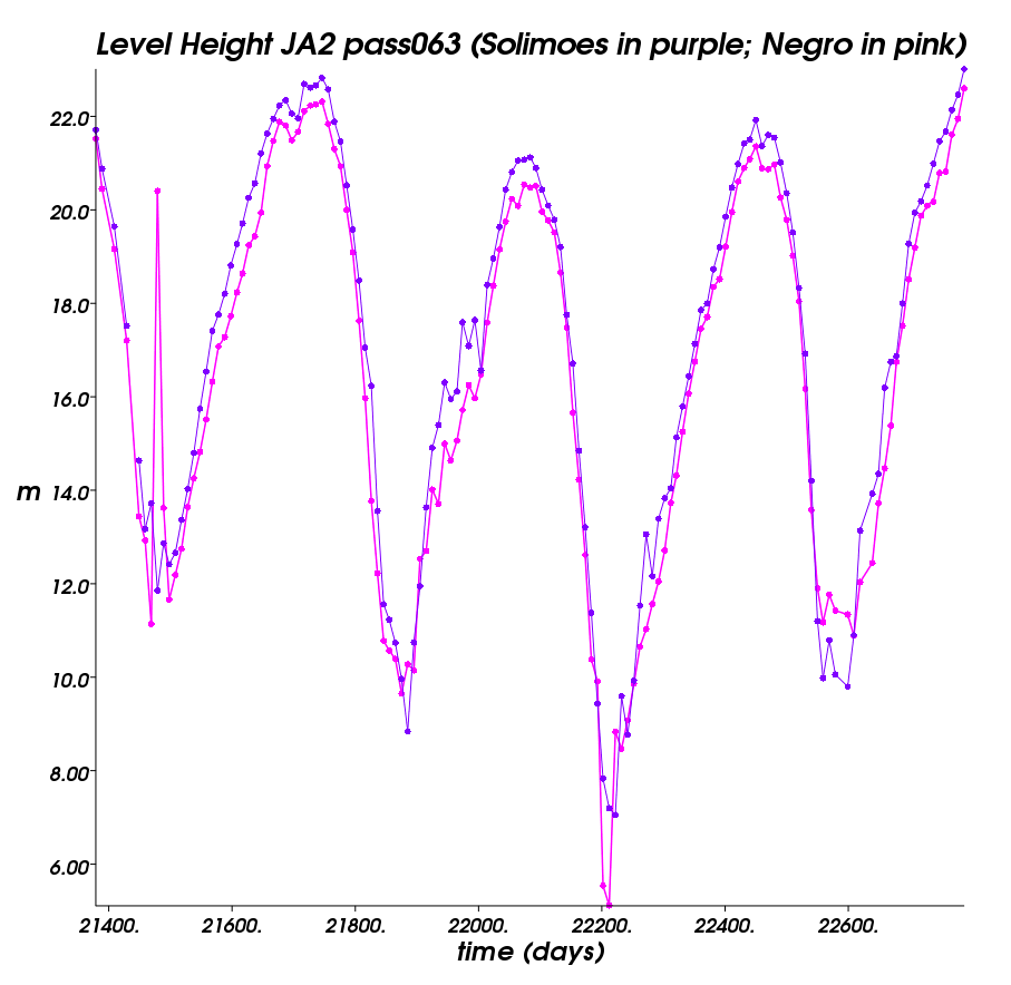
Time series (in julian days) of altimetry-derived heights (in meters) in the Amazon basin from upstream (top left, nearby the town of Iquitos) to downstream (bottom right, nearby the town of Manaus) areas.
These measurements were done with the Jason-2 data under pass 026, 013, 102, 241 and 063, from cycle 1 (July 2008) to cycle 143 (end of May 2012) and are provided by Pistach project (IGDR products with a specific treatment adapted to continental waters).
The exact latitudes coordinates for a given ground track are shown when clicking on each image. Use the pass locator to locate the ground track with Google Earth. Use the calendar tool to convert julian days to calendar days. Credits CLS/Cnes.

Further information:

EnglishFrançais
Rss feedsContactPartnersFAQLexiconLegal noticePersonal Data Protection PolicyMobile
You must enable cookies in your browser preferences to save the modifications
You are using an older version of Internet Explorer, please update to take full advantage of Aviso+ features

Customize the home page

View all widgets
Reduce display
Public profile
User profile

Select/Deselect widgets

Discover AVISO+

Customizable home, reading tools, products search guide, etc.. Discover step by step the features of the new site AVISO+.

Customizable homepage

This home page is composed of blocks called "widgets".

Rearrange the blocks with a "Click & Drop".

Hide a widget with the cross at the top right. Reset or add a widget with the "wrench" icon. The "User" and "Public" profiles offer a predefined organization.

All the modifications are automatically saved as cookies on your machine so as to enable you to have your own specific AVISO+.

Reading tools

Ease your reading by choosing the page background colour (black/white) and/or by modifying the font size.

Browsing menu and breadcrum trail

To ease your browsing through AVISO+, you can use at any time the main banner items with the interactive submenus or use the browsing menu on the left side of the screen (it is open by default). For more readiness of the page contents, you can fold and unfold the browsing menu by clicking on the tab. At any time you can know where you are thanks to the browsing menu or the breadcrum at the top of the page.

Products search guide

The first submenu of the "Data" banner item leads you to a new search form enabling you to find quickier the product that suits your needs. The list of results is updated according to your selection criteria.

AVISO+ Multimedia

The first submenu of the "Multimedia" banner item leads you to AVISO+ collections of images and videos linked to altimetry and its applications. Have a nice visit!