


Archives of Monomission data : updates
September 2019: New dissemination of S/O/I/GDR products
The ftp dissemination of the Geophysical Data Records (S/I/GDRs for Jason-1, Jason-2, Jason-3, Saral and OGDRs for Saral) products is available via the authenticated AVISO+ ftp portal. The previous anonymous access (ftp://avisoftp.cnes.fr/AVISO/pub/ ) is now closed.
Note that the deliveries on the Online Data Extraction Service (ODES) and the AVISO+ Cnes Data Center remain unchanged.
Current data:
Since June 20th, the operational chain has been delivering the data for the current missions on both AVISO+ ftp portals, allowing operational users to switch to the authenticated ftp portal as soon as possible.
Historical data:
The historical data (past and current missions) has been transferred to the authenticated Aviso+ ftp portal
You will find information about the products in the dedicated pages:
and on your dedicated MY AVISO+
February 2019: New version of L2P Non Time Critical Sentinel-3A products
The new version 02_01 is disseminated by AVISO+ via ftp or AVISO+ CNES Data Center (see the product sheet) with unchanged access (available in version_02_01 folder).
Note that the last cycle produced in version 02_00 has already been delivered (cycle 39). The next cycle 40 will be produced only in version 02_01.
The version 01_00 will be removed from the ftp site.
With this new version:
- the input data are the “spring 2018 reprocessed” version of input NTC L2 products fully detailed in the EUMETSAT S3A STM reprocessing technical note
- the retracking version is homogeneous for all the cycles
- the standards are the same as in 02_00 version
- the temporal coverage of L2P versions and L2 baseline used are:
| S3A L2P NTC version 02_01 | S3A L2P NTC version 02_00 | S3A L2P NTC version 01_00 | |
|---|---|---|---|
| temporal coverage | 15/06/2016 → present | 15/06/2016 → 02/01/2018 | 15/06/2016 → 02/01/2018 |
| based on L2 baseline collection | 003 | 002 (till 17/11/2017) and 003 afterwards | 002 |
You will find the details in the handbook
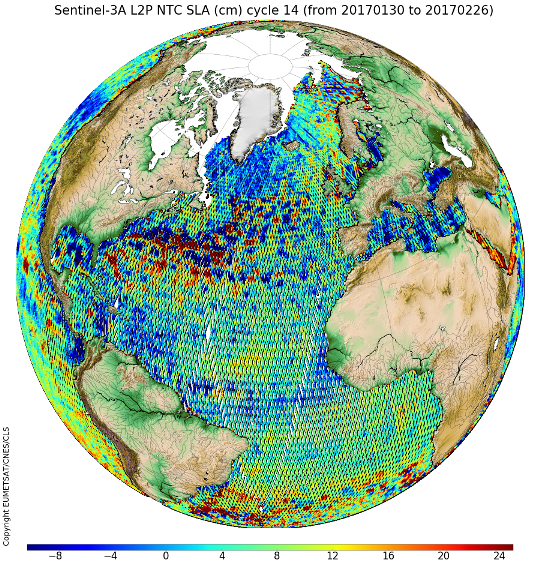
February 2019: New Along-track Significant Wave Height (SWH) Level-2+ (L2P) products available for Sentinel-3A and Sentinel-3B
The Along-track Significant Wave Height Level-2+ (L2P) products are now available for Sentinel-3A and Sentinel-3B. These mono-mission products contain calibrated (relative to buoys) along-track significant wave height (SWH), a validity flag and the applied bias correction. These new products are processed by the Sentinel-3 L2P/L3 Marine Altimetry Service (CNES/CLS), in the frame of a EUMETSAT contract, part of the COPERNICUS Programme funded by the European Union. Please refer to the product sheet and disclaimer for more information. The details about the processing is described in the Product handbook. Dissemination:Sentinel-3 L2P are disseminated by AVISO+ (via ftp or AVISO+ CNES Data Center) and will also be disseminated by EUMETSAT via EUMETCast once the service will be fully operational, i.e. mid-June 2019. AVISO+ Access:
|
SWH (m) for Sentinel-3A and Sentinel-3B missions between Feb 1st and 9th 2019 (click to enlarge) |
February 2019: SARAL has been encountering periodic nadir mispointing events
Over the last few weeks, SARAL has been encountering periodic nadir mispointing events the quality of AltiKa products can be uneven.
Consequently, users are advised to edit out AltiKa data when the off_nadir_angle_wf parameter is over 0.09 deg² (threshold may depend on data usage)
in addition to standard quality flags. The ISRO Operational Team in charge of the SARAL platform is currently investigating various options to revert a nominal mission status and product quality.
January 2019: New Along-track Sea Surface Heights Level-2+ (L2P) products for Copernicus Sentinel-3B
These new products are processed by the Sentinel-3 L2P/L3 Marine Altimetry Service (CNES/CLS), in the frame of a EUMETSAT contract, part of the COPERNICUS Programme funded by the European Union.
The products are available in Near-Real Time, Short Time Critical and Non time Critical and the service is operational.
DISSEMINATION:
Sentinel-3B L2P are disseminated by AVISO+ (via ftp or AVISO+ CNES Data Center) and NRT/STC products will also be disseminated in the near future by EUMETSAT via EUMETCast.
AVISO+ ACCESS:
For new users, please see information and registration on the product page
For AVISO+ registered users,
- if you are already registered to Along-track Sentinel-3A L2P products, the new mission is available with the same access (just replace s3a by s3b)
- if not, you need to choose the product "Sea Level Anomalies Along-track Level-2+ (L2P) Sentinel-3” in your private space.
November 2017: New version of Non-Time-Critical Sentinel-3A L2P products
These products are processed by the Sentinel-3 L2P/L3 Marine Altimetry Service (CNES/CLS), in the frame of a EUMETSAT contract, funded by the European Union.
The new version 02_00 is disseminated by AVISO+ via ftp or AVISO+ CNES Data Center (see the product sheet). Note that the last cycle produced in version 01_00 has already been delivered (cycle 22). The next cycle 23 will be produced only in version 02_00.
With this new version:
- the input data are the “spring 2017 reprocessed” version of input NTC L2 products fully detailed in the EUMETSAT S3A STM reprocessing technical note
- the standards are the same as in 01_00 version
- new cycles are available (cycles 5 to 11)
September 2017: Release of L2P products (all missions except S3A)
Upgrade of Delayed-Time CORSSH data including new standards (standards 2018) now called L2P products (for Level-2+). The format is adapted to the existing Sentinel-3A L2P products already delivered on AVISO+ (NetCDF format with change in the variables names). All information is described in the product page and in the <link file:23163 - download>handbook</link>.
The information about the dissemination for L2P all missions except for S3A is detailed in the table below:
| Dissemination | CORSSH (former version) end of dissemination | L2P (new version) beginning of dissemination |
|---|---|---|
| ftp | end 2017 | now |
| ODES | end 2017 | not yet planned |
Note about Wind/Wave variables:
The variables swh and sigma0 don't exist anymore in the L2P products. You will find those variables in the L2 products (GDR/IGDR/OGDR) on the AVISO+ dedicated web page product.
Jun 2017: [Sentinel-3A] Operational release of Sentinel-3A Value Added products
The products processed by the Sentinel-3 Level 2P/L3 Marine Altimetry Service (CNES/CLS consortium under an EUMETSAT Contract, funded by the European Union) have been delivered as a pre-operational service on the AVISO+ dissemination since December 15th, 2016 for L2P NRT, January 17th, 2017 for L2P STC (see AVISO+ web page product) and on the CMEMS Catalogue since April 19th, 2017 for L3 NRT/STC products.
The products:
These products are derived from the SRAL (dual-frequency Synthetic Aperture Radar Altimeter) instrument onboard Sentinel-3. The L2P products are mono-mission global products containing 1 Hz along-track corrected sea surface heights with respect to a mean sea surface, corrections and geophysical parameters. The last versions of altimetric standards are used and there is a homogenised format for all satellites. They are generated in Near-Real Time (NRT), Short-Time Critical (STC) and Non-Time-Critical (NTC) timeliness. They are distributed in the user friendly NetCDF format. The added value compared to level 2 products is:
- The update of geophysical standards to calculate sea level anomalies, such as
- FES2014 ocean tide
- CNES/CLS 2015 mean sea surface referenced to a 20 year reference period
- Filtered ionospheric correction
- Dynamical atmospheric correction for L2P NRT products (instead of only inverted barometer height correction in the case of L2 NRT products).
- A validity flag to remove spurious measurements
- The distribution of L2P SLA near real time products splitted in passes (instead of 10 minute granules for L2 near real time products).
The L3 Sentinel-3A products are global along-track products that contain time, sea level anomaly and absolute dynamic topography only for valid marine surfaces. The L3 products have under-gone a multi-mission cross-calibration process versus a reference mission (Jason-3).
The dissemination:
Considering the success of the pre-operational service delivery, EUMETSAT decided to begin the operational phase. Beginning on June 27th, the operational phase will imply the product’s warranty in terms of accuracy, fitness for use or purpose.
Note also the dissemination of Non-Time-Critical (NTC) Sentinel-3A products
- will begin on June 27th for L2P on AVISO+ dissemination (delivery of cycle 12 on 27th and cycles 13 to 17 during the following week). To subscribe to AVISO+ L2P products, please fill in the registration form by choosing “Sentinel-3 Along-Track Level-2+ “.
- will be soon disseminated for L3 by CMEMS (delivery of days 2016/12/24 to 2017/01/07)
The L2P NRT/STC products are also available through EUMETSAT dissemination via EumetCast.
Jan. 2017: Sentinel-3A CorSSH-L2P Short Time Critical (STC) products are released in pre-operational phase on 2017/01/17
Mid-December 2016, we were pleased to inform you that a new type of Corrected Sea Surface Heights products (also known as L2P products) were now available for Sentinel-3A in Near Real Time.
These mono-mission products contain along-track corrected sea surface heights with respect to a mean sea surface, corrections and geophysical parameters. The last versions of altimetric standards are used and there is a homogenized format for all satellites. These products are processed by the Sentinel-3 L2P/L3 Marine Altimetry Service (CNES/CLS), in the frame of a EUMETSAT contract, funded by the European Union.
Today, we are pleased to inform you that CorSSH Short Time Critical (STC) products are released in pre-operational phase. They are available on the ftp server from January 12, 2017 (cycle 13 pass 241). Please refer to the product sheet and disclaimer for more information.
All users have to subscribe to get access: please fill in the registration form by choosing “Sentinel-3 Along-Track Level-2+ “ even if you're already subscribed.
Sentinel-3A CorSSH are disseminated by AVISO+ (via authenticated ftp or AVISO+ CNES Data Center) and in the near future, when the service will become operational, it will also be disseminated by EUMETSAT (via EUMETCast, EUMETSAT Data Centre and potentially via CODA).
October 2015: Reprocessing of Jason-1 data as version "E" currently in progress
The data are available as version "E" GDR data products at the AVISO and PODAAC ftp sites as follows:
- ftp://avisoftp.cnes.fr/AVISO/pub/jason-1/
- ftp://podaac.jpl.nasa.gov/allData/jason1/L2/
All products are available in NetCDF format, and are available in three forms, similar to those from the Jason-2/OSTM mission:
- The native (N) dataset containing 1-Hz records as well as 20-Hz high-rate values (GDR)
- The reduced (R) 1-Hz subset of the full GDR data set. (GDR-SSHA)
- The expert sensor (S) data set containing the full radar-echo waveforms (S-GDR) in addition to the GDR dataset. (Please note that SGDRs will be available with latency of 4-8 weeks after GDR release.)
A User Handbook is provided at the above-mentioned ftp areas.
- ftp://avisoftp.cnes.fr/AVISO/pub/jason-1/documentation_gdr_e/ or on the Aviso+ website (pdf)
- ftp://podaac.jpl.nasa.gov/allData/jason1/L2/docs/Handbook_Jason-1_v5.0_Sept2015.pdf
The User Handbook provides details on the evolution of the version "E" products compared to the preceding version "C" products.
The primary evolutions include:
Products are provided in NetCDF format instead of binary.
- Orbit solutions are from so-called version "E" standards, based on ITRF08.
- Time tags are adjusted to correct for the datation bias that existed in previous versions (A, B, C) of the Jason-1 products.
- Altimeter range instrument correction and associated Ku- and C-band range account for error in internal path delay. (+63.9 mm compared to version C)
- Recalibrated radiometer data, and application of near-land path delay algorithm.
- Altimeter wind speeds are recomputed using recalibrated atmospheric attenuations from radiometer.
- New Ku- and C-band sea state bias models, and values that are computed using revised wind speeds.
- The ionosphere correction is recomputed using updated altimeter ranges and sea state bias correction
- Current state-of-the art geophysical models including:
- Model dry troposphere correction from ECMWF Reanalysis (ERA) in addition to previously available operational ECMWF
- Model wet troposphere corrections from ECMWF Renalysis (ERA) in addition to previously available operational ECMWF
- Model wind speeds from ECMWF Reanalysis (ERA) in addition to previously available operational ECMWF.
- Inverse barometer and high-frequency corrections using ECMWF Reanalysis (ERA) in addition to previousl available operational ECMWF.
- Ocean tides from FES2014 and GOT4.10 models
- Mean sea surface from MSS_CNES-CLS11, computed from a 20-year reference period.
- Mean dynamic topography from MDT_CNES-CLS13
- Geoid from EIGEN2008
- Bathymetry from DTM2000.1
- Rain flag updated
With this announcement, Jason-1 version E GDRs for 2002-2004 (cycles 1-110) are now available.
The remaining years are scheduled for release as follows:
- 2005-2008 by the end of October.
- 2009-2013 by the end of November.
The CNES and JPL science data system teams.
May 2015: New Jason-2 GDR-E orbit standard
The new GDR-E orbit standard becomes operational on May 26th, 2015! It is or will be used in all altimeter processing chains in coming weeks or months.
Foreseen Improvements
The main changes between the previous GDR-D and the new GDR-E POD standards are (for complete details, please consult the summary of all the changes):
- Geophysical models:
- Updated geopotential model accounting for interannual variability
- Orbits better referenced to the center-of-mass of the total Earth system
- Orbit parameterization:
- Calibrated semi-empirical Solar Radiation Pressure (SRP) models
- Improved stochastic (reduced-dynamic) parameterization
- DORIS-only and GPS+DORIS orbits
- SLR used as a reference to independently evaluate orbit precision and stability
The foreseen improvements are:
- ~2mm RMS radial orbit improvement over the previous GDR-D solutions for Cryosat-2 (based on high elevation SLR residuals)
- better agreement of the geographically correlated radial orbit drift rate (1 mm/y to less than 0.5 mm/y over ~6 years) with respect to JPL (RLSE14A) GPS-only reduced-dynamic orbits for Jason-2
Jason-2 mission
For Jason-2, the new MOE GDR-E orbits will be released on May 26th, 2015 (made with data of May 25th). Thus, IGDRs products of May 26th 2015 will benefit from the new POD standard. Concerning the precise ephemeris, the new POE GDR-E orbit will be released for cycle 254.
A special interest is paid to Jason-2, which is the reference mission in the multi-mission SSALTO/DUACS system (see the dedicated webpage)
The OSTM/Jason-2 products Handbook has been updated.
Other missions
- For Cryosat-2, the new standard is already operational since April 2nd, 2015 for MOE and during cycle 67 for POE (arc 260).
- Jason-3 POE orbits will be produced in GDR-E standards from cycle 1.
- Saral orbits will switch to the GDR-E standards on July 2nd (data of July 1st), 2015 for MOE and from cycle 25 for POE.
- Jason-1 POE orbits will be available by the beginning of July 2015.
- HY-2A & ENVISAT POE orbits will switch to the GDR-E standards at a later stage.
For any question, please contact aviso(at)altimetry.fr
October 2014 : New Delayed-Time monomission along-track CorSSH products delivered on authenticated servers
The Delayed-Time monomission along-track CorSSH products have been reprocessed with
- new standards of corrections and/or models,
- new format in NetCDF-CF convention,
- time referenced to Jan. 1st 2000 (instead of 1950)
- new nomenclature
- and are now delivered on authenticated servers: FTP and the Online Data Extraction Service (ODES).
CorSSH are monomission altimeter satellite products, with corrections and geophysical parameters. Significant wave heights and backscatter coefficient are also provided. These corrections are provided enabling you to add/adapt new formulas to apply them yourself.
Note that monomission products by definition are not intercalibrated at crossover points. Thus Jason-1 and Envisat data for example may not be homogeneous at a given point, since their orbits are different. Note also that these products are not corrected from Large Wavelength Error (LWE), unlike multimission Ssalto/Duacs products.
You can use the same login / password that you already have for downloading on the FTP server (as for the Delayed-Time / Near-Real Time Ssalto/Duacs products) and/or through ODES.
If you don't have login/password to access to authenticated servers, please, fill in the registration form, by choosing the appropriate data (click on Monomission CorSSH in product selection). Once your request is processed, we will send you your own access by e-mail and details on host servers names and paths
Consequently, the old CorSSH version delivered on the anonymous FTP server will be soon deleted (the corresponding path was: /pub/oceano/AVISO/SSH/monomission/dt/corssh/ref).
Further information:
- See the CorSSH product sheet
August 2013: Saral Version 'T' patch 2 Geophysical Data Records: Public Release
As one of major outcome of the first SARAL/AltiKa verification workshop in August 2013, the “patch 2” has been prepared to improve the data quality. The evolutions included in this patch are summarized below and the main impacts on ocean sea surface height are detailed in the pdf document. This calVal analysis was performed on CNES and CLS side using classical tools like Cross-Overs and SLA analysis. This memo provides early metrics computed on our side in order to ease the Saral Patch 2 use. This is based on the analysis of GDR data dated from mid-March 2013 to beginning of October (cycles 1 to 6). The Patch 2 evolutions have been analyzed thanks to a Saral dedicated prototype (PEACHI). The Calval analysis will continue with the routine monitoring of OGDRs, IGDRs and GDRs products.
Patch 2 includes the following evolutions:
- Wind look-up table: The table provided by NOAA is used. This table is only based on the measured sigma0, taking into account the atmospheric attenuation (sigma0 at the surface). (Reference: John Lillibridge et al. [2013] - One and Two-Dimensional Wind Speed Models for Ka-band Altimetry - JTECH-D-13-00167.1) SSB look-up table: The table provided by R. Scharroo is used. We use only the significant wave height to compute the SSB.
- Radiometer neural algorithm: Taking into account several months of AltiKa measurements, the neural network coefficients have been updated.
- Ice-2 retracking algorithm: The algorithm has been updated taking into account the AltiKa Ka band specificities (ice2 algorithm was based on ENVISAT Ku band experience).
- FES2012 tide model: This new tide model is included, improving the SSH accuracy in coastal zones. (Reference : see FES2012 bibliography)
- Matching pursuit algorithm: the algorithm based on J. Tournadre proposal has been tuned to comply to AltiKa Ka band specificities.
- MQE parameter scale factor: the scale factor of the MQE has been modified.
- Update of the altimeter characterization file: The altimeter characterization file has been modified in order to account for 63 values of altimeter gain control loop (AGC). This has impacts over sea ice and land hydrology, in some cases the AGC was set to default value in current P1 products.
- Doris on ground processing (Triode): The Doris navigator ground processing has been upgraded to reduce the periodic signal observed on the altitude differences with MOE/POE
This patch will be installed on IGDRs products around January 21st 2014. And it will be installed on OGDRs processing chains (at EUMETSAT) around February 5th 2014. We will provide the actual installation dates and the name of 1st products generated with Patch 2 as soon as possible.
Regarding the GDRs products, all the cycles will be reprocessed with the patch 2. As a consequence, the cycles 1 to 7 already disseminated (and generated with the patch 1) can be found on the AVISO ftp server in the directories named gdr_t_old / sgdr_t_old / ssha_gdr_t_old. The patch 2 products will be circulated on the gdr_t / sgdr_t / ssha_gdr_t directories. Access to the AVISO ftp server.
On behalf of CNES Saral project,
Nicolas Picot - CNES Measurement System Engineer
Amandine Guillot –Saral CalVal Responsible
July 2013: Saral, Synthesis of data quality after public release of the O/IGDRs
We are pleased to provide this short synthesis of the Saral IGDR-T products data quality assessment over oceans. CalVal analysis was performed on Cnes and CLS side during past months using classical tools like Cross-Overs and SLA analysis.
This memo provides early metrics computed on our side in order to ease the Saral use. This is based on the analysis of IGDR and OGDRs data dated from mid March 2013 to end of June. The Calval analysis will continue with the assessment of the first GDRs cycles and the routine monitoring of OGDRs and IGDRs products.
We also like to mention that a patch has been prepared to correct for some anomalies and to account for the in-flight calibration data in the ground processing. The evolutions included in this patch are described in the pdf document. This patch has been installed on IGDRs products on July 11th. It will be installed on OGDRs processing chains around July 17th.
Regarding the IGDRs products, the first product generated with this patch is :
SRL_IPN/R/S_2PTP004_0395_20130710_235618_20130711_004636.Cnes.nc
This is mentioned in the Netcdf product in the global attribute ‘references’. This patch corresponds to the patch number 2 on the Level1B Scientific Library ; number 10 on the Level2 Scientific Library and number 9 on the Processing Pilot chain :
references = "L1 library=V3.1p1p2, L2 library=V4.2p1p6p9p10, Processing Pilot=V3-4-1p2p5p6p7p8p9" ;
Former values were:
references = "L1 library=V3.1p1, L2 library=V4.2p1p6p9, Processing Pilot=V3-4-1p2p5p6p7p8" ;
Amandine Guillot –Saral CalVal Responsible
Nicolas Picot - Saral Measurement System Engineer
On behalf of Cnes Saral project.
May 2013: Jason-1 GDR production delay until mid-July
The recent Jason-1 safe hold has impacted the calibration on the Jason-1 Microwave Radiometer (JMR). In particular, attitude dependent behavior of the JMR wet troposphere delay correction has been observed at the level of 1 cm. A new calibration is being developed by the JMR instrument team and requires in-flight data from additional attitude regimes.
As a result, the Cnes and JPL science data teams have decided to delay Jason-1 GDR production until the new JMR calibration becomes available. We are expecting to return to the normal Jason-1 GDR production schedule in mid-July.
Meanwhile, Jason-1 OSDR and IGDR production schedules will not be affected and will continue to be available as usual.
Thank you for your patience during this delay in Jason-1 GDR production.
Nicolas Picot (Cnes) and Shailen Desai (Nasa/JPL)
October 2012: Jason-1 geodetic mission and Jason-2 GDR-D standards applied in monomission CorSSH and SLA products
Jason-1 is on its new geodetic orbit since May 2012. The cycle 500 is the first cycle of this geodetic mission and the CorSSH products are now delivered. No SLA is delivered after cycle 374 since the orbit is non repetitive.
For Jason-2, monomission CorSSH and SLA are now using the version D of Jason-2 Geophysical Data Records (GDRs) standards starting from cycle 146. Previous cycles are still in version C, and will be reprocessed in the future.
All information available in the CorSSH and SLA user Handbook
July 2012: release of the Jason-2 GDRs version "D"
The Jason-2/OSTM GDRs version "D" has been prepared following the recent OSTST meetings.
- GDR: The reprocessing of the Jason-2 mission in GDR-D version started in May 2012. Cycles 1-36 (except 19) and 117-140 are currently available. We will continue reprocessing backward and we expect to complete the reprocessing before end of 2012. See the GDR product page.
- OGDR: As previously announced, the transfer in operations of the GDR-D standard for the OGDR production (see Eumetsat news) has been performed. First OGDR product generated with GDR-D standard is : JA2_OPN_2PdS150_078_20120731_120200_20120731_133930.nc
- IGDR: The transfer in operations of the GDR-D standard for the IGDR production has also been performed. IGDR product generated with GDR-D standard will start with the first pass of cycle 150.
Users are invited to proceed with analyses based on this version "D" release of the Jason-2 GDRs. Jason-2 version "D" GDRs are available from the following two sources:
- Cnes/Aviso's site: ftp://avisoftp.cnes.fr/AVISO/pub/jason-2
- Noaa's CLASS site: www.class.noaa.gov
Instructions for data access are included in the OSTM/Jason-2 Product Handbook which can also be found at the following sources:
- Cnes/Aviso's site: OSTM/Jason-2 Products handbook
- Noaa's CLASS site : OSTM/Jason-2 Products handbook
The OSTM/Jason-2 Product Handbook also provides recommended criteria to edit the data. You will find in the file:
- a description of the evolutions included in GDR-D standards (see : Jason-2 GDR-D standard, page 2). Further details are available in the OSTM/Jason-2 Product Handbook document.
- a summary of the CalVal analysis performed on the formation flying cycles (see : Jason-2 GDR-D analysis, page 5). A more detailed report is also available on the Cnes/Aviso's site: Jason-2 reprocessing impact on ocean data (cycles 001 to 020). Comparison of Jason-2 Gdr-D with GGDR-T, as well as with Jason-1 GDR-C
July 2012: Information about the new altimetric standard version "D" in Jason-2
Jason-2 OGDRs, IGDRs and GDRs will switch to a new altimetric standard (version "D") this summer. A reprocessing campaign will process the four first years of mission to provide an homogeneous GDR dataset.
May 2012: New geodetic orbit for Jason-1
Following the on-board anomaly on March 3rd, the Cnes-Nasa Joint Steering Group directed the Jason-1 Project to move the satellite to a geodetic orbit.
Maneuvers
The target orbit was 12+297/406 with a mean altitude at the Equator of 1323.4 km.
Jason-1 maneuver operations were started on April 23rd with this baseline, and the first operations to lower the orbit were performed on April 25th.
After an initial series of 4 maneuvers were completed, they encountered a serious new propulsion anomaly which resulted in the unexpected overconsumption of hydrazine.
A 5th maneuver was designed in order to correct orbital eccentricity. At the time of this new anomaly, Jason-1 was -12.0 km below the reference altimetric orbit with 600m remaining to reach the -12.6 km goal, however there were very few grams of fuel remaining in the tank to continue orbit lowering.
Final orbit
After checking the current orbit carefully, the operational team determined that a geodetic mission was still possible. It was also decided to preserve all remaining fuel for future station keeping maneuvers which is mandatory in a geodetic orbit. Core payloads were switched ON on May 4th and after some POSEIDON2 radar (PRF) adjustments the mission was resumed on May 7th at 15:12:48 UTC.
Below are the characteristics of the new orbit which will be maintained, as before, within +/- 1km control box at the Equator:
| Semi major axis: | 7702.437 km |
| Eccentricity: | 1.3 to 2.8 10-4 |
| Altitude equator: | 1324.0 km |
| Orbital period: | 6730s (1h52'10'') |
| Inclination: | 66.042° |
| Cycle: | 406 days |
| Sub-cycles: | 3.9_10.9_47.5_179.5 days |
Products
For this new phase of the Jason-1 mission, the cycle numbering will restart at 500. Off-line products will be produced once a day for the IGDR and every 11 days for the GDR's.
February 2011: start of Envisat reprocessing in version 2.1
Since February 2011, the reprocessing of Envisat data in version 2.1 has begun and will continue during all the year 2011. It concerns cycles 10 to 92.
See the validation reports (in pdf)
The changes and comparisons between version 2.1 (IPF V6.04 and CMA V9.3_05) and the previous version (IPF V5.06 and CMA V9.2_03) have been analysed by: Ollivier A, J.F. Legeais, N. Granier, Y. Faugere, F-PAC Calval Team: "CalVal status on the Envisat V2.1 reprocessing impact on main altimetric parameters"
June 2010: New reprocessed CorSSH and SLA monomission products
Mofications were applied on CorSSH and SLA monomission products with new standards for corrections and/or models and processing of ERS-1 data. Major changes are:
- T/P: new non parametric Sea State bias solution from N.Tran et al. (2010) with up-to-date standards (e.g. : DAC or wind algorithm) and orbit solution.
- T/P: new orbit solution, kindly provided by GSFC.
- Jason-1: GDR-C used from 2009 reprocessing.
- ENVISAT: new non parametric SSB solution from S.Labroue.
- ENVISAT: GDR-C orbits used (from cycle 15).
- GFO: new orbit solution, kindly provided by GSFC. As the new solution is not allways available, the GDR orbit is also used with empirical coherency restoration in between.
- GFO: new non parametric Sea State bias solution from N. Tran et al. (2010) with up-to-date standards and orbit solution (computed after orbit error minimization on calibrated reference missions)
- ERS: minimization of brightness temperature drift before wet tropo computation (NN)
- All missions: GDR-C or better standards applied whenever necessary (GOT4v7, High Resolution DAC correction...)
- All missions: new mean profiles computed in coherency with the new standards and algorithms. New algorithms were applied to correct for time-averaging period discrepancies (e.g.: T/P = Jason-1) or ocean variability. The new mean profiles are still referenced over 1993-1999 for the sake of coherency, but they integrate a precious information from the most recent missions and datasets.
- All missions: minor upgrades of the editing process and complete re-editing based on new standards and corrections.
The handbook has been updated to follow all changes.
October 2009: new ftp site to download monomission products
We are changing our ftp site to provide you with a better service. From now on monomission products (SLA monomission and CorSSH) are delivered on a new ftp site.
The new ftp address is: ftp.aviso.oceanobs.com . This one replace the old one (ftp.cls.fr).
The anonymous access, the directory paths and the file nomenclature don't change : ftp://ftp.aviso.oceanobs.com/pub/oceano/AVISO/SSH/monomission/
January 2009: Jason-1's orbit has been shifted
After more than 7 years of service on the nominal ground track, the Jason-1 satellite began several maneuvers to be moved to a new ground track on January 26, 2009 after the end of repeat cycle 259. Several maneuvers shifted Jason-1 on its new orbit on mid-February. Nominal production of all data products in the new orbit resumed on 14-Feb-2009 at 20:51 UTC. Nominal science data delivery will continue for the remainder of Science Cycle 262. The first complete science cycle in the new Jason-1 orbit (Cycle 263) will begin at 04:18 UTC on 20-Feb-2009.
Jason-1 assumes a new orbit midway between its original ground tracks but with a time lag of approximately 5 days with OSTM/Jason-2.The OSTM/Jason-2 satellite will continue the long term climate data record on the primary Topex/Jason-1/OSTM-Jason-2 ground tracks.
December 2008: Jason-1 GDR-C standards applied on monomission CorSSH and SLA
Jason-1 monomission CorSSH and SLA are now using the new version C Jason-1 Geophysical Data Records (GDRs) standards, starting from cycle 233. Previous cycles are still in version B, and will be reprocessed in the future, following Jason-1 GDRs reprocessing.
October 2008: Version C Jason-1 GDR
New version C Jason-1 Geophysical Data Records (GDRs). Currently, cycles 213-232, and 240 are available on the Aviso and Podaac ftp servers:
- AVISO: ftp://avisoftp.cnes.fr/AVISO/pub/jason-1/gdr_c/
- PODAAC: ftp://podaac.jpl.nasa.gov/sea_surface_height/jason/gdr_c/
Early versions of some cycles (e.g. 220-239) of the version C GDRs were released in July, but have since been reprocessed with modified precise orbit ephemerides. Users are advised to download those cycles again, and to only use version C GDRs that have file generation times of August 12, 2008 onwards. All version C Jason-1 GDRs for all cycles will be available by the middle of 2009.
Users are advised to note the following primary differences between the version B and version C Jason-1 GDRs:
- Use of ITRF2005 reference frame and time variable gravity in precise orbits.
- In improved sea state bias model that is consistent with the MLE4 retracked altimeter data.
- Updated altimeter instrument corrections.
- Recalibrated JMR measurements using data from cycles 1-227.
Given the schedule for reprocessing version C GDRs, we are providing users with an interim means to correct the version B Jason-1 GDRs for these primary changes, as follows:
- GDR-C precise orbit ephemerides are provided as sp1 files on the following ftp server. ftp://avisoftp.cnes.fr/AVISO/pub/jason-1/gdr_c_aux_files/poe/
- The sea state bias model used on the version C GDRs is provided on the following ftp server: ftp://avisoftp.cnes.fr/AVISO/pub/jason-1/gdr_c_aux_files/
- Tables of the altimeter instrument corrections used on the version C GDRs are provides on the following ftp server:ftp://avisoftp.cnes.fr/AVISO/pub/jason-1/gdr_c_aux_files/
- A JMR replacement product that adopts the JMR calibration parameters used to generate the version C GDRs is available on the following ftp server: ftp://podaac.jpl.nasa.gov/pub/sea_surface_height/jason/jmr_replacement/
An updated user handbook is provided:
- SMM-MU-M5-OP-13184-CN, Edition 4.1, October 2008
Aviso and PoDaac User Handbook - IGDR and GDR Jason-1 Products, pdf version (2 Mo)
August 2008: Envisat CorSSH and SLA modifications
Mofications were applied on Envisat CorSSH and monomission SLA to follow Jason-1 standards, starting from cycle 65. Changes are:
- Mog2D high resolution replaces Mog2D
- Wet tropospheric correction is now a composite of radiometer correction (further than 50 km from the coast) and model correction (between 10 and 50 km), with smoothing at the frontier.
- change in ERS mean profile, including now coastal effects
- GIM correction replaces the dual-frequency ionospheric correction
The handbook has been updated to follow all changes.
July 2008: Jason-1 CorSSH and SLA modifications
Mofications were applied on CorSSH and monomission SLA to follow Jason-1 GDR-C standards. Changes are:
- Mog2D high resolution replaces Mog2D
- Wet tropospheric correction is now a composite of radiometer correction (further than 50 km from the coast) and model correction (between 10 and 50 km), with smoothing at the frontier.
- changes in validation process (including a new ice flag, effects from Mog2D High Resolution, looser criteria near the coasts...)
- change in T/P mean profile, including now coastal effects
The handbook has been updated to follow all changes.
April 26, 2007: Jason-1 CorSSH and SLA products
Jason-1 CorSSH and SLA "Ref" products were reprocessed:
- sea state bias (SSB) is issued from non parametric method already available in the GDRs 'b' from cycle 001 to 021 (Labroue, S., P. Gaspar, J. Dorandeu, F. Mertz, OZ. Zanifé, 2006, Overview of the Improvements Made on the Empirical Determination of the Sea State Bias Correction, 15 years of progress in radar altimetry Symposium, Venice, Italy, 2006)
- a new ice flag, similar as for ERS, is now applied.
Attention: cycles 32, 60, 89, 90 et 91 are not validated yet and not delivered on the server.
September 8, 2006: Envisat CorSSH and SLA products
Envisat CorSSH and SLA products were reprocessed, modifications are the same as for Jason-1; please refer to previous information published on August 9, 2006.
August 9, 2006: Jason-1 CorSSH and SLA products
Jason-1 CorSSH and SLA products were reprocessed, hereafter the modifications:
- Sea State Bias correction is the one provided in the GDRs 'b' and is homogeneous all along the time period.
- With the new version of GDRs (cycle 136) IB correction based on a cartesian grid (cycle 1 to 135) was, by mistake, replaced by an IB correction based.
October 24, 2005: Envisat GDR and IGDR products
Implementation of a new Envisat operational production chain; starting dates for the new processing chain are as follows:
- IGDR products (near real time products): October, 24th 2005
- GDR products (off line products): September, 20th 2005 (i.e. from cycle 41).
Improvements concern MOE/POE orbit computation chains and new algorithms.
More details about those improvements are available on ESA web site.
October 21, 2005: Jason-1 GDR and IGDR products
Implementation of a new Jason-1 operational production chain; starting dates for the new processing chain are as follows:
- IGDR products (near real time products): October, 24th 2005 (i.e. first day of cycle 140)
- GDR products (off line products): September, 14th 2005 (i.e. from cycle 136).
This new version will be identified with the letter "b", therefore GDR Jason-1 products will be named "JA1_GDR_2Pb" from the start of the new chain.
Main features:
New MOE and POE orbit computation chains :
Both chains will use the latest GRACE geoid model developed by the LEGOS group (EIGEN-CG03C). The POE chain also takes into account GPS data (MOE orbits are computed with Doris data solely). See Choi et al., 2004.
New JMR characterization file :
A new calibration file has been developed to correct for jumps in the JMR path delays and to minimize yaw state effects (Brown et al., 2004).
New MLE4 retracking algorithm :
Based on a second-order altimeter echo model, MLE4 simultaneously retrieves the 4 parameters that can be inverted from the altimeter waveforms: epoch, SWH, Sigma0 and mispointing angle. This algorithm is more robust for large off-nadir angles, (up to 0.5°, as encountered in August-September 2005). See Amarouche et al. 2004.
Instrumental tables (fields # 31-32, 47-48 and 61-62):
New instrumental correction tables have been established, based on MLE4 algorithm (Thibaut et al., 2004).
Vandemark/Gourrion wind algorithm (fields # 85-88):
A specific empirical wind-speed model has been tailored to Jason-1 data by Collard et al. (2004). This represents an update from the previous version of the altimeter wind estimate (the previous algorithm was fitted on TOPEX data).
SSB table (fields # 38-40):
Sea-State bias table has been recomputed accounting for the impact of the geophysical parameters used (Labroue et al., 2003). Note that this SSB table was derived from altimeter data that we computed from the MLE3 retracking algorithm.
Tidal models (fields # 77-78 and 81-82):
The two tide models (FES and GOT) have been updated to their latest versions (respectively FES2004 and GOT00.2). As before, both geocentric ocean tide fields (fields #77 and #78) also include the load tides from the respective models (also provided separately in fields #81 and #82), and the equilibrium long-period ocean tide (also provided separately in field #79). These two fields (#77 and #78) now also include the S1 oceanic response to atmospheric pressure based on the model from Ray and Egbert (2004). The FES2004 model now also includes the M4 ocean tide. Note that the load tide fields (fields #81 and #82) only include the load tides from the GOT00.2 and FES2004 models, and do not contain the load tides from the S1, M4, or equilibrium long-period ocean tides.
Non Equilibrium Long Period Tides (fields # 80):
Previously set to default value, this field is now calculated based on the predictions of the Mf, Mm, Mtm, Msqm tides from the FES2004 model. This field is provided as a correction to the equilibrium long-period ocean tide. To apply this correction, it should be added to fields 77, 78, or 79, depending on which ocean tide field is being used.
MSS (field # 70):
CLS01 MSS model solution has been implemented (Hernandez, 2002).
Non-tidal High Frequency correction (field # 75) :
The correction is calculated from the Mog2D ocean model, and is only available in GDR products. Note that the IB correction is still taken from ECMWF atmospheric pressure products. This field is provided as a correction to the inverse barometer. To apply this correction, it should be added to field #74.
S1/S2 management (fields # 33 and 74) :
S1 and S2 ocean tide effects have been removed from the inverse barometer correction (field #74) and from the non-tidal high frequency correction (field #75) as both ocean tides are now included in the ocean tide models. Note also that explicit models for the S1 and S2 atmospheric tides have been added into the dry tropospheric correction.
Rain Flag (field # 93):
A new table provided by Tournadre (2004) is used in ground processing for rain_flag determination.