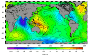
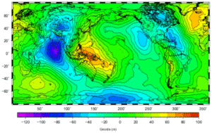
The direct method
The altimeter provides the sea surface height relative to the reference ellipsoid. It is the sum of the geoid plus the dynamic topography, once removed other oceanic and atmospheric effects. By averaging altimetric heights over a given period, a Mean Sea Surface (MSS) can be estimated.
The MSS is referenced to the Earth ellipsoid; we use CLS01 MSS , computed using altimeter data averaged over the 1993-1999 period.
MSS is the sum of the geoid plus the mean dynamic topography MDT. Thus, by subtracting the geoid we can obtain the Mean Dynamic topography MDT; this is the so called "direct method".

The two surfaces (Mean Sea Surface - Geoid) are subtracted, and provide after optimal filtering, a first guess of the mean dynamic topography at a large scale. The resolution of this first guess is limited to the resolution for which the errors on geoid are about one centimeter.


