


Modelling the flow
Image of the Month - June 2019
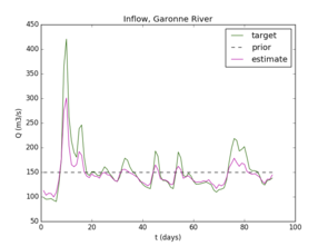
Inferred runoff and bathymetry from daily Cal/Val SWOT-like measurements for Garonne (upstream) river (South-west of France). Left, inflow discharge. Right, bed elevation minus the elevation of a linear trend of real bed elevation. First guesses (priors) are provided by the low complexity model. (Credits INSA-IMT/CNES-CS corp./ICUBE/LEGOS/IMFT)
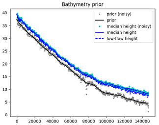
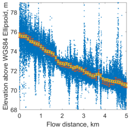
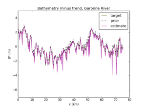
Two examples with either simulated High resolution data (left, Sacramento river Median water surface elevation, upstream), or AirSWOT experience (right, Water surface profile data on the first day of AirSWOT flights (March 16, 2015 over the Willamette river) for a subset of the study reach. AirSWOT pixel elevations are shown in blue, while 100 m node-averaged AirSWOT and in-situ elevations are given in red and yellow, respectively, with 1 standard deviation error bars) (Crédits INSA-IMT/CNES-CS corp./ICUBE/LEGOS / AirSWOT investigation team OSU/USGS/U. Oregon)
As mentioned some months ago, one of the challenges of SWOT will be to estimate operationally river runoffs whenever we will have measurements from the satellite over a river. Investigations have progressed, and solutions are now proposed. One of the main difficulties is that if the satellite will measure water height, river slope and width, the estimation of runoff needs also bed roughness and bathymetry to be analytically computed. But those are not known for each and every river that will be overflown by SWOT, and, moreover, they can change.
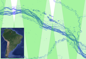
To overcome this, an algorithm has been proposed by INSA-IMT with CNES-CS corp./ICUBE/LEGOS. This algorithm is based on a dedicated hierarchical river flow model (constituted by a 0.5D model and the classical 1D St-Venant dynamic model) and an advanced Variational Data Assimilation process. The estimation of a prior mean value of one of the sough quantities (bathymetry or discharge) may be crucial. Next, the dedicated 0.5D model enables to provide the first guess value for runoff, bathymetry and roughness which is then re-estimated by minimizing the difference between the model output and data. The flow model and estimation algorithm have been applied to quite complex braided rivers too (eg into a Rio Negro portion in Amazonia). If only one in situ cross-section measurement is available, accurate (~100km long) bathymetry can be estimated. Past one year of learning period, the derived low complexity 0.5D model enables to provide discharge values in real-time in the future from SWOT measurements.
SWOT will provide brand new capabilities for hydrological measurements and studies. Preparation are ongoing so that the data can be used by as wide a Community as possible once the calibration phase will be over.
See also:
- Image of the Month, Dec. 2016: Testing algorithms
- Applications: High-resolution hydrology
- Missions: Swot
Other web sites on this topic:
- DassFlow computational software (Data Assimilation for Free Surface flows). Open
sources available upon request.
References
- K. Larnier, J. Monnier, P.-A. Garambois, J. Verley. "On the estimation of river discharges from altimetry". Submitted
- P. Brisset, J. Monnier, P.-A. Garambois, H. Roux. "On the assimilation of altimetry data in 1D Saint-Venant river models". Adv. Water Ress., vol. 119, pp 41-59, 2018.
- P.-A. Garambois, S. Calmant, H. Roux, A. Paris, J. Monnier, P. Finaud-Guyot, A. Montazem, J. Santos da Silva, "Hydraulic visibility: using satellite altimetry to parameterize a hydraulic model of an ungauged reach of a braided river". Hydrological Processes, Vol. 31, 4, 756-767, 2017.
News
 Archives .
- Aviso Newsletter .
- Search.
- Front-page news.
- Image of the month .
- 2025 .
- 2024 .
- 2023 .
- 2022 .
- 2021 .
- 2020 .
- 2019 .
- Dec. 2019: Mean dynamic topography.
- Nov. 2019: 2019 monsoon monitored using altimetry .
- Oct. 2019: Monitoring an iceberg topography with altimetry.
- Sep. 2019: Internal tides in the Solomon Sea change with ENSO phases.
- Aug. 2019: Fifty years ago....
- Jul. 2019: Increasing wave power.
- Jun. 2019: Modelling the flow.
- May 2019: Liguro-Provençal current seen by in situ instruments and altimetry.
- April 2019: Pantanal wetlands.
- Mar. 2019: Focusing on small water bodies.
- Feb. 2019: Sharks in eddies and meanders.
- Jan. 2019: From La Niña to El Niño, Aviso Image of the Month 20th birthday!.
- 2018 .
- 2017 .
- 2016 .
- 2015 .
- 2014 .
- 2013 .
- 2012 .
- 2011 .
- 2010 .
- 2009 .
- 2008 .
- 2007 .
- 2006 .
- 2005 .
- 2004 .
- 2003 .
- 2002 .
- 2001 .
- 2000 .
- 1999 .
- 1998 .
- Operational news and status .