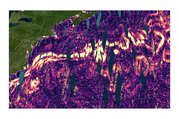
Currents in 2 dimensions
As early as the mid-19th century, the role of major ocean currents in transporting heat from the equator to the poles was known - traces of which can be found in the novels of Jules Verne. More than a century later, with satellites, their turbulence, meanders, and especially the omnipresence of eddies in the oceans, both in major currents and everywhere else, have become visible and measurable.
Large scale ocean currents are mostly “geostrophic”, meaning they depend on the bumps and troughs of the ocean, as well as on the rotation of the Earth in a mechanism similar to the winds around atmospheric anticyclones and depressions. Conventional along-track altimetry allows the computation of transverse components, perpendicular to the satellite's ground track, or, when data from multiple missions are combined into 2D-grids, the computation of the geostrophic currents over the entire globe.
Swot provides natively its measurements in two dimensions along its two swaths, so that geostrophic currents can be directly derived from them. They are therefore computed from sea surface heights measured at the same moment, and this with the resolution of the KaRIn interferometer-altimeter, either 250 m or 2 km. In very powerful and turbulent currents such as the Gulf Stream, the Kuroshio, or the Agulhas Current, these simultaneous measurements are particularly interesting as they exhibit numerous rapidly varying eddies and meanders.


