


Latest News
17.01.2025 Jason-3, already 9 years old!

Jason-3 was launched 9 years ago, placed in the "historic" orbit of Topex/Poseidon, Jason-1 and 2 after leaving Sentinel-6 Michael Freilich alone in this orbit in April 2022.[more]
10.01.2025 January 2025: 30 years of sea ice for both Arctic and Antarctic Oceans
")
A homogeneous 30-year series (1994-2023) of sea ice thickness and volume variations over the two hemispheres has been reconstructed from altimetry by Legos
07.01.2025 New tandem phase for Jason-3 and Sentinel-6
Jason-3 will return to a tandem phase with Sentinel-6 MF during 4 months in 2025, as requested by OSTST and validated by JSG 4partner.[more]
19.12.2024 v1.0 of Experimental Multimission Level-4 maps with SWOT
AVISO is pleased to announce the release in v1.0 of experimental multi-mission Level-4 maps using SWOT L3 products. [more]
16.12.2024 Swot was launched two years ago
 with FSLE plotted (Credit Cnes/Mira Production)")
The Surface Water and Ocean Topography (Swot) mission was launched two years ago, on December 16, 2022. Congratulations on 2 years of Swot![more]
13.12.2024 December 2024: Detecting icebergs using altimetry to help marine safety
")
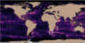
Satellite altimetry can detect icebergs under the satellites' tracks. This can be used to help in maritime security at latitudes where they can be a problem.
06.12.2024 CFOSAT SWIM change on the acquisition macrocycle

On December 2, 2024, CFOSAT SWIM instrument changed from the acquisition macrocycle 0, 2, 4, 6, 8, 10 to 0, 2, 10, 10, 10[more]
News
- Search.
- Front-page news.
 Image of the month .
- Press review.
- Operational news and status .
- News from CTOH .
- Events calendar.