Mobile version

Hydrology and Land

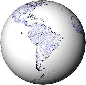
The earliest altimetry missions were dedicated to studying the open ocean and some ice measurements. However, every stretch of water (enclosed seas, lakes, rivers, flooding areas...) or even flat surfaces over lands can give valid data - as long as the satellite fly over them. Swot will change drastically the latter point, with a near-complete, high resolution monitoring of the continents (except Antarctica). 

Satellite altimetry has the advantage of being able to take global, homogeneous, repeated measurements, unhindered by clouds, night or even vegetation, thus enabling systematic monitoring to be carried out over several years. The measured surface heights are referenced to the same frame. However, classical radar altimetry technique has been mainly optimized for the ocean and takes measurements only at the nadir (i.e. just under below the satellite), with a rather narrow footprint -- and averaging everything in that footprint. Specific processing can be applied to retrieve all the possible data. Moreover, the satellite acquisition modes have been improved since 2017 so that the altimeter can be in a receiving mode over lands using a Digital Elevation Model. Over non-ocean surfaces (wet or dry), the accuracy of the altimetry measurements can be degraded by several centimetres or tens of centimetres, mainly because of the heterogeneity of the reflecting surface (a mix of water and emerged land surfaces), and because of reflections on the river banks. Another important source of error lies in the propagation of the signal through the atmosphere. It must also be noticed that the satellites repeat-orbits are rather long (10 to 35 days), which do not fit real-time monitoring of river or lake level variations (e.g. flood alerts), but agree well with seasonal or interannual monitoring.

  • Hydrological simulator
  • High-resolution Hydrology

    Swot, by providing an image everywhere will enable to know where is the water, its slope and thus compute its discharge at least every 22 days. Comparisons between two successive measurements will also provide with variations of those quantities.

  • Lakes and enclosed seas

    The level of lakes varies along the seasons. Enclosed seas level is a major indicator of their good (or bad) health. Altimetry able us to continually monitor these levels.

  • Rivers

    For certain major rivers and wetlands, hydrological information can often be difficult to obtain due to a region's inaccessibility, the sparse distribution of gauge stations, or the slow dissemination of data. Satellite radar altimeters can potentially monitor height variations of inland waters.

  • Wetlands

    Wetlands are ubiquitous on Earth, and provide with a number of "services" for life on Earth - including human beings' ones. Their observation is thus an important stake for all.

  • Land

    Reception of return echoes on land is less reliable, since a field or a forest do not reflect radar pulses as well as water, but conclusions can still be drawn.

  • Hydrology from space CTOH

    Our data base contains time series over water levels of large rivers, lakes and wetlands around the world. These time series are mainly based on altimetry data from Topex/Poseidon for rivers, but ERS-1 & 2, Envisat, Jason-1 and GFO data are also used for lakes. At present, water level time series of about 100 lakes (in Europe, Asia, Africa, North and South America) including Aral & Caspian seas are available. About 250 sites (called virtual stations) on large rivers are also available (see maps below). Users of the data base can visualize the water level time series as well as Landsat images showing the geographic location of the site. Users can download the numerical values of the time series as well as associated errors.

EnglishFrançais
Rss feedsContactPartnersFAQLexiconLegal noticePersonal Data Protection PolicyMobile
You must enable cookies in your browser preferences to save the modifications
You are using an older version of Internet Explorer, please update to take full advantage of Aviso+ features

Customize the home page

View all widgets
Reduce display
Public profile
User profile

Select/Deselect widgets

Discover AVISO+

Customizable home, reading tools, products search guide, etc.. Discover step by step the features of the new site AVISO+.

Customizable homepage

This home page is composed of blocks called "widgets".

Rearrange the blocks with a "Click & Drop".

Hide a widget with the cross at the top right. Reset or add a widget with the "wrench" icon. The "User" and "Public" profiles offer a predefined organization.

All the modifications are automatically saved as cookies on your machine so as to enable you to have your own specific AVISO+.

Reading tools

Ease your reading by choosing the page background colour (black/white) and/or by modifying the font size.

Browsing menu and breadcrum trail

To ease your browsing through AVISO+, you can use at any time the main banner items with the interactive submenus or use the browsing menu on the left side of the screen (it is open by default). For more readiness of the page contents, you can fold and unfold the browsing menu by clicking on the tab. At any time you can know where you are thanks to the browsing menu or the breadcrum at the top of the page.

Products search guide

The first submenu of the "Data" banner item leads you to a new search form enabling you to find quickier the product that suits your needs. The list of results is updated according to your selection criteria.

AVISO+ Multimedia

The first submenu of the "Multimedia" banner item leads you to AVISO+ collections of images and videos linked to altimetry and its applications. Have a nice visit!