


News
Altimetry applications in videos: Tsunamis
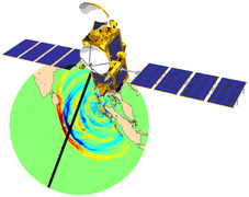
Tsunamis are huge waves which can result in devastating waves breaking on the shore. By measuring sea surface height, altimetry satellites can theoretically detect tsunami waves in open ocean.
 See the video Tsunamis: flash (9 Mo) or mpeg (38 Mo)
Tsunamis are waves which are not generated by the wind, but are caused by undersea earthquakes, volcanic eruptions or landslides. They can travel extremely rapidly over vast distances.
In the Indian Ocean, where the tsunami of 26 December 2004 occurred, the Indo-Australian tectonic plate is forced beneath the less dense Burma plate. As these plates converge, with one sliding beneath the other, they gradually become distorted through the subduction movement of 4 to 5 cm/year, at the same time accumulating a huge amount of pressure. When a certain threshold is reached, it causes a sudden break in the fault which instantly releases all the stored energy, triggering an earthquake of enormous magnitude. This abrupt movement of the fault causes the sea bottom to rise and the water's surface to deform, although its low amplitude (just a few tens of centimetres) makes it barely detectable at the time. The resulting wave spreads across the ocean basin at a speed approaching 800 km/h. When the waves approach the coasts, the reduced depth of the ocean forces them to slow down. This loss of velocity translates into an increase in the height of the waves. Particular geographical characteristics of the coastline can have a channelling effect, causing resonance phenomena and amplifying wave size. For the Sumatra tsunami, the combination of a very strong earthquake (magnitude 9), occurring along an extended stretch of the fault (over 1,000 km long and 15 m high), the close proximity of the coasts and coastal amplification, resulted in devastating waves breaking on the shore.
By measuring sea surface height, altimetry satellites can theoretically detect tsunami waves if they are actually flying over the waves shortly after they have been triggered (which is highly unlikely) and if the signal is strong enough to be isolated from ocean variability (which includes variations due to currents, tides, the geoid, atmospheric pressure, temperature, salinity, etc). With the tsunami of 26 December 2004, four altimetry satellites (Jason-1, Topex/Poseidon, Envisat and GFO) passed over the Indian Ocean between two and eleven hours after the earthquake. Jason-1 detected the first wave front at a latitude of around 4° South, about 1,500 km from the epicentre, with an amplitude of 60 cm. Envisat measured an amplitude of 35 cm, 3hrs 19mins after the earthquake, at around 2,600 km from the epicentre. GFO was the last to detect the wave front, in the south-west Indian Ocean, with a low amplitude of 10 cm, barely distinguishable from the ocean signal. This abundance of data, acquired during a major tsunami for the first time, has made it possible to refine tsunami wave propagation and dissipation models.
Apart from directly measuring the height of the tsunami wave in the open ocean, the ability of altimetry satellites to estimate submarine relief is also exploited by wave propagation models. By measuring ocean surface topography, altimeters can indirectly map the topography of the ocean floor, as the surface is modified by submarine ridges and troughs: for instance a seamount corresponds to a bump on the ocean surface. Studied in different scenarios using known areas of seismic activity, the propagation models integrate these bathymetric grids in order to simulate wave changes in space and time, thus revealing the areas most at risk and calculating the time needed to raise the alarm.
Altimetry satellites do not and never will form part of a tsunami early warning system, due to the difficulty and low probability of observing the phenomena, and the relatively limited coverage of these satellites - not to mention the time needed for processing their data. These resources are used instead for basic research and understanding of the events, and complement the measurement and alert systems able to provide early warning to populations at risk. The launch of the Jason-2 satellite in June 2008 will augment the constellation of satellites currently flying (Jason-1, Envisat and GFO) in order to further our understanding of the oceans.
Further information:
- Applications, Geodesy and geophysics : <link internal-link>Tsunamis
- Ablain, M., J. Dorandeu, P-Y. Le Traon, A. Sladen, <link http: earth.esa.int cgi-bin _blank external-link-new-window>The Indian Ocean Tsunami of December 26, 2004, Observed by Multi-satellite Altimetry, 15 years of progress in radar altimetry Symposium, Venice, Italy, 2006.
- JPL, <link http: www.nasa.gov centers jpl news jason-011105.html external-link-new-window>Nasa/French Satellite Data Reveal New Details of Tsunami.
- CEA, <link http: www-dase.cea.fr actu dossiers_scientifiques index.html external-link-new-window>Séisme et tsunami de Sumatra du 26 décembre 2004 (in french).
- CNRS, <link http: www.insu.cnrs.fr external-link-new-window>Comprendre en profondeur le séisme et le tsunami de Sumatra-Andaman (in french)


