


News
Keops-2 Background and objectives
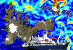
Fifty scientists are aboard the research vessel Marion Dufresne for the cruise Keops-2. A specific support from Cnes allows to deliver the satellite data in real-time and delayed-time, specifically processed for this area.
Credits CLS/Locean/Legos/Nasa.
This is "News from the cruise Keops-2", which during the southern spring, aims to give news from scientists embarked on this research cruise, to explain their objectives and present their results.
Fifty scientists are preparing to board the research vessel Marion Dufresne for the cruise Keops-2, which will cross the Kerguelen Plateau in the Howling Fifties, in the Southern Ocean. Keops-2 is a project funded by the Agence Nationale de la Recherche (ANR), the Centre National de la Recherche Scientifique / Institut National des Sciences de l'Univers (CNRS / INSU) and the Institut Polaire Paul-Emile Victor (IPEV).
The first campaign (Keops-1) took place during the austral summer in 2005. Its purpose was to measure the biological activity (including phytoplankton) depending on the chemical composition (including iron) and the impact on the biogeochemical cycles (especially the carbon cycle, including CO2). The atmospheric CO2, key component for its role of greenhouse gas and its impact in global warming, is partly assimilated into the ocean by the biological "pump". Photosynthetic organisms (including phytoplankton) within the upper ocean's sunlit zone, transform CO2, which "residues" are transported to the ocean deep layers. The ocean biological pump is thus a major process in controlling the content of CO2 and hence the Earth's climate.
This new campaign, Keops-2 occurs at the beginning of the biological activity season (in 2005, it was at the end of this season), in deeper waters, at the East of the Kerguelen Plateau. Its purpose is to better understand the biogeochemical mechanisms that we have just described. New analysis tools are implemented, such as profiling floats and satellite data in real time. A specific support from CNES allows to deliver the satellite data in real-time and delayed-time, specifically processed for this area. These data include Ssalto / Duacs sea level heights, a new mean dynamic topography (MDT) over the area, geostrophic currents and the currents induced by wind (Ekman currents). Others data from satellite sensors (Modis and Meris) measured the ocean color (and thus biological activity) are also distributed. | <link fileadmin images news cruise mdt_kerguelen_v1.0.png download> Examples of Ssalto/Duacs products processed and delivered for the Keops-2 project: new Mean Dynamic Topography (MDT) over the Kerguelen area (above) and absolute dynamic topography with absolute geostrophic velocities in near-real time (bottom). Credits Ssalto/Duacs. <link fileadmin images news cruise keops_madt_uv_20111007.png download> |
|---|

Further information:
- IPEV website: <link http: www.institut-polaire.fr ipev actualites tout_public des_nouvelles_du_terrain keops_ii _blank external-link-new-window>Keops-2, des nouvelles du terrain (in french).
- Image of the month, <link http: cms-dev.cls.fr internal-link>April 2009: Cruise around Kerguelen Island
- Access to Ssalto/Duacs data delivered for Keops-2 : first subscribe by filling in the <link http: cms-dev.cls.fr internal-link>form.


