News
Altimetry applications in videos : Life in the ocean
The ocean is very fertile. By combining biological data with circulation models it is now possible to simulate the complex interactions between ocean physics and chemistry and marine life.

 See the video Life in the ocean: flash (9 Mo) or mpeg (29 Mo)
The ocean is very fertile - from the surface to the deep abyss plains, the ocean is home to a huge variety of life forms. This marine life is highly constrained by the physical and chemical characteristics of the environment. The cold waters and available nutrients lead to concentrations of phytoplankton, the first link in the food chain, and currents and drifts create migratory routes. By combining biological data with circulation models it is now possible to simulate the complex interactions between ocean physics and chemistry and marine life. While satellite measurements of water temperature or chlorophyll content are the most suitable way of quantifying phytoplankton, altimetry measurements of sea surface height are used to complete and confirm the observations.
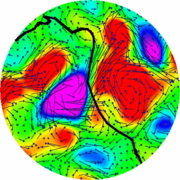
Areas of intense biological activity have a particular signature that can be observed both in sea height measurements and in chlorophyll content measurements. Areas with high chlorophyll content are encountered especially around eddies, on the edge of currents, in areas where cold waters well up, or when Rossby waves go by. Each of these areas can be highlighted and physically characterized by altimetry.
These very productive areas are also a meeting point for other links in the food chain - from zooplankton, through small fish, up to large predators. These more evolved biological levels can be described, analysed and simulated by relating biological and physical data. Species that are large enough, such as some fish, reptiles and ocean mammals, can be tracked individually with markers (such as Argos transmitters) that are relayed by a network of stations and satellites. Currents and sea heights, determined from altimetry data, when combined with biotelemetry, have also shown that turtles, during their long migration, move along very specific fronts where their prey accumulates. This method can be used to understand the behaviour of such animals as well as their migration, reproduction, and feeding strategies, and to set up appropriate protective measures, by limiting their accidental capture in fishing nets.
Sustained stewardship of marine resources, protection of threatened species and understanding the role of climate change on marine life, are major issues. The Jason-2 altimetry satellite, to be launched in June 2008, will be capable of providing a physical description of the oceans, thus furthering the development of operational biogeochemical models and increasing our understanding of ecosystems.
Further information :
- Applications : <link internal-link>Biology
- External websites :
- <link http: www.cnes.fr web external-link-new-window>Argonautica, educational program and <link http: argonautica.jason.oceanobs.com html argonautica welcome_uk.html _blank external-link-new-window>its online data (maps and locations for marine animals),
- Marine Ecosystem Modeling and Monitoring by Satellite (<link http: www.cls.fr memms external-link-new-window>MEMMS),


