News
Altimetry applications in videos: Ocean circulation
Because the currents transport heat and energy, they are major players in the Earth's climate. Observations by altimetry, combined with in situ surveys, give us a precise view of them, both at the surface and at depth.

 See the video Ocean circulation : flash (10 Mo) or mpeg (25 Mo)
"The sea has its large rivers like the continents" (Jules Verne, "Twenty Thousand Leagues Under the Sea"). Marine currents are the engines of the oceans: on the surface or at depth they stir up the oceans, rebalance the Earth's heat budget (by transporting heat from the equator to the poles) and redistribute nutrients. Currents do not circulate randomly; they obey laws of physics which compel them to turn in a particular direction, descend to the ocean depths or rise to the surface.
Surface currents, which can reach depths of around 800m, are mainly driven by friction from winds at the ocean surface. Owing to the action of the Earth's rotation, the Coriolis force pushes these water masses in a clockwise direction in the northern hemisphere (and anticlockwise in the southern hemisphere). Large circular currents are therefore formed, which cross the ocean basin, stretching out in long meanders, and accumulate on the western edge of the oceans (in the northern hemisphere), transporting heat and humidity and making harsh climates milder. This is the case with warm currents such as the Gulf Stream in the North Atlantic Ocean, the Kuroshio in the North Pacific Ocean, the Brazil Current and the Agulhas Current. Another surface current, which encounters neither hindrance nor obstacle, is stirred up by very high winds and pushed eastwards by this same rotational force of the Earth: the Circumpolar Current around Antarctica. Here it is, as described poetically and faithfully by Erik Orsenna during his southern voyage in 2006: "Who knows of this immense river, the largest on the planet? A thousand kilometres wide, twenty-four thousand long, and carrying one hundred and fifty million tonnes of water per second, a hundred and fifty times more powerful than all the world's rivers combined. It makes the Gulf Stream look ridiculous, even at its peak. Its disorderly surface, agitated by the winds, generates breakers that are the stuff of legend wherever sailors meet to swap stories. But in its heart, this king of currents is a gentle giant. It moves majestically forward at a leisurely pace, hardly more than a kilometre per hour, taking three years to circumnavigate the Earth." (Isabelle Autissier, Erik Orsenna, "Salut au Grand Sud", published by Editions Stock 2006.)
Deep water currents, in contrast, are not generated by the wind, but set in motion by differences in temperature and/or salinity between the ocean's different layers. Evaporation, precipitation, the contribution from inland waters, and pack ice formation are just some of the factors which can modify sea water's thermohaline characteristics. A high level of evaporation, such as in the Mediterranean Sea for example, can therefore lead to a higher concentration of salt in sea water. This water becomes denser and descends towards the bottom. At other latitudes, for instance in the Greenland Sea, the waters of the Atlantic cool down in winter. The water's density is thus increased and it flows towards the sea bottom. This thermohaline current is the starting point for global ocean circulation. These deep, cold, salty waters travel across the ocean bottom (Atlantic, Antarctic, Indian and Pacific) like a conveyor belt, before warming up and rising to the surface in the Pacific and Indian Oceans, where they then continue their course in the opposite direction, at the surface, to complete the loop of their epic, millennial journey.
At other seasonal or spatial scales, there are a host of other currents which have an important role to play, interacting with the atmosphere and the climate: monsoon currents, Rossby and Kelvin planetary waves, fronts, eddies, etc.
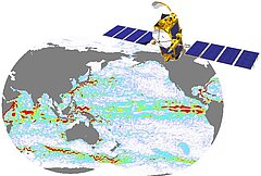
Because the currents transport heat and energy, they are major players in the Earth's climate. Observations from space, combined with in situ surveys, give us a precise view of them, both at the surface and at depth. By directly measuring sea surface height, altimetry satellites can identify the hollows and bumps around which the currents flow. The successful launch of Jason-2 on the 20th of June will add to the constellation of altimetry satellites currently in operation (Envisat, Jason-1, GFO and ERS-2). Combining all their data will lead to increased spatial and temporal resolutions, which will then improve simulations and forecast models.
Further information:
- Applications: <link internal-link>Large-scale circulation, <link internal-link>Mesoscale circulation
- Newsstand: <link http: www.aviso.oceanobs.com en newsstand links external-link-new-window>List of related links on ocean circulation and its variations
- Isabelle Autissier, Erik Orsenna: <link http: www.editions-stock.fr livre stock-244262-salut-au-grand-sud-hachette.html external-link-new-window>Salut au Grand Sud, Editions Stock, 2006. (in french).


