


News
Altimetry applications in videos: Offshore activities
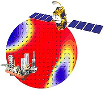
The launch of the OSTM/Jason-2 satellite, on June 2008, makes new data available, improving operational systems for ocean forecasts and marine meteorology and thus contributing to the safety of people and property in all offshore activities.
 See the video : flash (9 Mo) or mpeg (24 Mo)
The offshore industry includes all commercial activities that take place at sea, with the exception of fishing and maritime transport. It covers oil platforms and power generation (from winds, currents and waves) as well as the installation of pipe-lines for the former and submarine cables for the latter and also for telecommunications.
The ocean is a challenging environment. Winds, waves and currents are sometimes described with menacing adjectives to describe sea states that are potentially hazardous to sailors navigating on the surface, such as squalls, cross seas, adverse and changing currents, breakers or rogue waves. Reliable sea state forecasts, including wave height and direction and current velocity, are of great benefit to all offshore activities.
Satellite altimetry provides systematic, global, homogenous and constant cover and is unaffected by weather conditions (working even at night or through cloud) which makes it a very useful source of input data for forecasting models. Calculating sea height by altimetry helps to identify and measure the currents that swirl around the bumps and hollows on the surface of the oceans. Scientists can use the data to plot global or meso-scale ocean circulation on charts of currents and to measure their variations. Sea height is not the only variable of interest to offshore activities, however, and altimeters can provide other types of valuable information: the amplitude and shape of the radar echo can indicate wind speed and wave height. Data profiles compiled in situ complete these descriptions to give a fuller description of the masses of water at greater depths. The launch of the Jason-2 satellite, on 20 June 2008, make new data available, improving operational systems for ocean forecasts and marine meteorology and thus contributing to the safety of people and property.


