News
Swot was launched two years ago
The Surface Water and Ocean Topography (Swot) mission was launched two years ago, on December 16, 2022. Congratulations on 2 years of Swot!

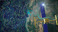
Artist's view of Swot overflying Tsiribihina (Madagascar) with FSLE plotted (Credit Cnes/Mira Production)
The swath radar altimeter on Swot (KaRIn), provides users around the world with 2-km or 250-m spatial resolution data over the ocean, down to 10-m over land waters, over the entire Earth up to 77.6° North and South, over a 120-km wide swath.
It is the first altimeter to provide native water height imagery (not “just” along-track measurements). This makes it possible to see details of water surfaces day and night, with or without clouds.
Since the launch, a wealth of data from the ground segment has been used and analyzed by the mission and science teams. The mission is meeting expectations and more - the quality of the data has impressed the science team members and the space agency engineers. Glimpses of intriguing features may yet provide surprising applications, but new possibilities have already emerged from the data processing and analysis - see some of the first striking results in the Swot portfolio. Scientific papers are being published with the first year of data, with more to come.
The follow-on is already being designed, with "Sentinel-3 Topo NG" planned for around 2030, which will have an instrument similar to Swot’s KaRIn onboard, thus enabling to build long-time series of swath observations.
See “Two years after launch, exceptionally precise Swot data reap the rewards of 30 years of progress in satellite altimetry” Press Release on Cnes website


