


News
Doris 20th Anniversary
Doris system turns 20 years old today, January 22, 2010. This anniversary celebrates a technical, operational and scientific success in satellite orbit precise determination.
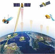
The Doris system (Doppler Orbitography and Radio positioning Integrated by Satellite) is used for precise (centimetric) orbit determination of satellites embarking Doris receivers. It is based on Doppler shifts measurements of radio-frequency signals transmitted by a terrestrial stations network, called Doris beacons, used as reference points at the Earth surface. Beacons are housed by more than 20 international host agencies. Conversely, the Doris system is able to locate ground positions with the same precision. This duality of Doris is associated to altimetric oceanography or ice missions, to the study of Earth shape and movements, and to a great number of localization services.
Developed in the early eighties by Cnes and IGN (Institut Géographique National) teams with Scientifics from GRGS (Groupe de Recherche en Géodésie Spatiale) and industry, Doriswas first tested on the Spot-2 satellite, launched on the 22nd January 1990. A Dorisreceiver was then on board Earth observation missions Spot-3 (1993), Spot-4 (1998) and Spot-5 (2002) helping in the orbit determination, images localization and unification of satellite time with ground time. It is also embarked on Pleiades, planned for launch in 2010.
Concerning altimetric missions, Doris was on-board the French-American satellite Topex/Poseidon then on Jason-1 (2001), Envisat (2002) and Jason-2 (2008). In a near future, it will contribute to the Cryosat-2 ice mission, to the French-Chinese oceanography mission HY-2A and to the French-Indian mission Saral/AltiKa. Then, Sentinel-3, Jason-3 and Swot will also benefit from Doris system. It is important to note that, for the first time, the attitude and orbit control system of Cryosat-2, launched on the 25th February 2010, will be based on an orbit calculated in real time by the Doris on-board flight software.
From the beginning, the Doris instrument is in continuous evolution. From the Spot-2 version, the Doris flight software has enriched with a "Diode" navigator allowing real time calculation of satellite trajectory with a precision ranging from a few meters to a few centimetres depending on the mission (between 2 and 5 cm on the Jason-2 altitude). In parallel, the Doris instrument has adapted to technological evolution and a miniaturization effort led to the current generation integrating a complete redundancy in a single Doris box and the possible reception of 7 beacons simultaneously.
Thanks to the achieved precision, associated to density and homogeneous coverage of the beacons network, Doris is now one of the precise localization techniques that participates to ITRF definition, which is the international terrestrial reference system from IERS (International Earth Rotation Service). For that purpose, the IDS service (International Doris Service, <link http: www.ids-doris.org>www.ids-doris.org) was created ten years ago for dissemination of Doris data and products to scientific community (geodesy, geophysics). The IDS service has been expanding rapidly for the last few years thanks to good Doris performance and to an increased number of contributing satellites (more than 4 since 2003). It achieves a mature level in 2009 as 7 international analysis centres contributed to a high quality combined Doris solution submitted to IERS for the ITRF2008.
Over the years, the system efficiency never ceased growing to better answer users needs. Doris is now an international reference system as GPS, laser telemetry or very long base interferometry techniques. Doris is 20 years old in 2010 and celebrates a technical, operational and scientific success as it fulfils the double challenge of performance and operationality. It will be at the heart of high precision altimetric missions for a long time.
- Related News:
 DORIS - 10.02.2014 08:05


