




Actualités
Nouveautés concernant les produits polaires sur AVISO ?
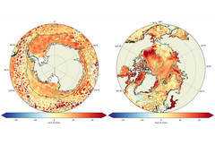
Il s'agit 1/ de la publication d'un nouveau dataset v2.0 des hauteurs de mer et des vitesses grillées multimission, obtenues grâce à la méthode de cartographie MIOST (Multiscale Inversion of Ocean Surface Topography) et 2/ de l'ajout des variables d'erreur formelles du dataset 2.0 des hauteurs de mer et des vitesses grillées multimission, obtenues grâce à la méthode de cartographie OI (Optimal Interpolation).
We are pleased to inform you that:
1/ there is a new dataset of multimission gridded sea level heights and velocities in v2.0 obtained with the Multiscale Inversion of Ocean Surface Topography (MIOST) mapping approach. This method is fully described in Ubelmann et al. (2021) and has been successfully applied and validated in open-ocean regions (Ballarotta et al., 2023). This dataset is now available to the community and experts to gather further validation and feedback, with the goal of implementing it in production in the coming months or years.
2/ the multimission gridded sea level heights and velocities dataset in v2.0 obtained with the Optimal Interpolation (OI) mapping method (Bretherton et al., 1976) has been actualized with the addition of the formal error variables.
The methodology for the Polar Oceans products is detailed in Veillard et al., 2024.
All information:
Experimental Products: Polar Ocean Along-track Level-3 Sea Surface Heights: 10.24400/527896/AVISO-2026.004
Experimental Products: Polar Ocean Gridded Level-4 Sea Surface Heights and Velocities: 10.24400/527896/AVISO-2026.005
Handbook : https://www.aviso.altimetry.fr/fileadmin/documents/data/tools/hdbk_duacs_experimental_SLA_polar_oceans.pdf
Data access:
CNES AVISO FTP/SFTP access (with AVISO+ credentials):
- ftp://ftp-access.aviso.altimetry.fr:21
- sftp://ftp-access.aviso.altimetry.fr:2221
- L3:
- /duacs-experimental/dt-phy-along-track/polar
- L4:
- /duacs-experimental/dt-phy-grids/polar_monomission
- /duacs-experimental/dt-phy-grids/polar_multimission
CNES AVISO THREDDS Data Server access (with AVISO+ credentials):
- L3:
- L4:
References:
Ballarotta, M., Ubelmann, C., Veillard, P., Prandi, P., Etienne, H., Mulet, S., Faugère, Y., Dibarboure, G., Morrow, R., and Picot, N.: Improved global sea surface height and current maps from remote sensing and in situ observations, Earth Syst. Sci. Data, 15, 295–315, https://doi.org/10.5194/essd-15- 295-2023, 2023.
Bretherton, F. P., Davis, R. E., and Fandry, C.: A technique for objective analysis and design of oceanographic instruments applied to MODE-73, Deep-Sea Res., 23, 559–582, https://doi.org/10.1016/0011-7471(76)90001-2, 1976.
Ubelmann, C., Dibarboure, G., Gaultier, L., Ponte, A., Ardhuin, F., Ballarotta, M., and Faugère, Y.: Reconstructing ocean surface current combining altimetry and future spaceborne Doppler data, J. Geophys. Res.-Oceans, 126, e2020JC016560, https://doi.org/10.1029/2020JC016560, 2021.
Veillard P, Prandi P, Pujol M-I, Daguzé J-A, Piras F, Dibarboure G and Faugère Y (2024) Arctic and Southern Ocean polar sea level maps and along-tracks from multi-mission satellite altimetry from 2011 to 2021. Front. Mar. Sci. 11:1419132. https://doi.org/10.3389/fmars.2024.1419132
 Archives