


X-TRACK-L2P: Sea Level Anomalies dedicated to coastal applications (2022 version)
Types of dataset: Altimeter Sea Level Anomalies dedicated to coastal applications at 1Hz
DOI: 10.24400/527896/a01-2022.020 - more metadata
Contents: Along-track Sea Level Anomalies projected onto the reference tracks with a spatial interval of about 6-7 km between points (1 second). The Sea Level Anomaly time series have been computed with the X-TRACK processing system (developed at LEGOS) starting from the Level 2 Plus (L2P) products distributed by Aviso+. The altimetry corrections applied are those provided in this product. See the details of the L2P processing on the dedicated product page.
Use: coastal applications
Description: multimission altimeter satellite product in delayed time
Format: NetCDF
Tools:
- User handbook
- Example of python script to read the files and plot several types of figures
- Reference: Birol, F., N. Fuller, F. Lyard, M. Cancet, F. Niño, C. Delebecque, S. Fleury, F. Toublanc, A. Melet, M. Saraceno, F. Léger, 2017. “Coastal Applications from Nadir Altimetry: Example of the X-TRACK Regional Products.” Advances in Space Research, 2017, 59 (4), p.936-953. doi:10.1016/j.asr.2016.11.005
Geographic coverage: 27 zones have been defined as indicated on the map.
Citation: These products were developed, validated and distributed by CTOH/LEGOS France. Publications should include the following statement in the Acknowledgments: “Altimetry data used in this study (v2.1, DOI 10.24400/527896/a01-2022.020) were developed, validated by the CTOH/LEGOS, France and distributed by Aviso+”.
Update: The improvements compared to former version are summarized here.
Copyright : 1992- ongoing.
Delayed-time
| Satellite | Version | Type | Authenticated access services | Data period |
|---|---|---|---|---|
| Topex/Jason-1/Jason-2/Jason-3 | v2.1 | along-track | Please, connect to the 'product page' of MYAVISO+, and select the product 'Coastal X-TRACK SLA') | 1993/02/28 (TP:cycle 17) to 2022/04/07 (J3:cycle 226) |
| Topex Interleaved orbit (TPN)/ Jason-1 Interleaved orbit (J1N)/ Jason-2 Interleaved orbit (J2N) | 2002/09/20 (TP:cycle 369) to 2017/05/13 (J2:cycle 327) | |||
| ERS-1/ERS-2/ Envisat/SARAL/AltiKa | 1992/10/23 (E1:cycle 89) to 2016/04/16 (SL:cycle 32) | |||
| Sentinel-3A | 2016/03/12 (cycle 2) to 2023/01/26 (cycle 94) | |||
| Geosat Follow On | 2000/01/08 (cycle 37) to 2008/09/08 (cycle 222) | |||
| Haiyang-2A | 2014/04/12 (cycle 67) to 2016/03/15 (cycle 119) |
The version v2.0 is available on demand
Data
- Products guide.
 Products .
- Sea surface height products .
- Global .
- Regional .
- SSALTO/DUACS Experimental products.
- Arctic Ocean - Sea Level Heights.
- Antarctic - Sea Level Heights.
- Europe area - Along-track Sea Level Heights.
- Europe area - Mean and Climatology.
- Along-track Sea Level Anomalies 5Hz.
- Gridded sea level heights and derived variables - Dynamic Interpolation.
- Gridded sea level heights and derived variables combining altimetry and drifters.
- X-TRACK SLA .
- X-TRACK-L2P SLA version 2022.
- Region selection.
- Region selection v2.1.
- Adelie-Mertz.
- Amazon.
- Arabia (Red Sea and Persian Gulf).
- Atlantic South America.
- Azores.
- Baltic Sea.
- Black Sea.
- China Sea.
- Drake passage.
- East Australia.
- Gulf of Mexico - Caribbean Sea.
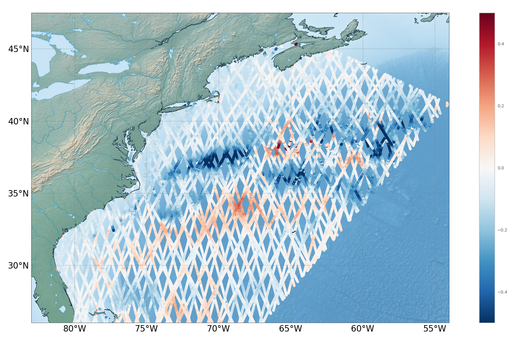
- Gulf Stream.
- Hudson Bay.
- Humboldt current.
- Kerguelen Islands.
- Labrador Sea.
- Mediterranean Sea.
- North East Atlantic.
- North Indian Ocean.
- North West America.
- North West Pacific.
- Norway.
- South and East Africa.
- West Africa.
- West Australia.
- West Latin America - California.
- West Tropical Pacific.
- CoastalDT-SLA products.
- Value-added products .
- Wind/wave products .
- Auxiliary products .
- Ice products .
- Ocean indicators products .
- Ocean data challenges .
- In-situ products .
- Data access .
- Tools .
- Product information .
- CALVAL .
- Operational information .