


News
IDS 10th Anniversary
The International DORIS Service is 10 years old in July 2013. The IDS is celebrating a successful cooperation in the geodetic applications based on the DORIS system.
The DORIS system (Doppler Orbitography and Radio positioning Integrated by Satellite) was deployed in 1990 for precise (centimeter-level) orbit determination of satellites flying DORIS receivers. DORIS is based on Doppler shift measurements of radio-frequency signals transmitted by a network of terrestrial stations (57 beacons) used as reference points on the Earth’s surface. The DORIS system is able to locate ground positions with the same precision. This duality of DORIS is crucial to altimetric oceanography and ice missions, enabling the study of the Earth’s shape and movements, and to a large number of localization services.
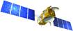
DORIS receivers have flown on several Earth observation and altimetric missions since 1990: SPOT-2 (1990), TOPEX/Poseidon (1992), SPOT-3 (1993), SPOT-4 (1998), Jason-1 (2001), Envisat (2002), SPOT-5 (2002), Jason-2 (2008), CryoSat-2 (2010), HY-2A (2011), and SARAL/AltiKa (2013). In the future, the Sentinel-3, Jason-3, Jason-CS, and SWOT missions will benefit from DORIS system to well beyond 2028.
Over the years, the system efficiency never ceased to grow: the DORIS instrument is in constant evolution and the global DORIS network is continually renovated and improved.
Thanks to the achieved precision, attributed to the density and homogeneous coverage of the network of beacons, DORIS is one of the precise localization techniques that is participating in the realization of the International Terrestrial Reference System (ITRF).
For that purpose, the IDS service (International DORIS Service, www.ids-doris.org) was created by the International Association of Geodesy (IAG) ten years ago, in July 2003, during the IUGG in Sapporo, for the dissemination of DORIS data and products to the international scientific community (geodesy, geophysics).
The IDS operates in close cooperation with the International Earth rotation and Reference systems Service (IERS) to support geodetic and geophysical research activities, through DORIS data and products. DORIS has achieved a mature level in 2009, as seven IDS Analysis Centers contributed to a high-quality DORIS combination for the ITRF2008. In 2010, the IDS extended the DORIS product combination process to an operational service and established a Combination Center, which is now fully operational. The IDS is now a well-recognized technique-oriented service for the IERS, and is preparing actively the next ITRF2013 submission.
The IDS service has been expanding rapidly over the last few years thanks to the excellent performance of the DORIS system available on an increased number of contributing satellites. The IDS is also a participant in the Global Geodetic Observing System (GGOS).
IDS data & products
The IDS collects, archives and distributes DORIS observation data sets as well as the following derived products: coordinates and velocities of the IDS tracking stations, geocenter and scale of the Terrestrial Reference Frame, ionospheric information, high accuracy ephemerides of DORIS satellites, and Earth rotation parameters.
Milestones
DORIS has been part of the IERS (as an observer) since 1994. Other significant DORIS-related events include:
- July 1999, creation of the DORIS Pilot Project by the International Association of Geodesy (IAG) to foster international cooperation
- July 2003, formalization of the International DORIS Service as a service of the IAG during the IUGG in Sapporo
- Since 2002, IDS Workshop every 2 years coupled with OSTST: Biarritz (2002), Marne Valley (2003), Paris (2004), Venice (2006), Nice (2008), Lisbon (2010), Venice (2012)
- 2005 3 analysis centers respond to the call of participation to ITRF2005,
- 2009-2010: maturity: IDS official contributor to ITRF2008 (solutions with an accuracy of 1cm 3D), seven IDS Analysis Center participated. Initialization of the routine combination by the Combination Center.
- 2013 active preparation for contribution to ITRF2013, expected significant improvements.
Robust and reliable DORIS network
The DORIS network of 57 stations is distributed uniformly across the globe. Most of the stations were installed between 1986 and 1990 in order to make the system operational with the first DORIS equipped satellite SPOT2, and are operated through partnerships with local national agencies. Co-location with GNSS, SLR, VLBI stations, and tide gauges is one of the key points in DORIS site selection.
Continuous DORIS integrity monitoring ensures the immediate detection of a faulty beacon or the first signs of aging, well before system performance is affected. Homogeneity, maintenance and ongoing monitoring make the network of DORIS stations a major asset of the system and guarantee stable performance. Maintenance and renovation of the stations is a joint CNES-IGN effort.
Recent IDS analysis
In line with the successful DORIS contribution to ITRF2008, the IDS decided to extend the combination process to an operational service. Thus, in early 2010, the IDS Combination Center (IDS CC) was opened and is now fully operational. The IDS CC aims to i) evaluate all the ACs’ weekly solutions, ii) perform the IDS multi-AC weekly combined solution, iii) support the ACs in the continued improvements of the DORIS products, and iv) compute and deliver the DORIS contribution to the next version of the ITRF, ITRF2013.
Current IDS organization (similar to other IAG Services)
- 1 Governing Board (Pascal Willis, IGN/France + 4 other elected members + 6 appointed members)
- 1 Central Bureau (Laurent Soudarin, CNES/CLS + 4 other members)
- 2 Data Centers (Carey Noll, CDDIS/USA, Bruno Garayt, IGN/France)
- 1 Combination Center (Guilhem Moreaux, CNES/CLS + 2 other members), Analysis Coordinator (Frank Lemoine, NASA)
- 6 Analysis Centers: ESA (Germany), GSC (USA), IGN (France), INASAN (Russia), GOP (Czech Rep.), LCA (France)


