Mobile version

News

11.02.2021 12:08 Age: 3 yrs

Crues sur le bassin de la Garonne

Category: Ocean and climate news

Les satellites montrent les crues qui se sont produites fin janvier-début février sur la Garonne et ses affluents.


Les lieux où des données sont tracés ci-dessous

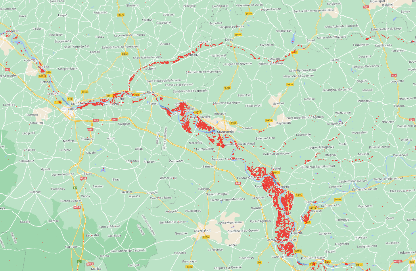
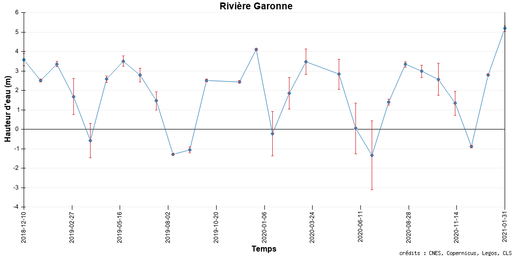
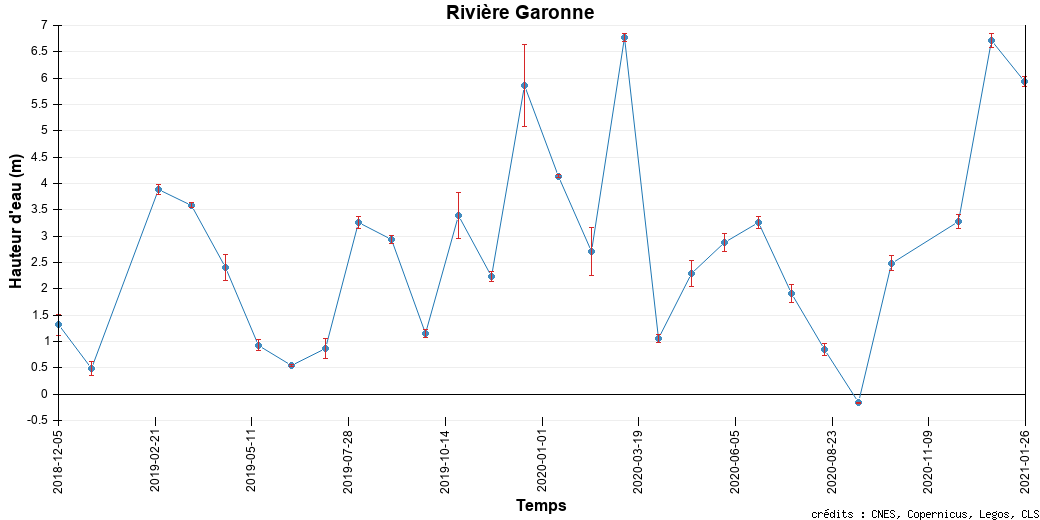
La Garonne est l'un des principaux fleuves de France. Prenant sa source dans les Pyrénées, il se dirige vers le nord, traverse Toulouse, se dirige vers le nord-ouest, traverse Bordeaux pour rejoindre l'océan Atlantique dans le golfe de Gascogne.

En janvier 2021, d'intenses précipitations sur le sud-ouest de la France ont fait monter le niveau du fleuve et de ses affluents, avec un pic fin janvier et début février, provoquant des inondations importantes dans les villes situées sur les bords des cours d'eau du bassin, comme La Réole. Les satellites montrent cette élévation, pour les altimètres, et même les inondations pour les techniques d'imagerie (ici Sentinel-1 SAR -- Swot pourrait également fournir de telles images une fois lancé).

 
Map of La Réole flood from Sentinel-1 SAR data.

Carte des inondations de La Réole à partir de données SAR Sentinel-1 ; en rouge, les zones sous l'eau entre le 27 janvier et le 2 février (traitements CLS, contient des données Copernicus modifiées)

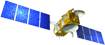
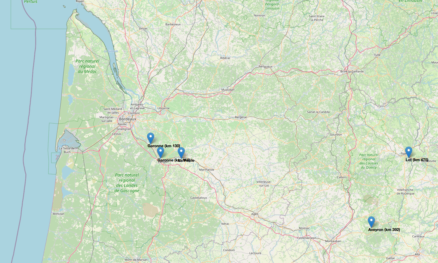
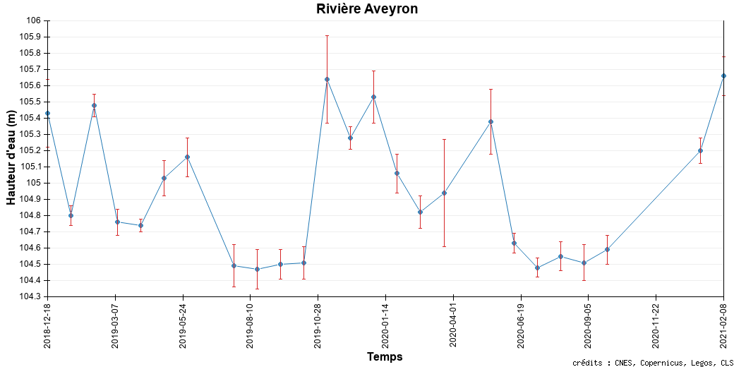
Hauteurs d'eau altimétriques sur des affluents de la Garonne à gauche : ll'Aveyron tributary (km 392) (en haut), et le Lot (km 475) (en bas), à droite, sur la Garonne elle-même (en haut, au km 130; en bas km 144) (credit Hydroweb)


EnglishFrançais
Rss feedsContactPartnersFAQLexiconLegal noticePersonal Data Protection PolicyMobile
You must enable cookies in your browser preferences to save the modifications
You are using an older version of Internet Explorer, please update to take full advantage of Aviso+ features

Customize the home page

View all widgets
Reduce display
Public profile
User profile

Select/Deselect widgets

Discover AVISO+

Customizable home, reading tools, products search guide, etc.. Discover step by step the features of the new site AVISO+.

Customizable homepage

This home page is composed of blocks called "widgets".

Rearrange the blocks with a "Click & Drop".

Hide a widget with the cross at the top right. Reset or add a widget with the "wrench" icon. The "User" and "Public" profiles offer a predefined organization.

All the modifications are automatically saved as cookies on your machine so as to enable you to have your own specific AVISO+.

Reading tools

Ease your reading by choosing the page background colour (black/white) and/or by modifying the font size.

Browsing menu and breadcrum trail

To ease your browsing through AVISO+, you can use at any time the main banner items with the interactive submenus or use the browsing menu on the left side of the screen (it is open by default). For more readiness of the page contents, you can fold and unfold the browsing menu by clicking on the tab. At any time you can know where you are thanks to the browsing menu or the breadcrum at the top of the page.

Products search guide

The first submenu of the "Data" banner item leads you to a new search form enabling you to find quickier the product that suits your needs. The list of results is updated according to your selection criteria.

AVISO+ Multimedia

The first submenu of the "Multimedia" banner item leads you to AVISO+ collections of images and videos linked to altimetry and its applications. Have a nice visit!